Day 7 Part 2 - Carbon County to Green River/Colorado River Confluence
|
|
Looking at the weather picture in the FBO, things actually looked pretty good. The bad weather was to the east. The way was reasonably clear southeast back to the Green River and Green River Airport.
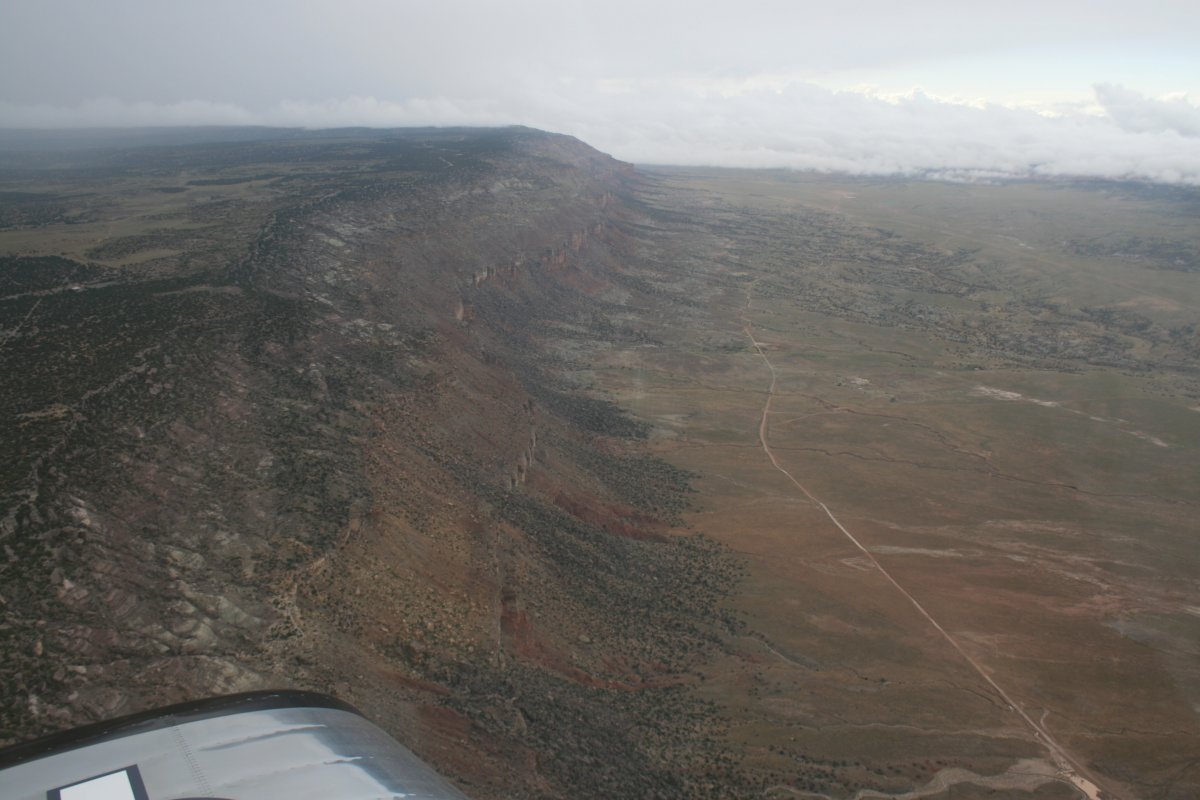
Just after takeoff, I'm flying parallel to the cloud front.
|
| |
 |
|
|
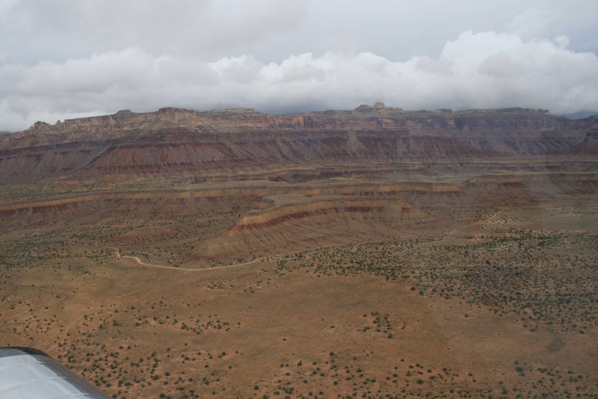
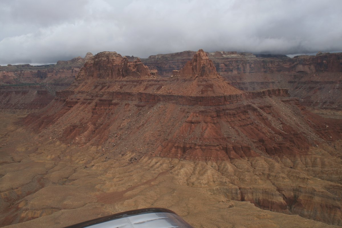
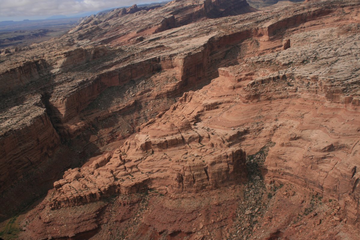
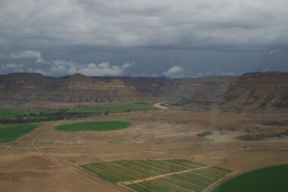
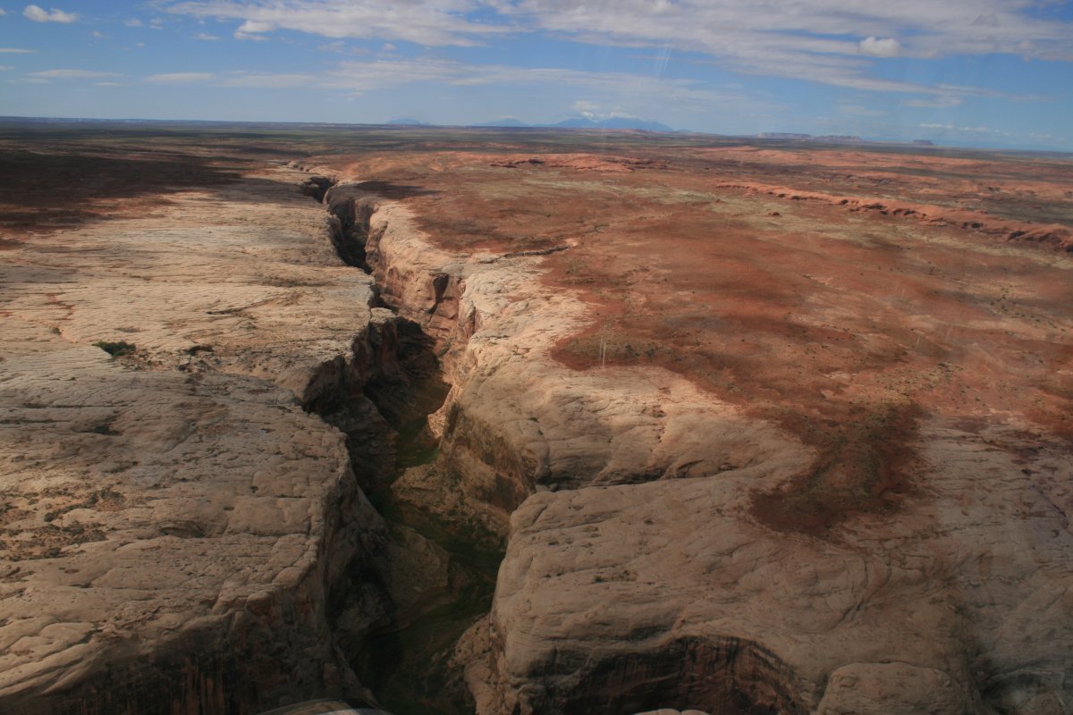
Nice little canyon. Clouds are breaking up.
|
| |
 |
|
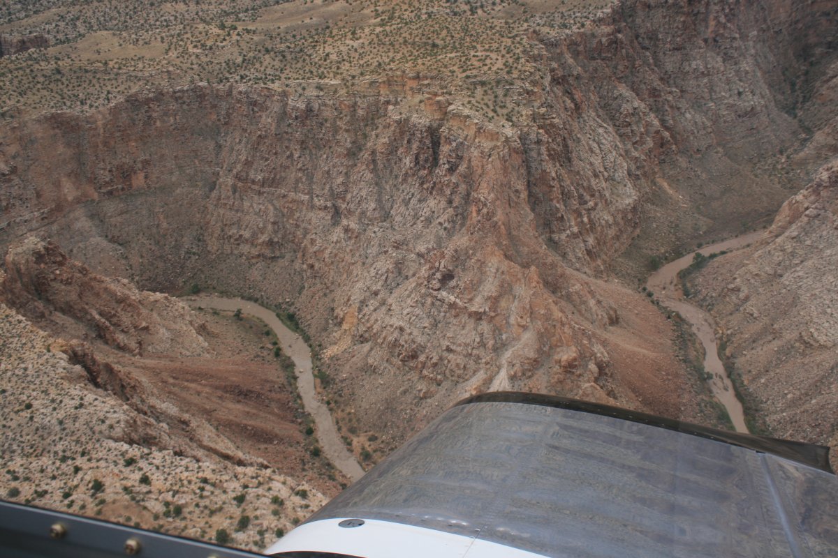
| So I went down a little lower to get a better look. |
| |
 |
|
|
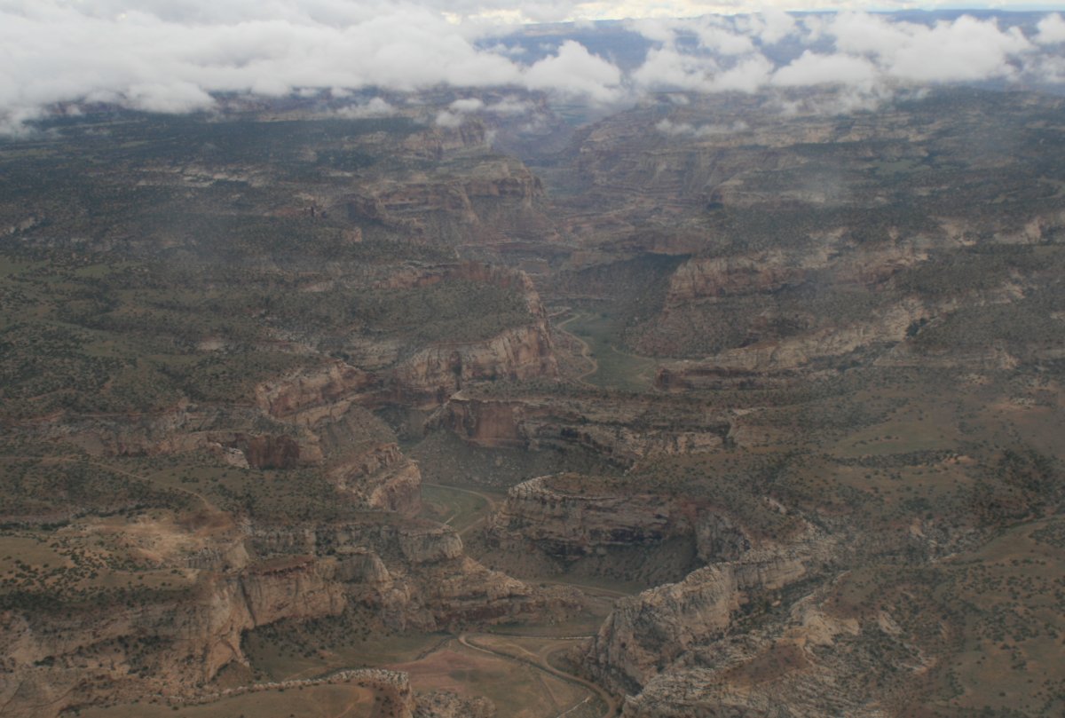
And suddenly the sun was out and I was in clear air. Simultaneously, an incredible scene opened up in front of me.
|
| |
 |
|
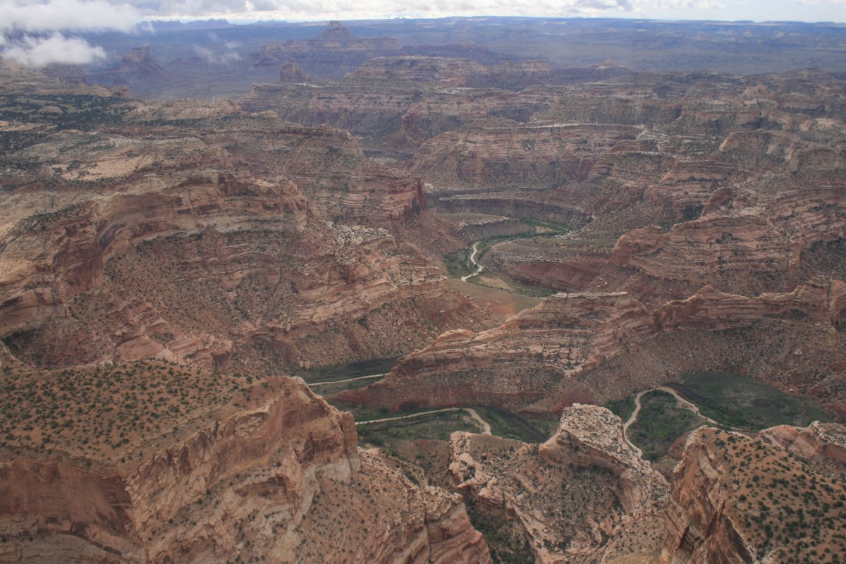
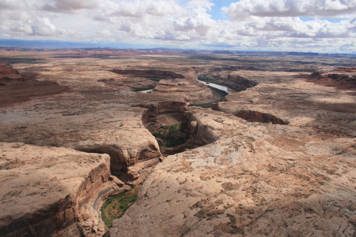
| This beautiful place has no name, is not a national park, or on the charts. But it was as beautiful as anything I saw the entire trip. |
| |
 |
|
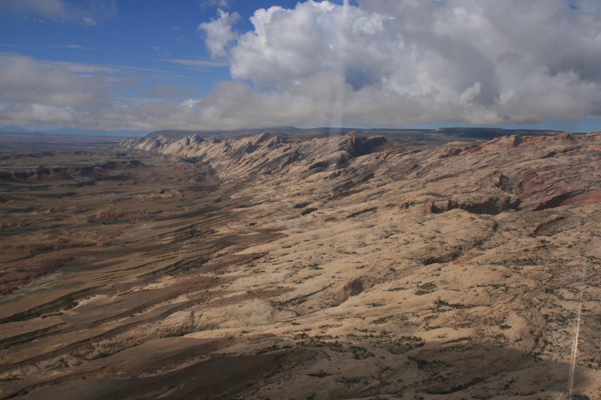
| Looking north, the weather is still there, like a big fence. |
| |
 |
|
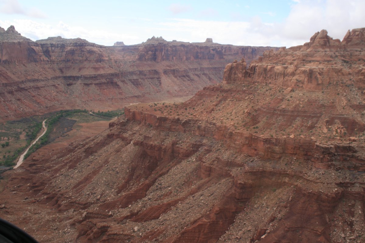
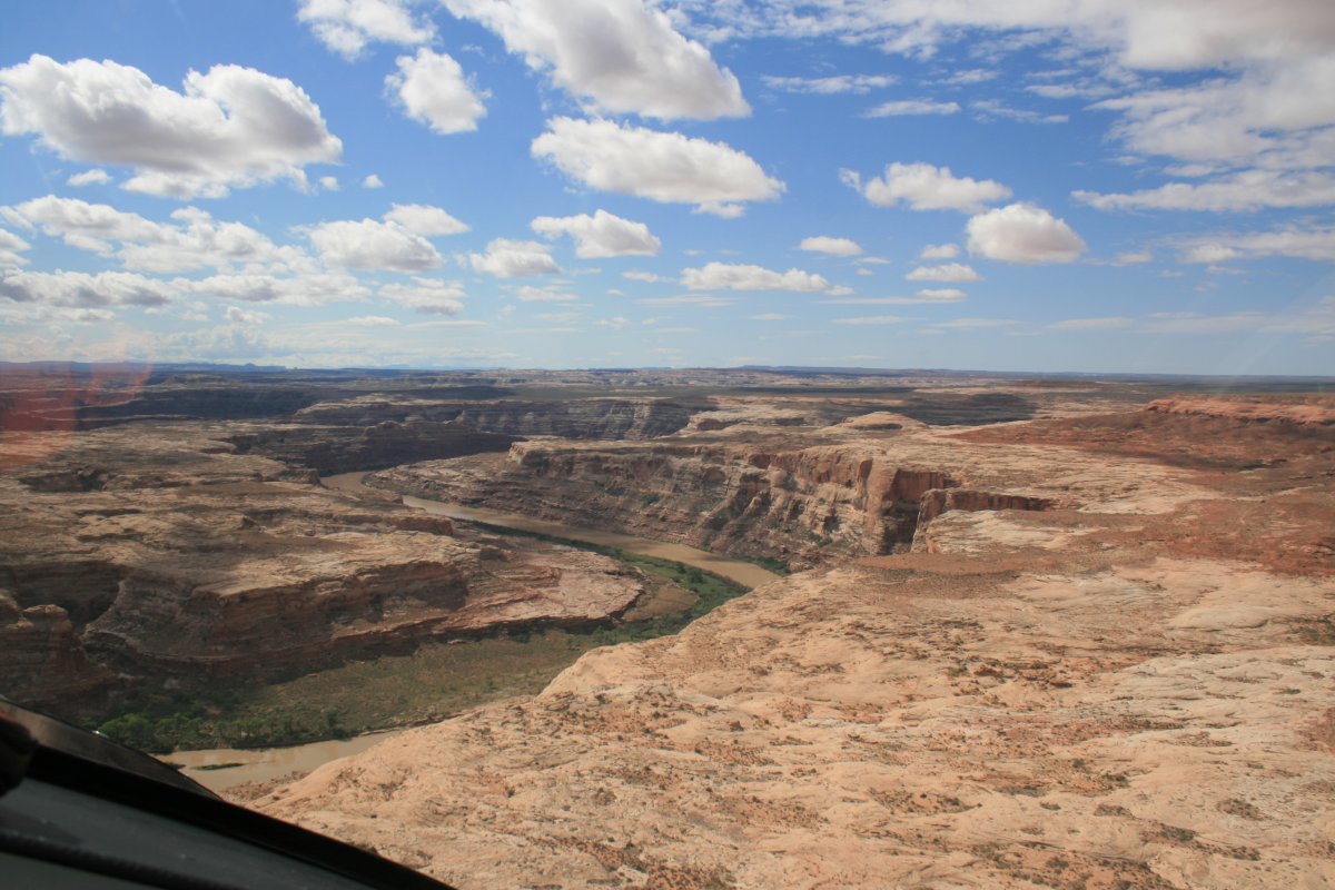
| I believe that is the Price River which runs into the Green River. |
| |
 |
|
|
|
| |
 |
|
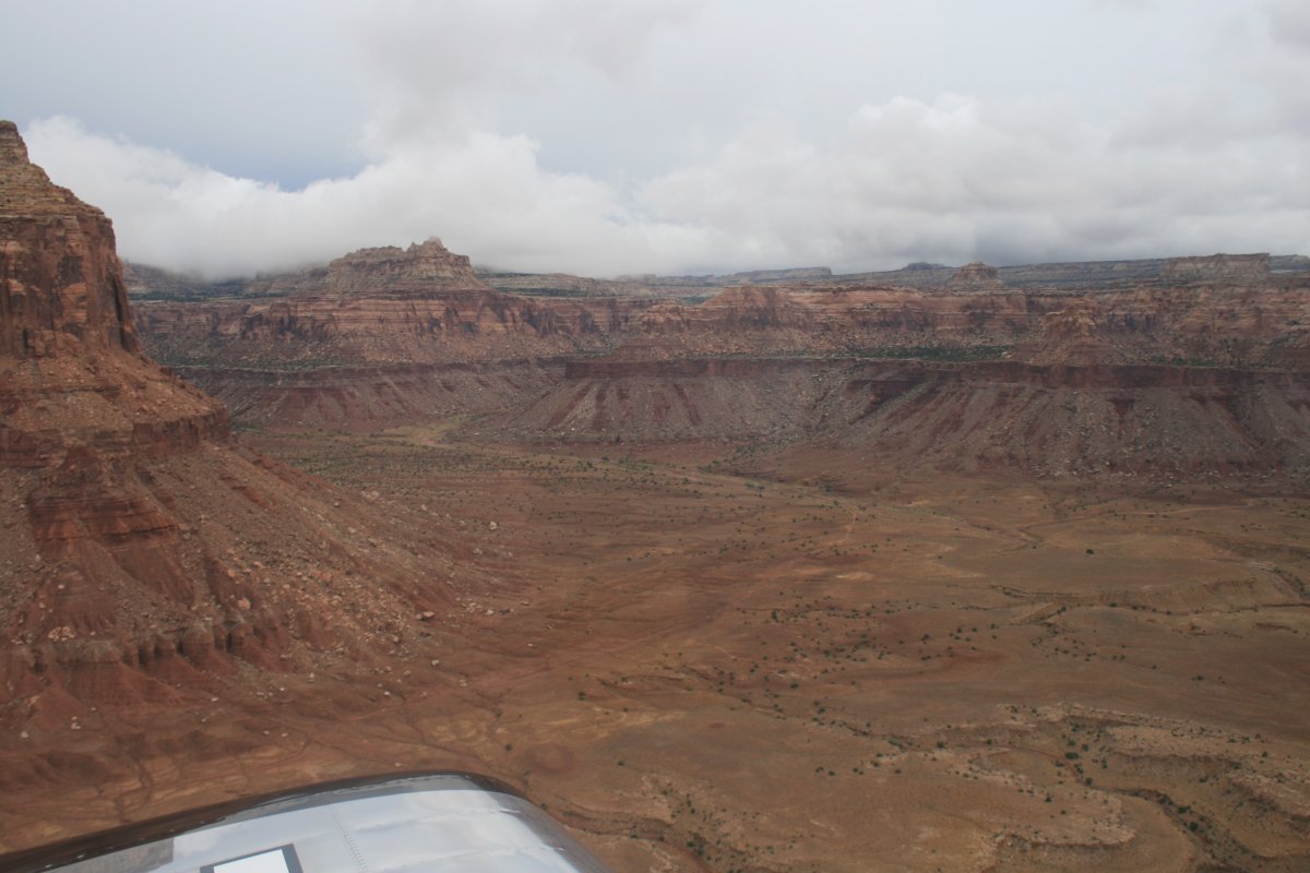
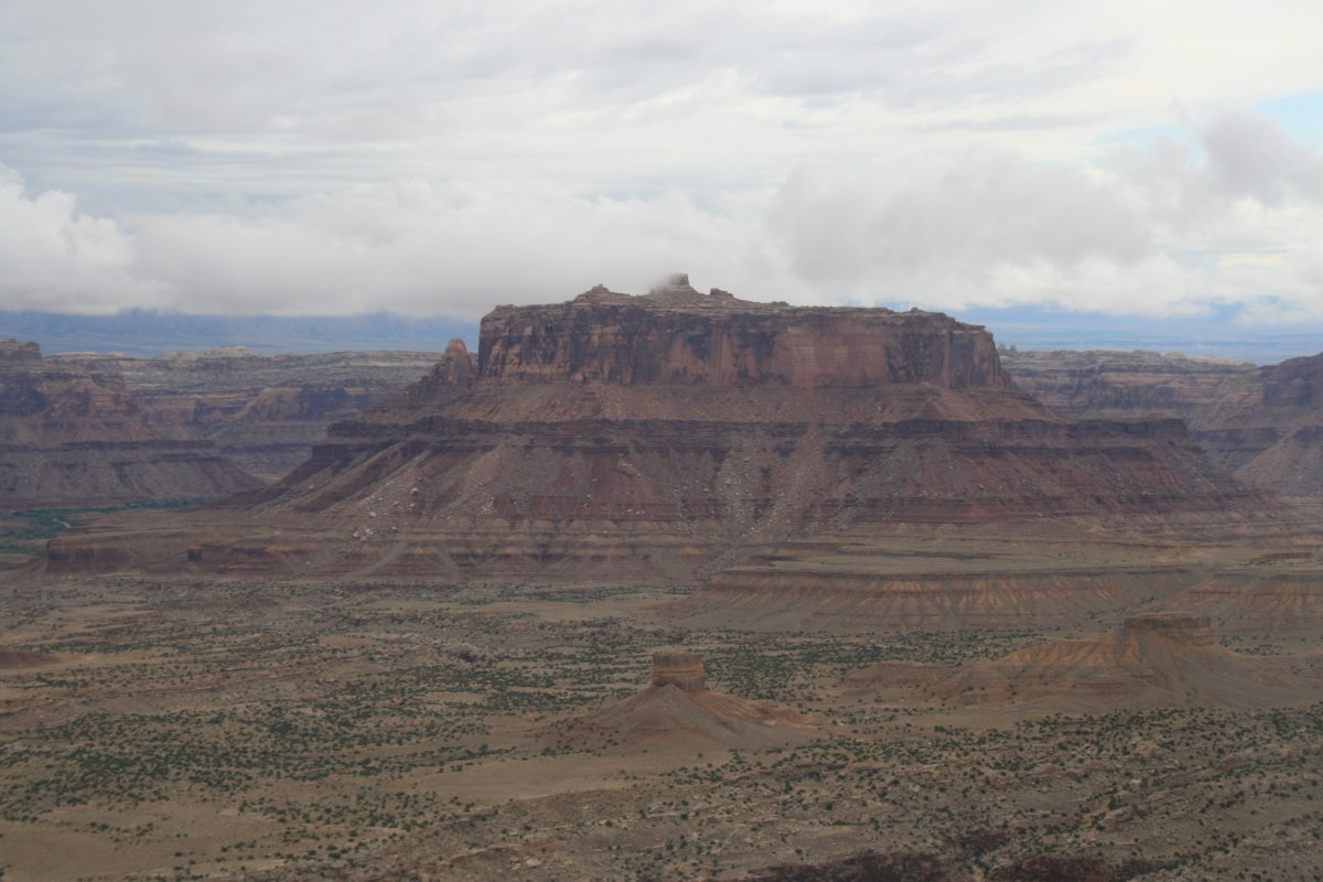
| The Patmos Mountains looking good. |
| |
 |
|
|
|
| |
 |
|
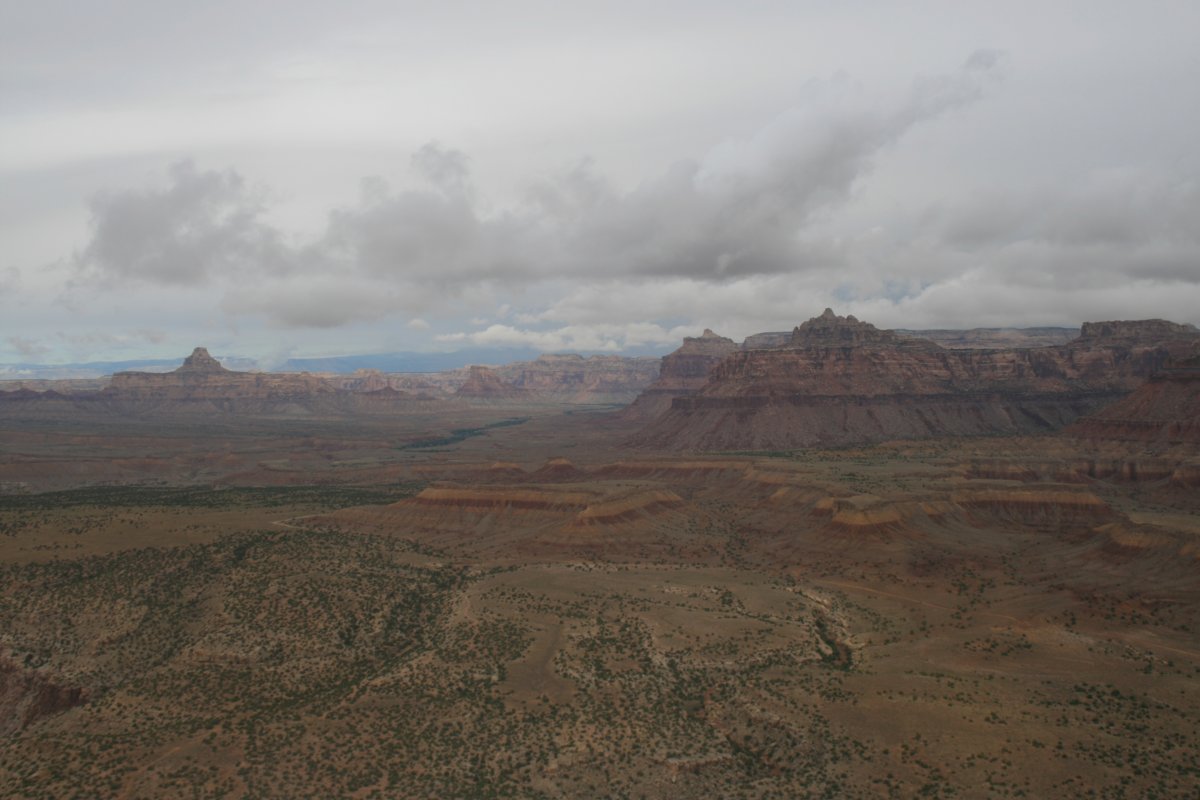
| Looking north. |
| |
 |
|
| |
| |
 |
|
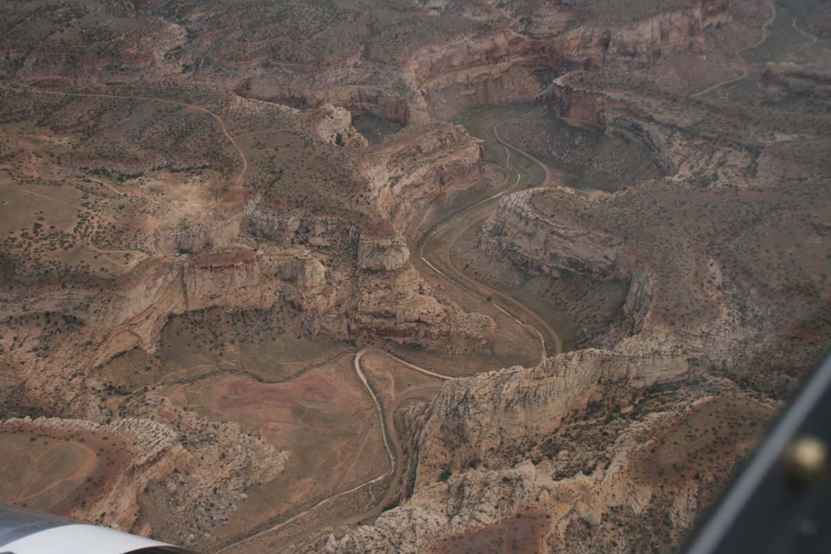
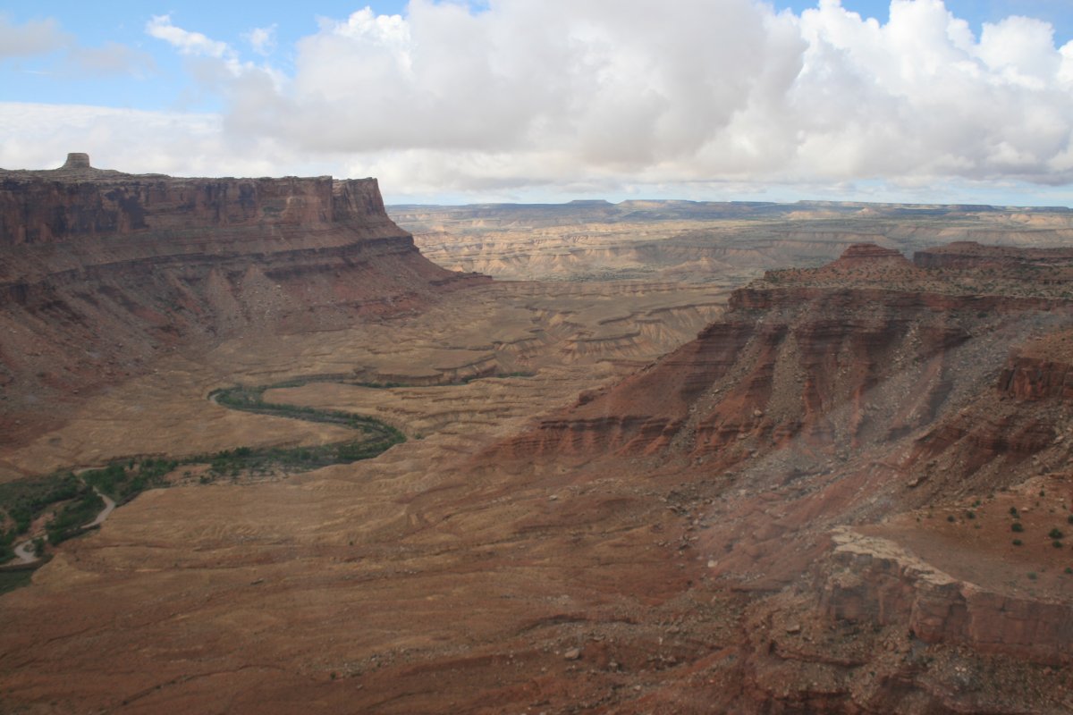
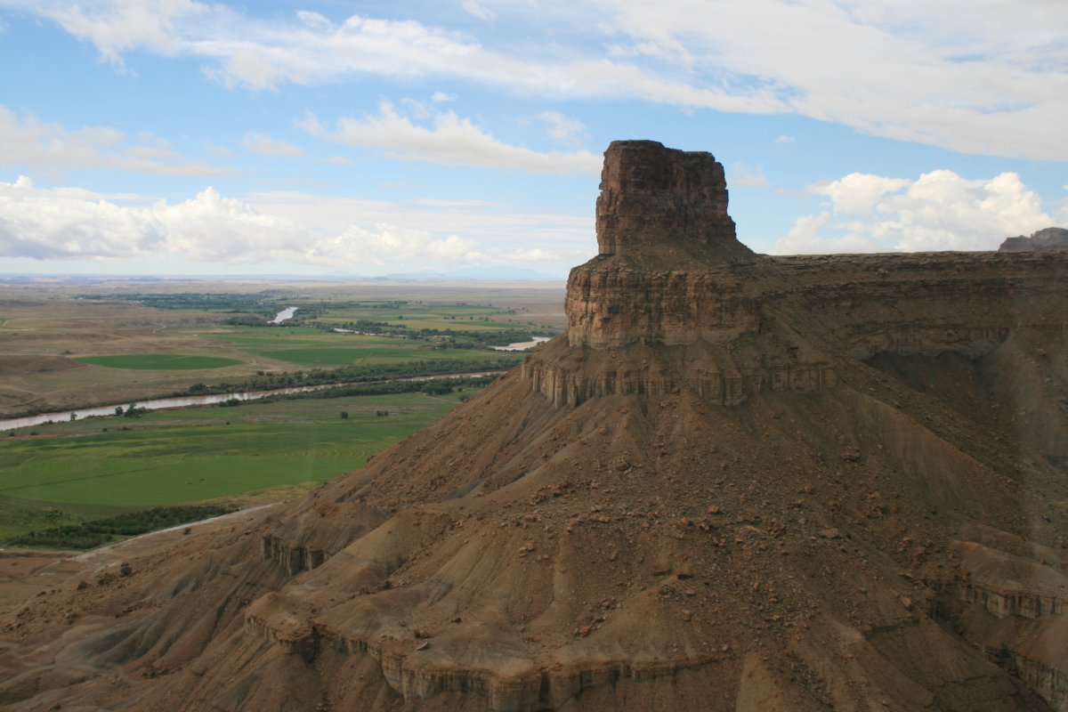
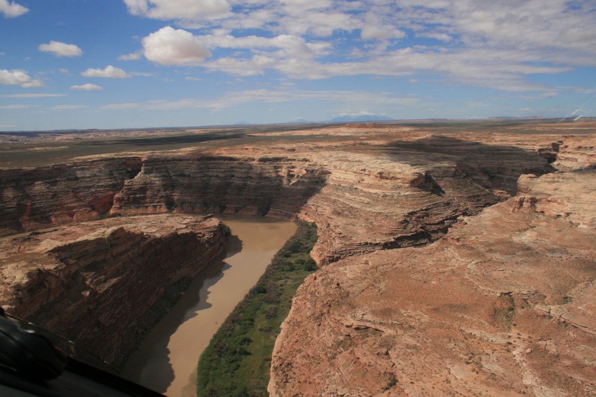
| I headed north up the Green River just a little bit into the Patmos Mountains. |
| |
 |
|
|
|
| |
 |
|
| |
| |
 |
|
|
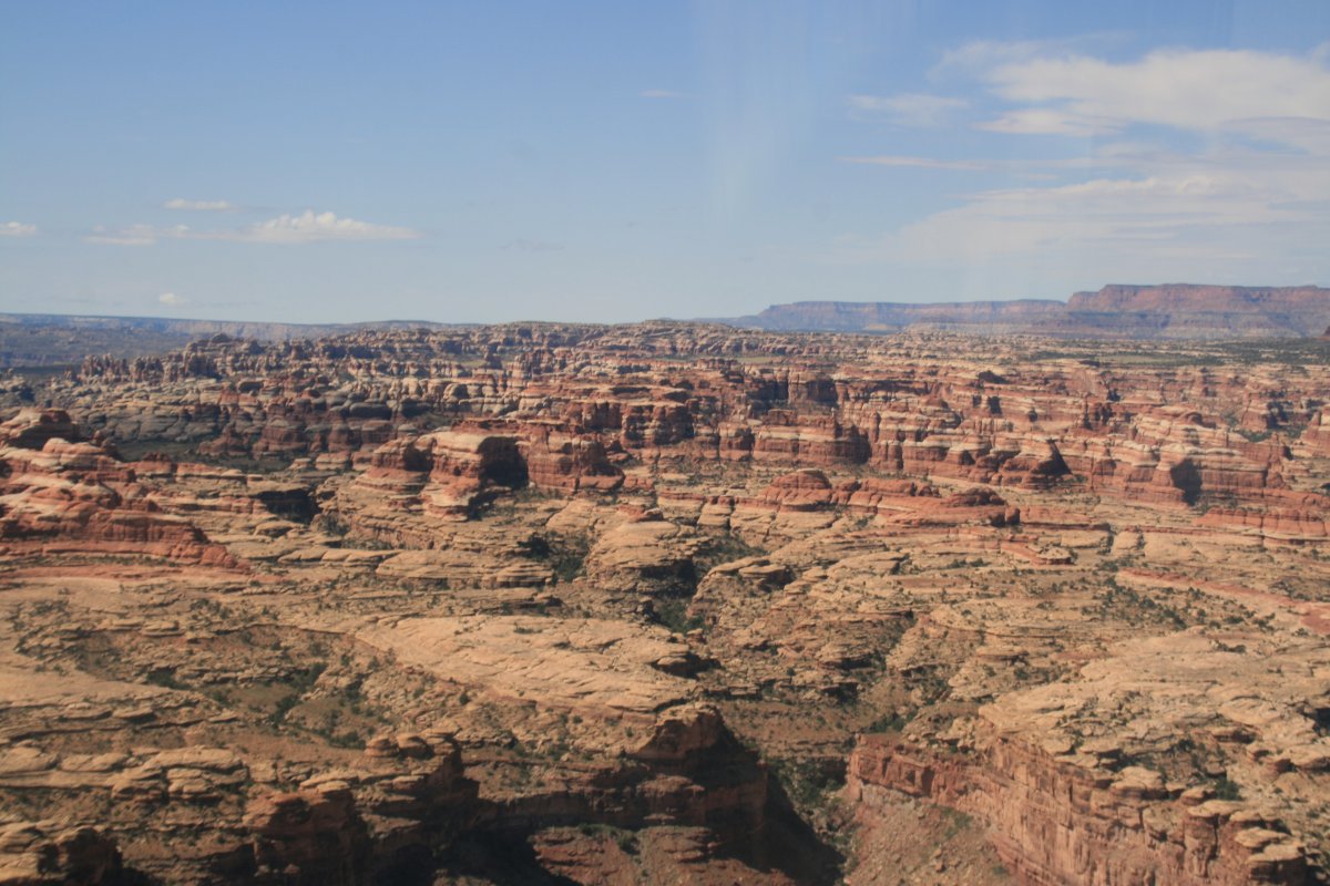
This area reminded me a lot of Monument Valley.
|
| |
 |
|
| |
| |
 |
|
| |
| |
 |
|
| |
| |
 |
|
|
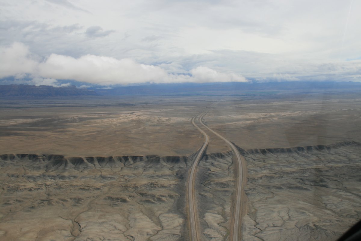
Interstate 70 streches out to the east.
|
| |
 |
|
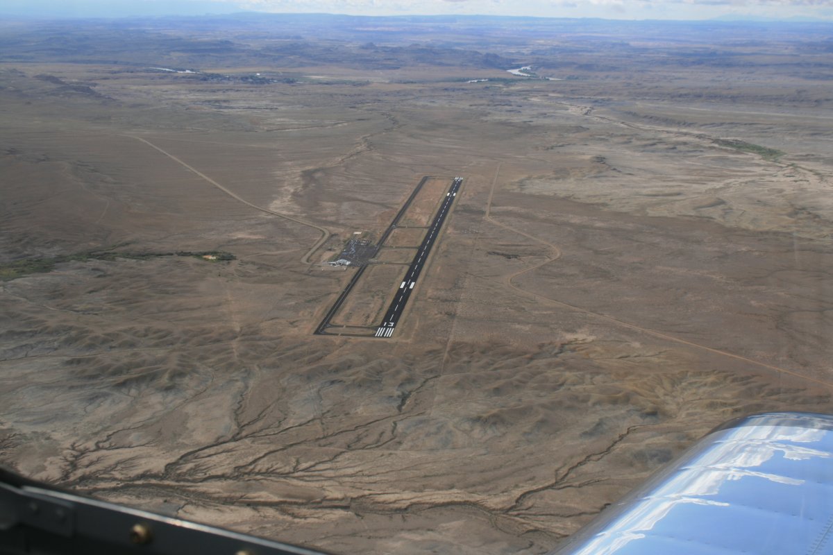
| Green River Airport (U34). The small town of Green River, Utah is a few miles away. So let me get this straight. There are two towns named Green River, one in Wyoming and one in Utah. |
| |
 |
|
|
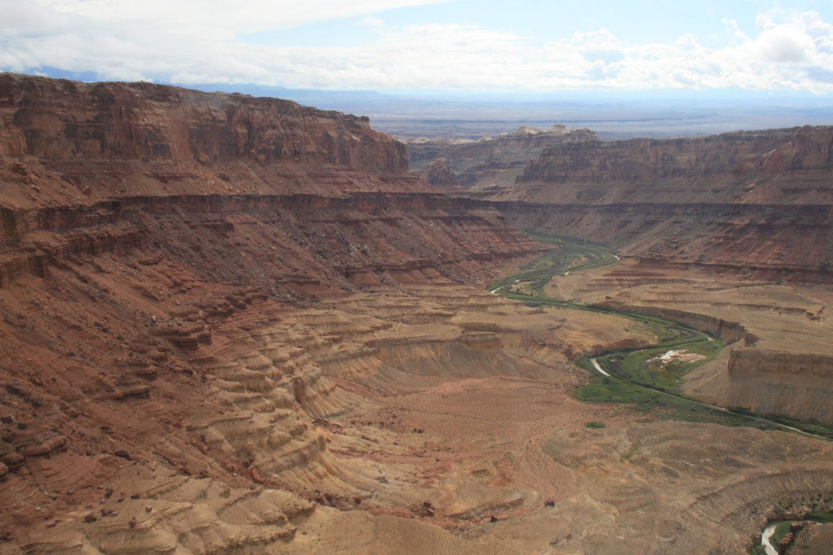
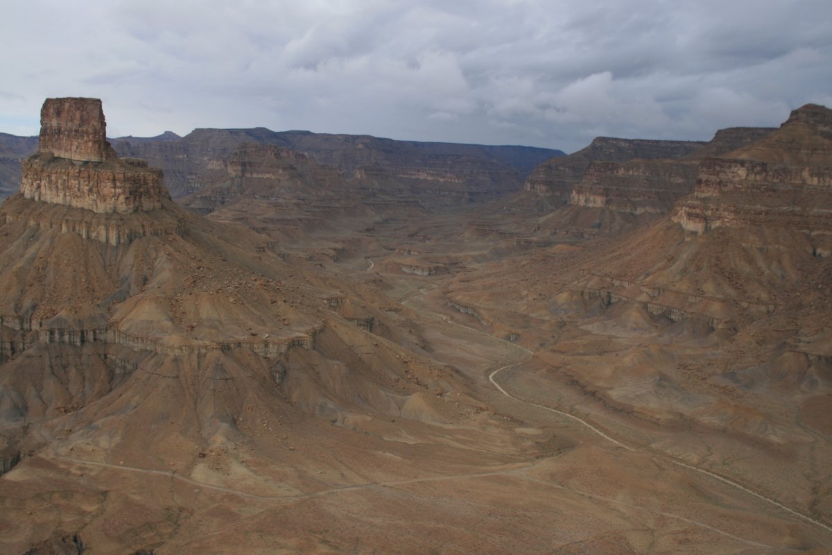
Looking north for a good look at where the Green River enters the Patmos Mountains.
|
| |
 |
|
| Looking south down the Green River. |
| |
 |
|
|
|
| |
 |
|
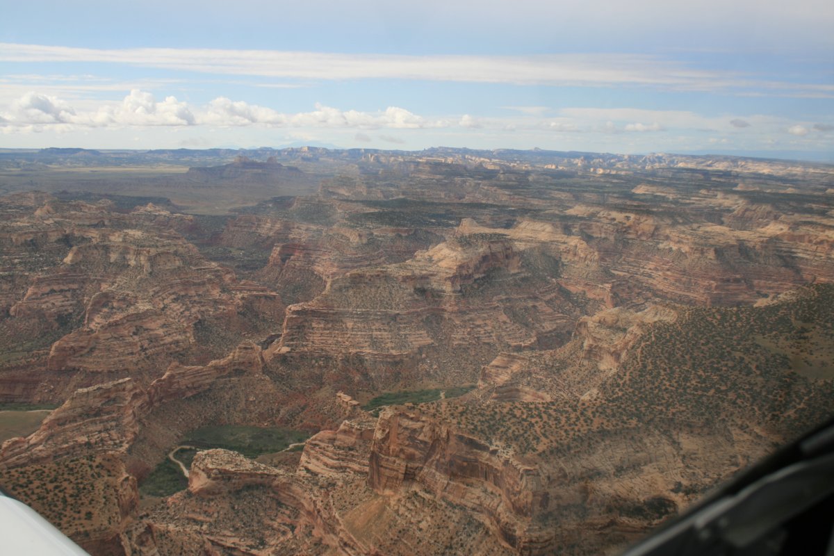
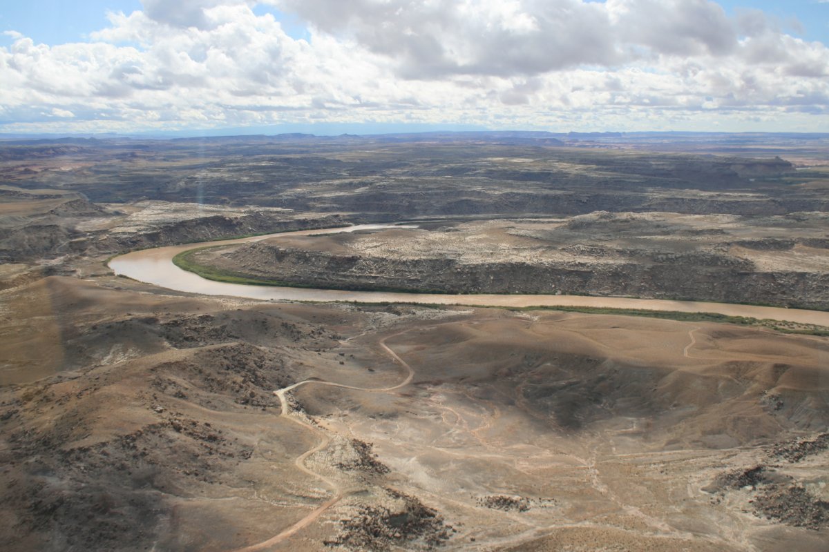
| Proceeding south, I was seeing very little green. |
| |
 |
|
| |
| |
 |
|
| |
| |
 |
|
|
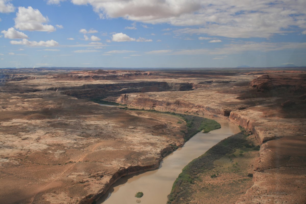
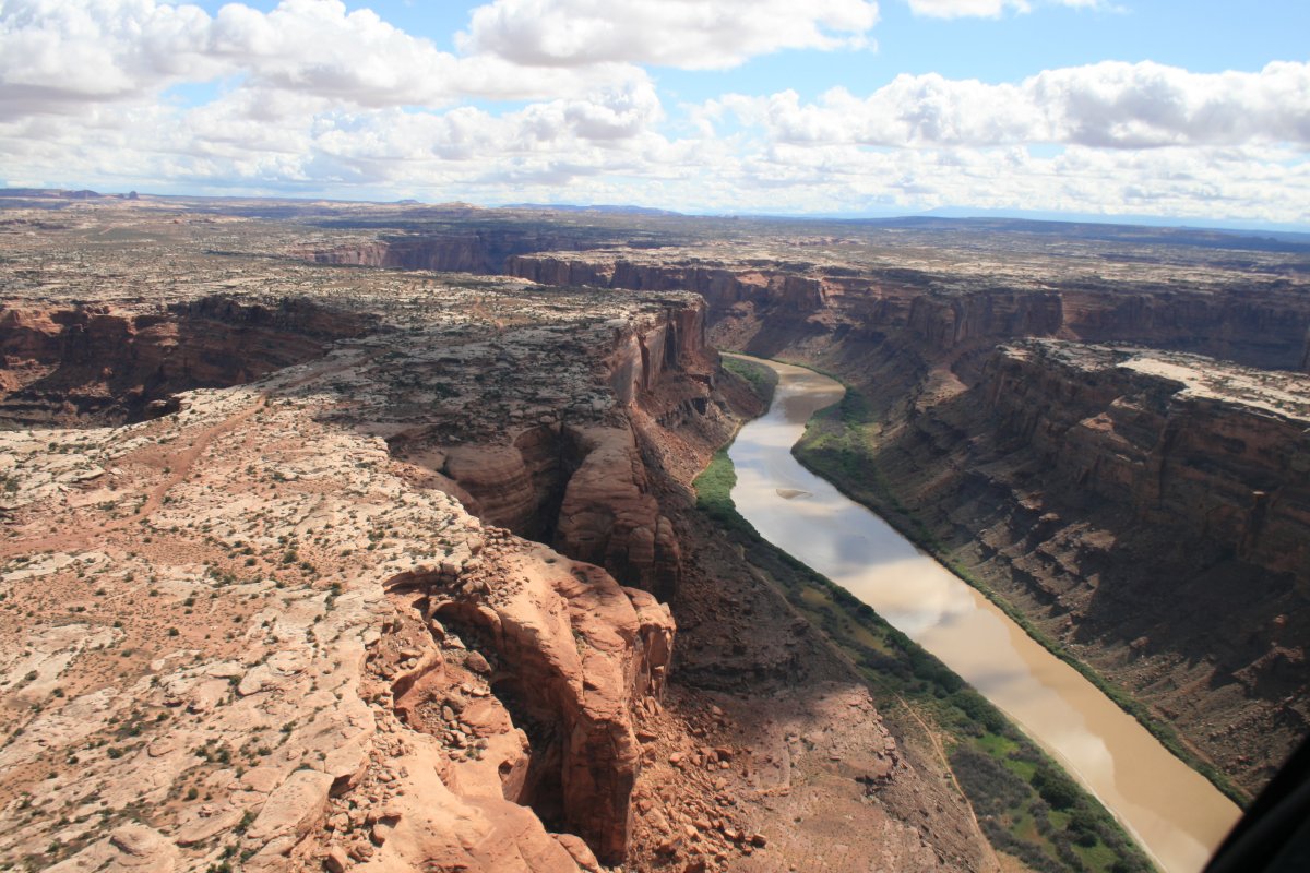
Tne river canyon was slowing emerging.
|
| |
 |
|
| River switchback. |
| |
 |
|
|
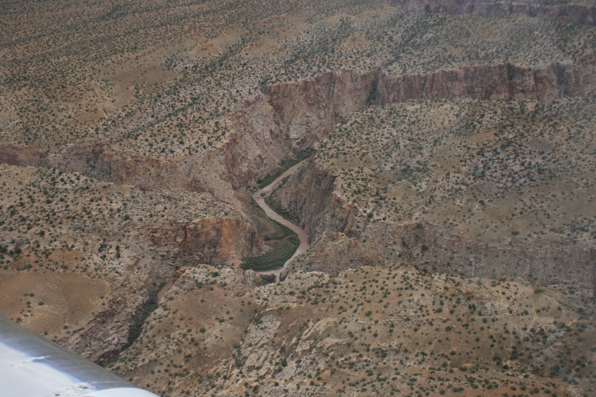
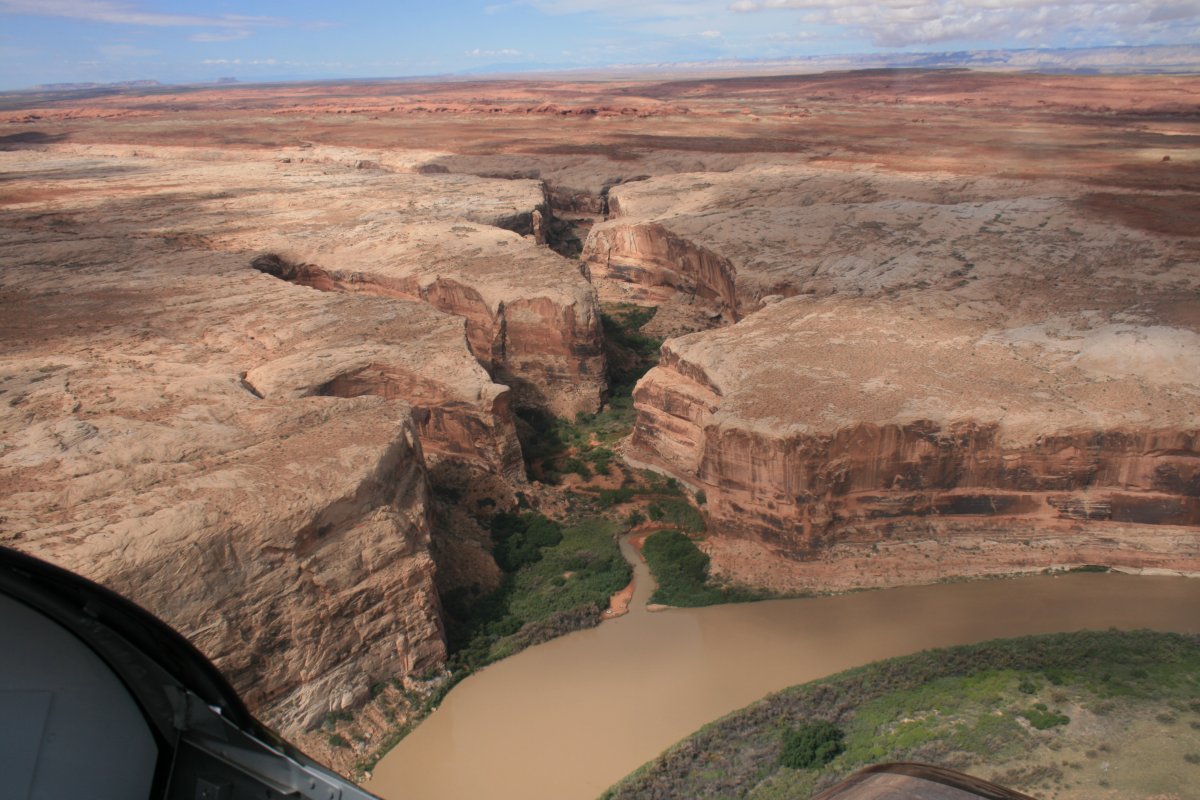
An interesting offshoot off the river.
|
| |
 |
|
| Another interesting offshoot. |
| |
 |
|
| I checked out one of the offshoots and am looking back at the Green River. |
| |
 |
|
| There was some Restricted Airspace on the east side of the river I had to be mindful of -- and stay out of. |
| |
 |
|
|
|
| |
 |
|
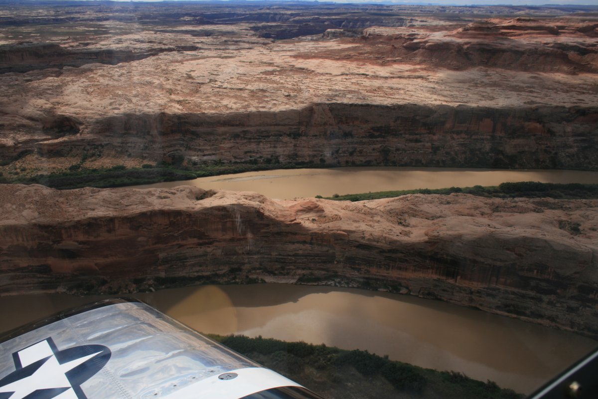
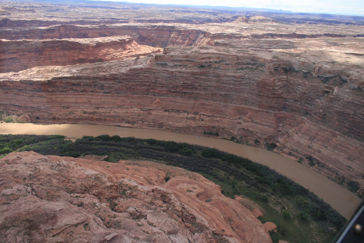
| The canyon walls just kept getting higher and higher. |
| |
 |
|
|
|
| |
 |
|
| |
| |
 |
|
| |
| |
 |
|
| |
| |
 |
|
|
It was just awesome flying down this section of the river.
|
| |
 |
|
| Mineral Canyon Strip Airport. This was a big uranium mining area in the 50's and this strip was carved out then. I think it's possible to land here with a permit. For obvious reasons, you want to land to the south and takeoff to the north. It would be a neat place to fly-in and camp. |
| |
 |
|
|
Well what do you know: a road. I don't know if I would want to drive it though.
|
| |
 |
|
| |
| |
 |
|
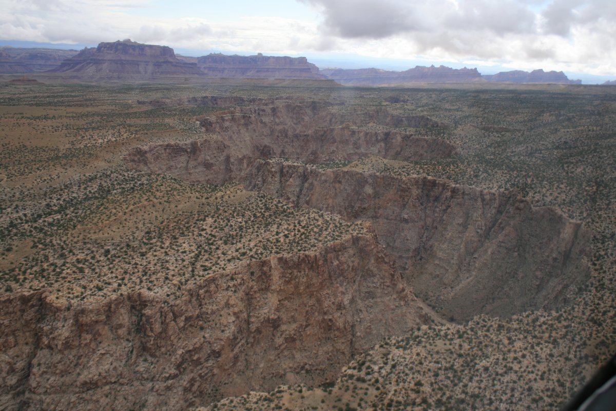
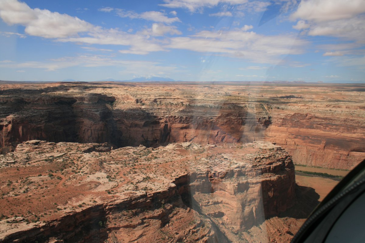
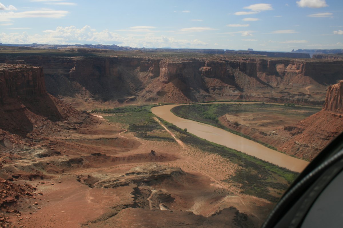
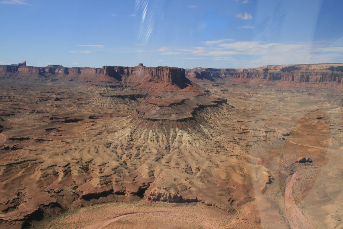
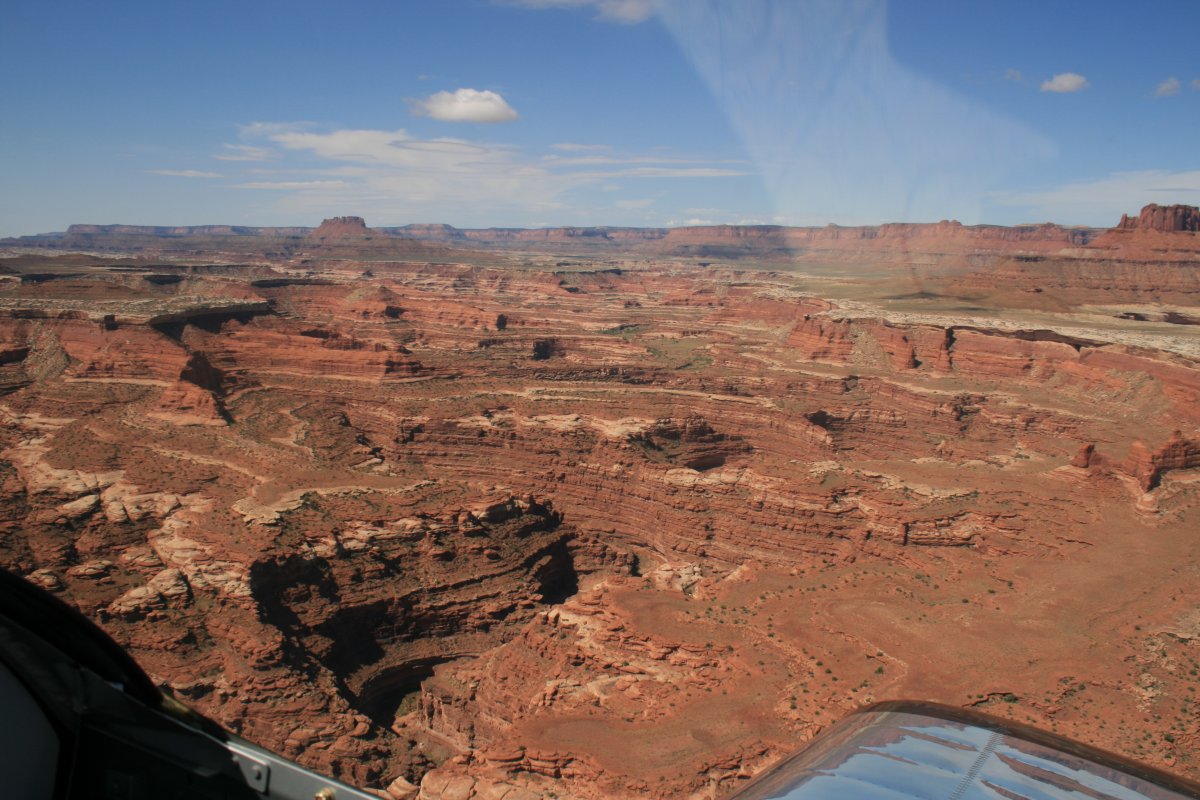
| A big canyon valley opens up to the east. |
| |
 |
|
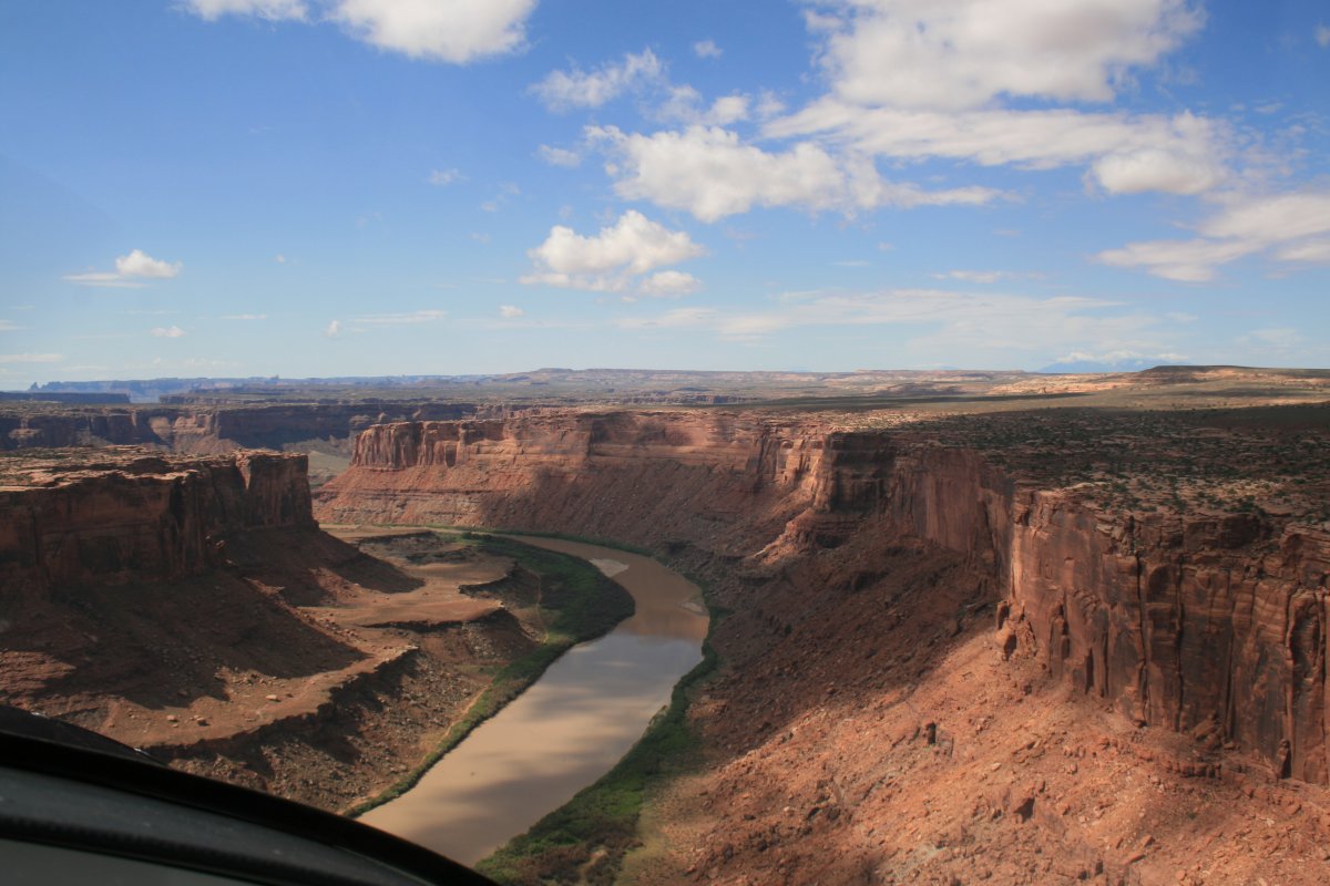
| But I stayed on the Green River. |
| |
 |
|
|
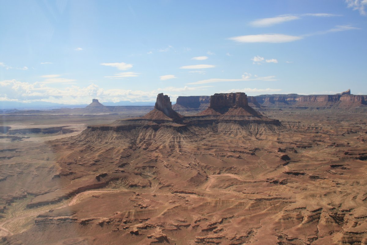
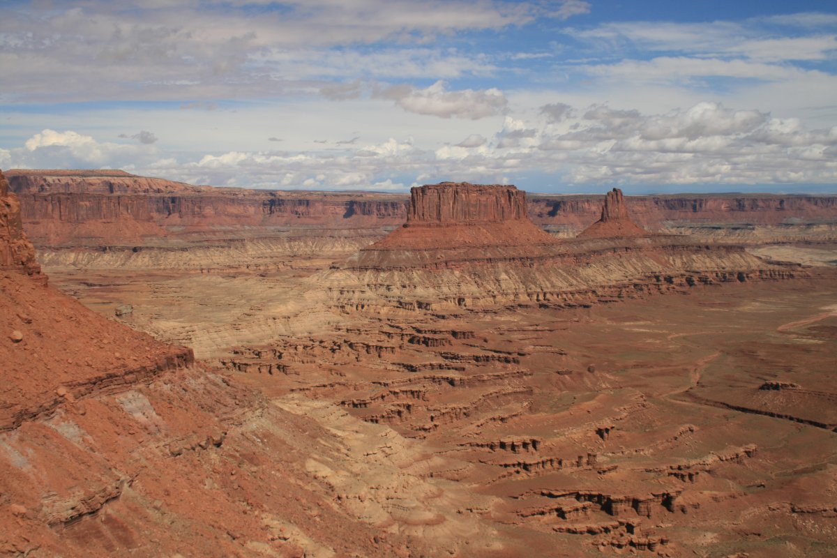
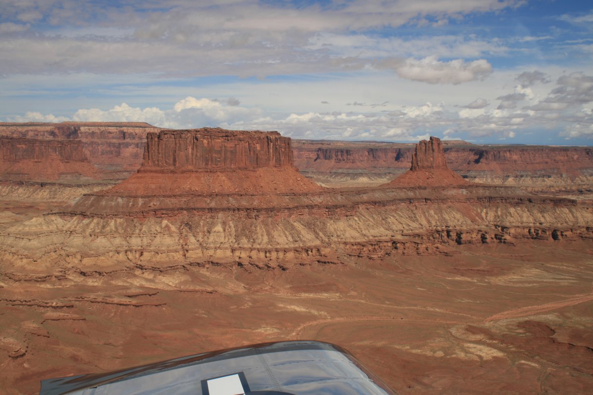
And then I was out into a big open area with buttes.
|
| |
 |
|
| |
| |
 |
|
|
|
| |
 |
|
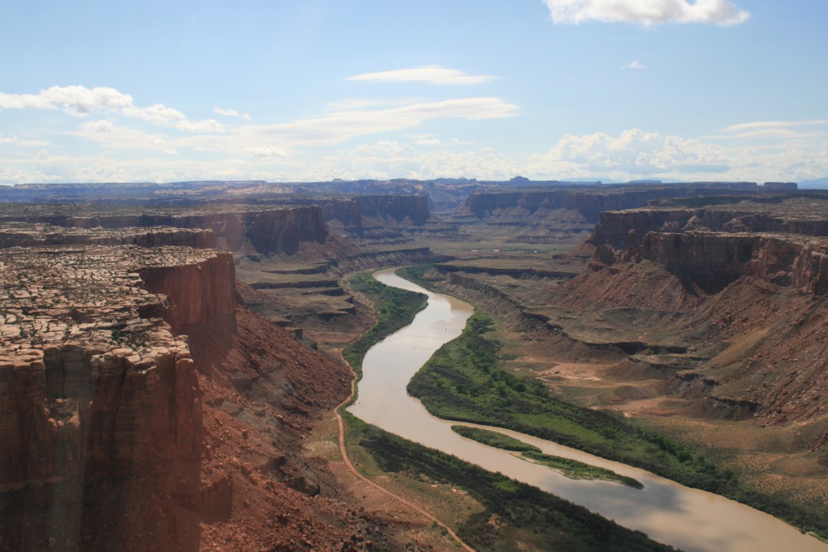
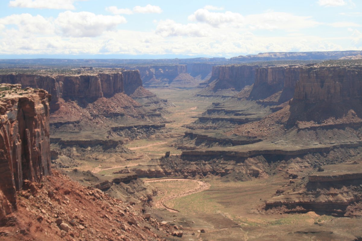
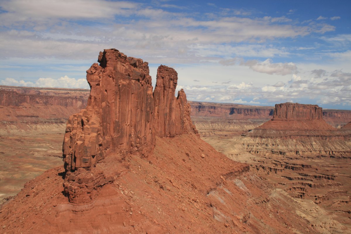
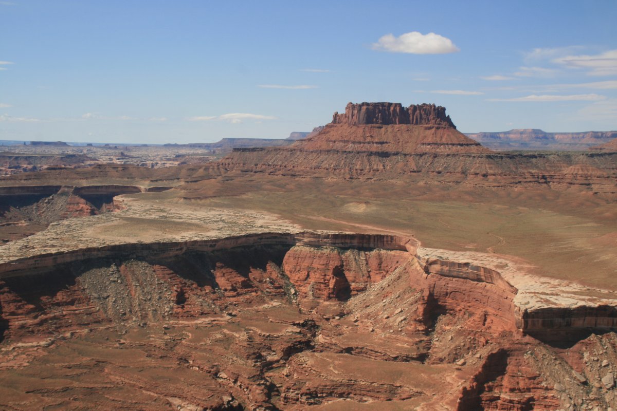
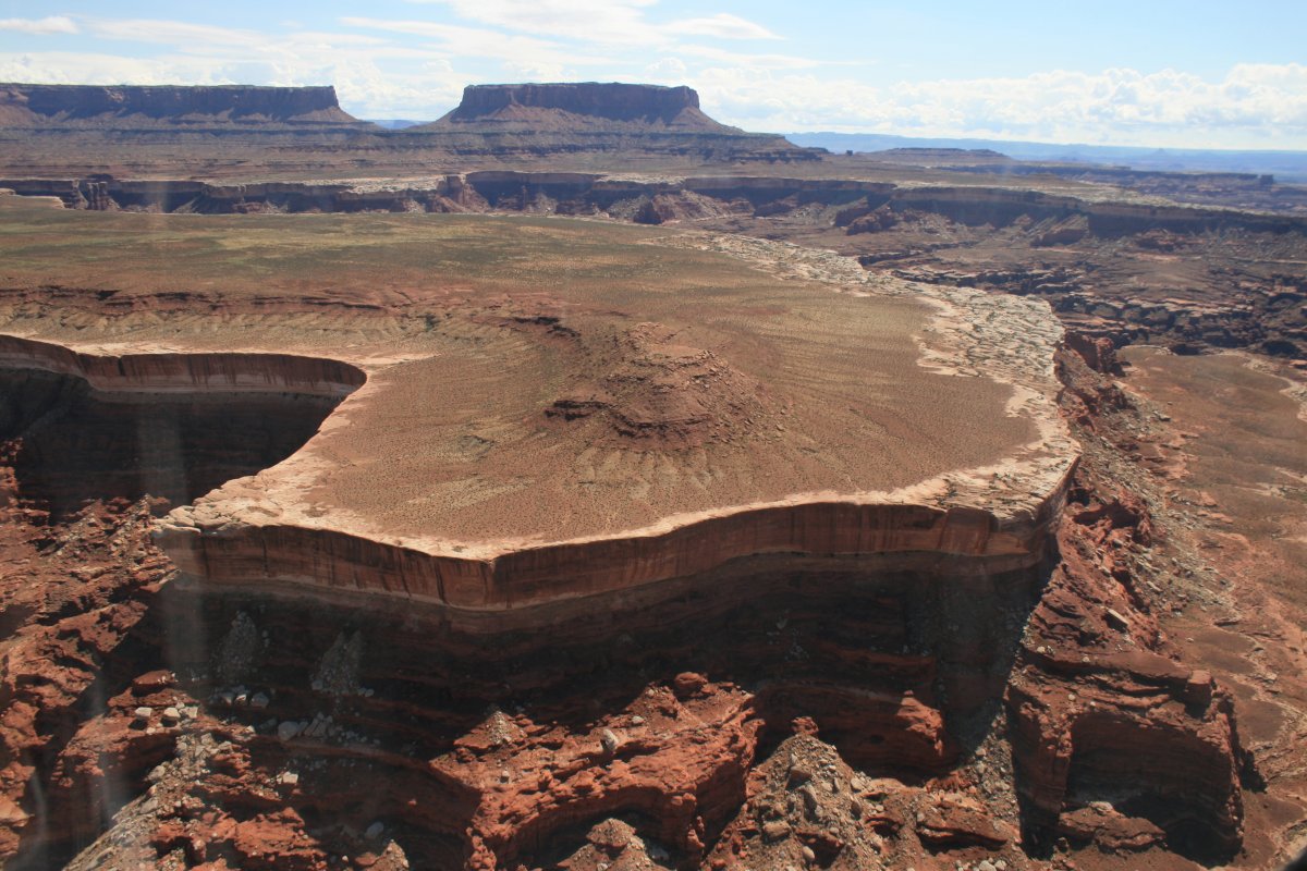
| In this place, every picture you take is worth framing and hanging on the wall. |
| |
 |
|
| |
| |
 |
|
| What can I say? |
| |
 |
|
|
|
| |
 |
|
| |
| |
 |
|
|
|
| |
 |
|
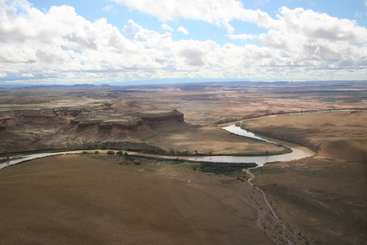
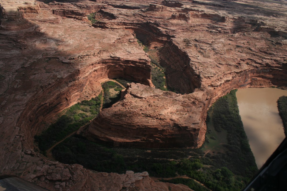
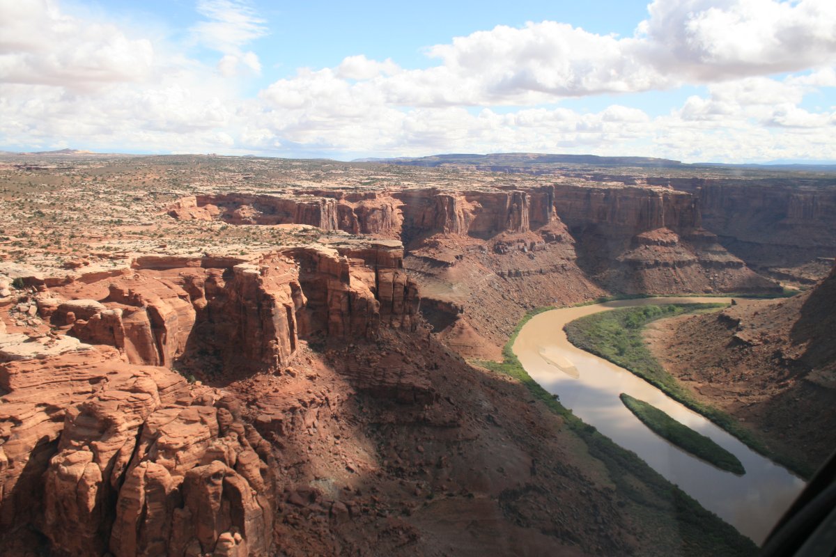
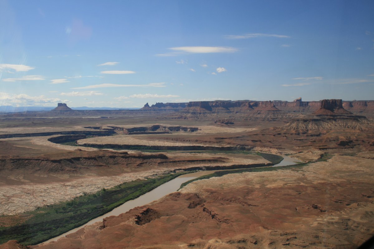
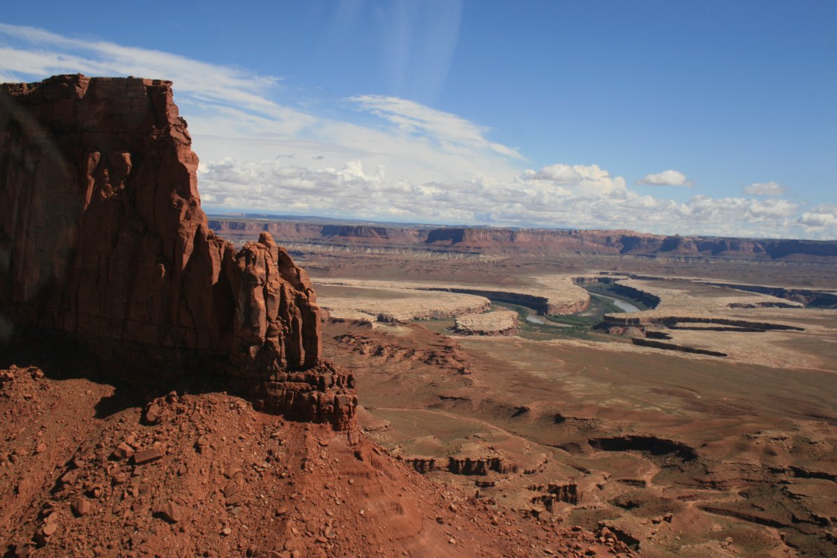
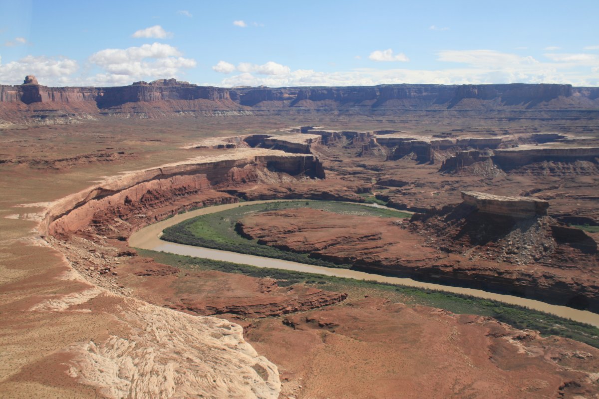
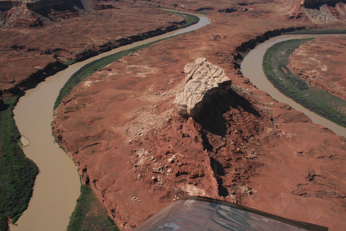
| Looking down at a Butte in a horseshoe bend of the river. |
| |
 |
|
|
|
| |
 |
|
| |
| |
 |
|
|
|
| |
 |
|
| |
| |
 |
|
|
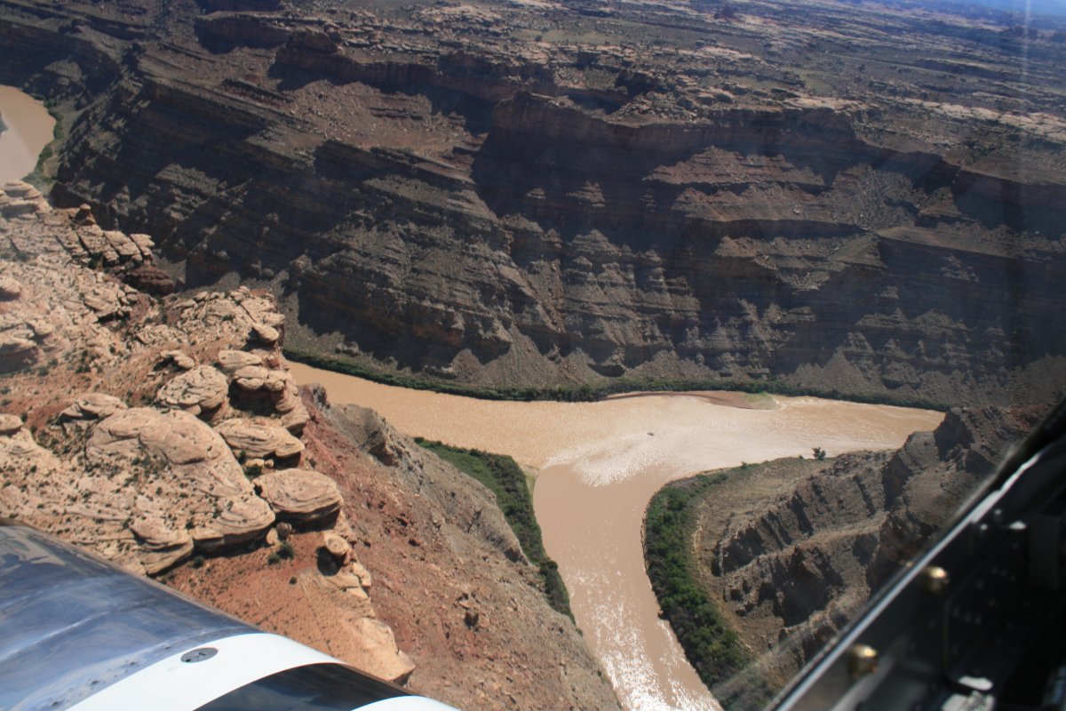
The Green and Colorado Rivers merge into just the Colorado River.
|
| |
 |
|
| |
| |
|
|
|
|
|
|