July 5, 2019 - Flight West - Day Ten
|
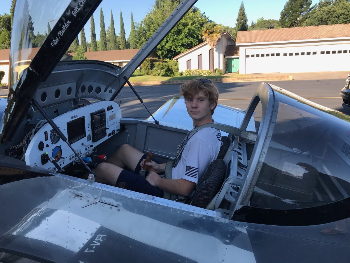
| Rob has two sons, ages 15 and 13, and asked me to take them for flights. Glad to! We flew early in the morning when the air was cool and smooth. Here is Rob's oldest son. |
| |
 |
|
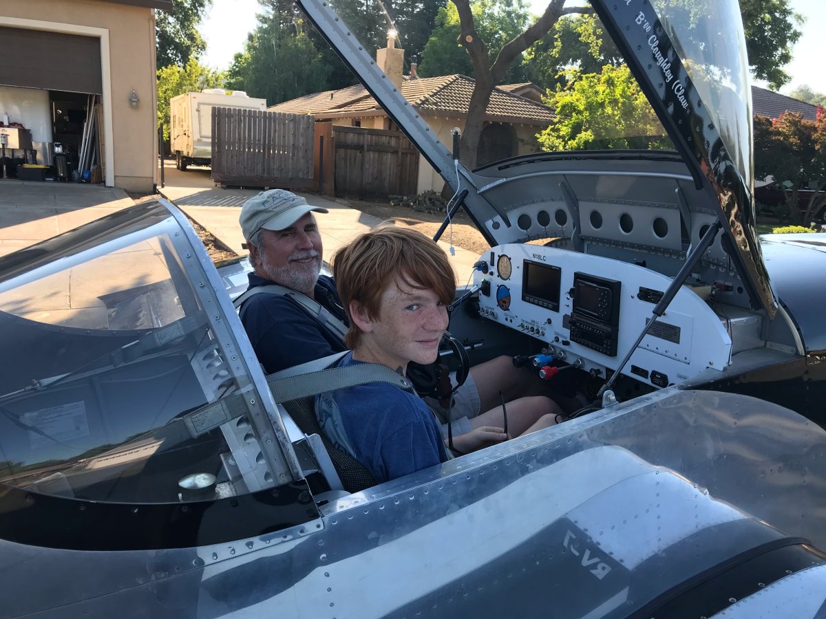
| And youngest. |
| |
 |
|
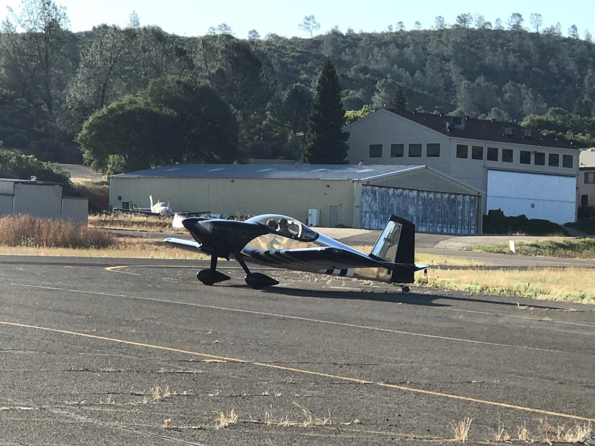
| Engine run-up prior to takeoff. |
| |
 |
|
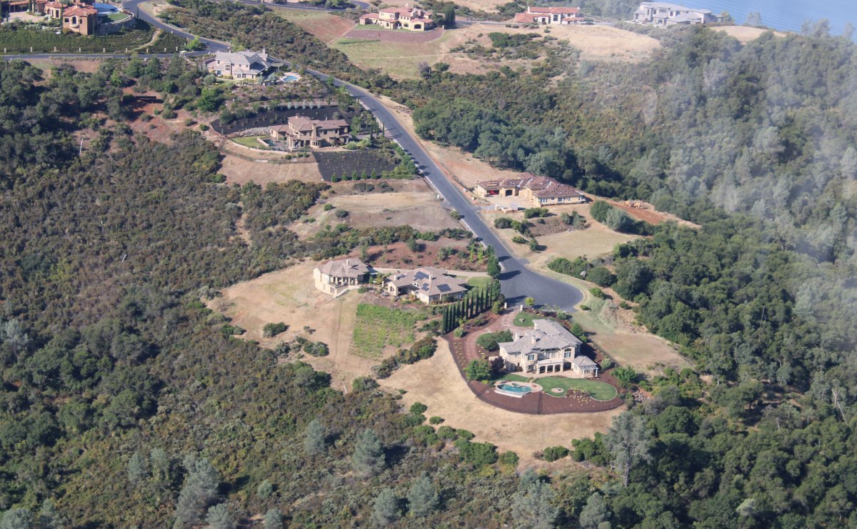
| Some beautiful houses on a hill just northwest of Cameron Park. |
| |
 |
|
|
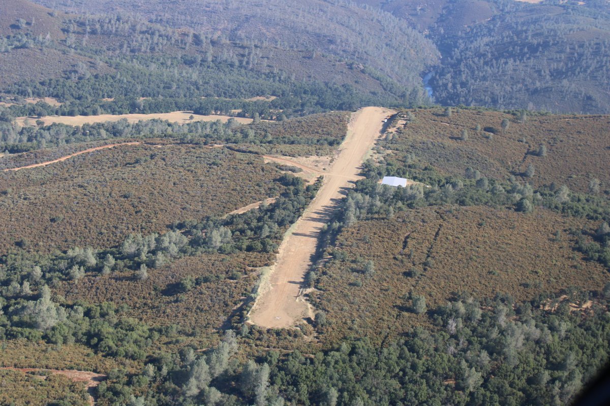
A little dirt strip with a cliff at the end!
|
| |
 |
|
|
I did the same flight for both boys: some sightseeing, a demonstration of what the RV can do, and some stick time. I think they both enjoyed the flight.
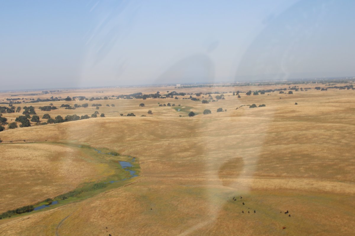
Here we are flowing low over the golden hills south of Cameron Park.
|
| |
 |
|
|
A few hours later, Rob and I hoped into the RV and headed southwest for an aerial tour of the San Francisco Bay Area.
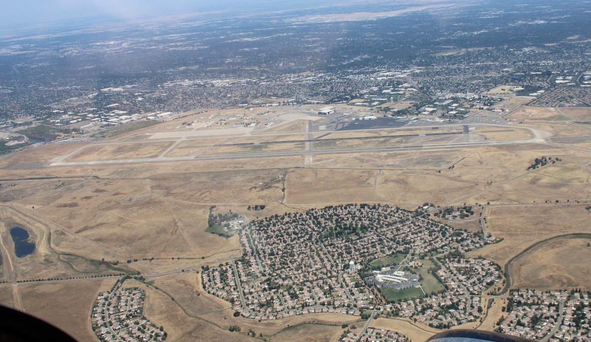
Here we are passing Mather Field, which used to be an Air Force Base. In fact, back in 1982, I was stationed here for six months while attending the joint Navy-Air Force Navigator school.
|
| |
 |
|
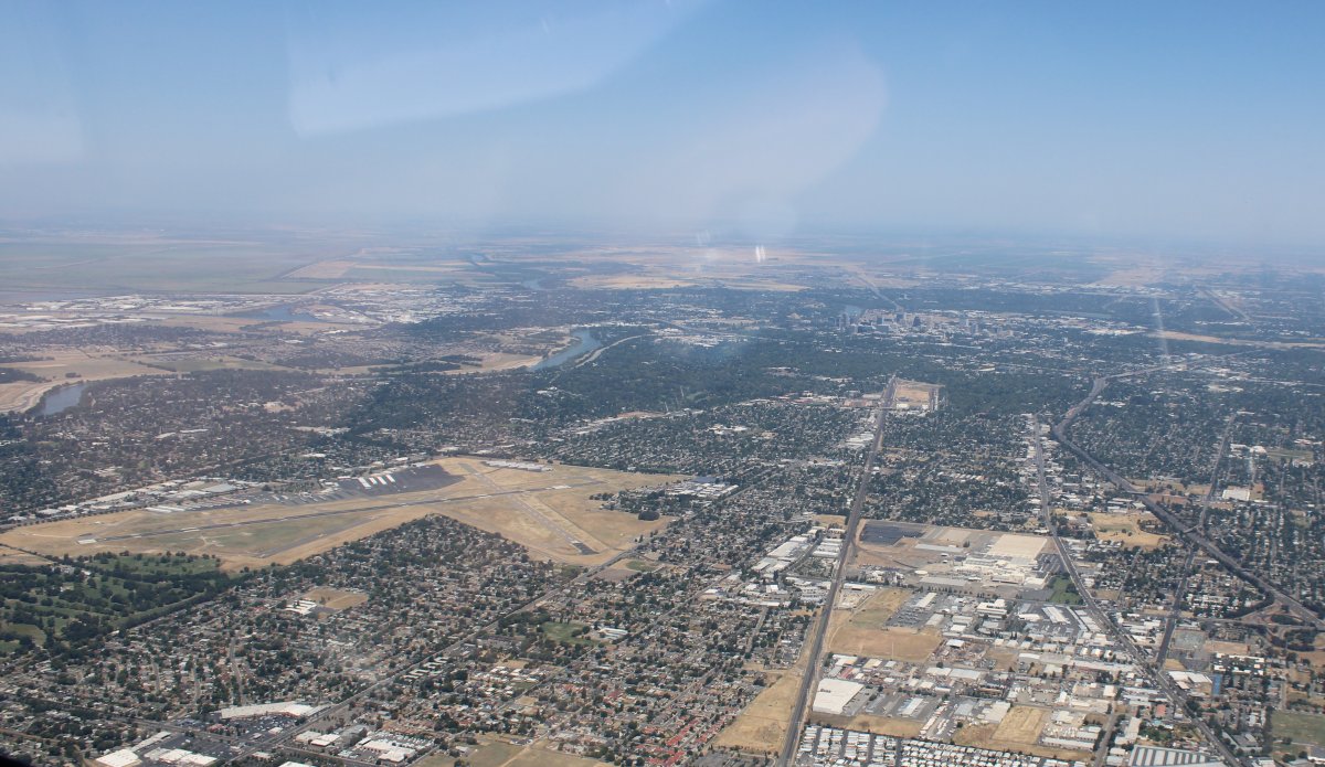
| Looking at Sacramento (upper right) off the right wing. Sacramento Executive Airport is at lower left. |
| |
 |
|
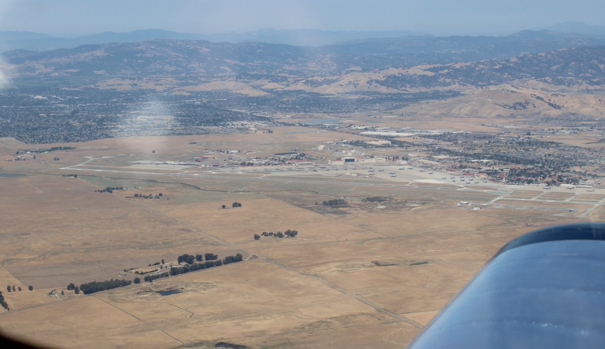
| Passing by Travis Air Force Base, home of all the big Cargo jets on the west coast. |
| |
 |
|
|
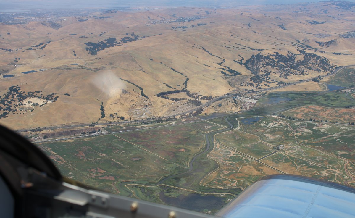
I grew up in what is now known as Silicon Valley -- Sunnyvale, Mountain View, Moffett Field. My grandparents lived in Sacramento so I have travelled the Silicon Valley to Sacramento path many times. That road down there is Interstate 680 and I know it well. But I never dreamed I'd someday be flying over it in my own plane. That I built.
|
| |
 |
|
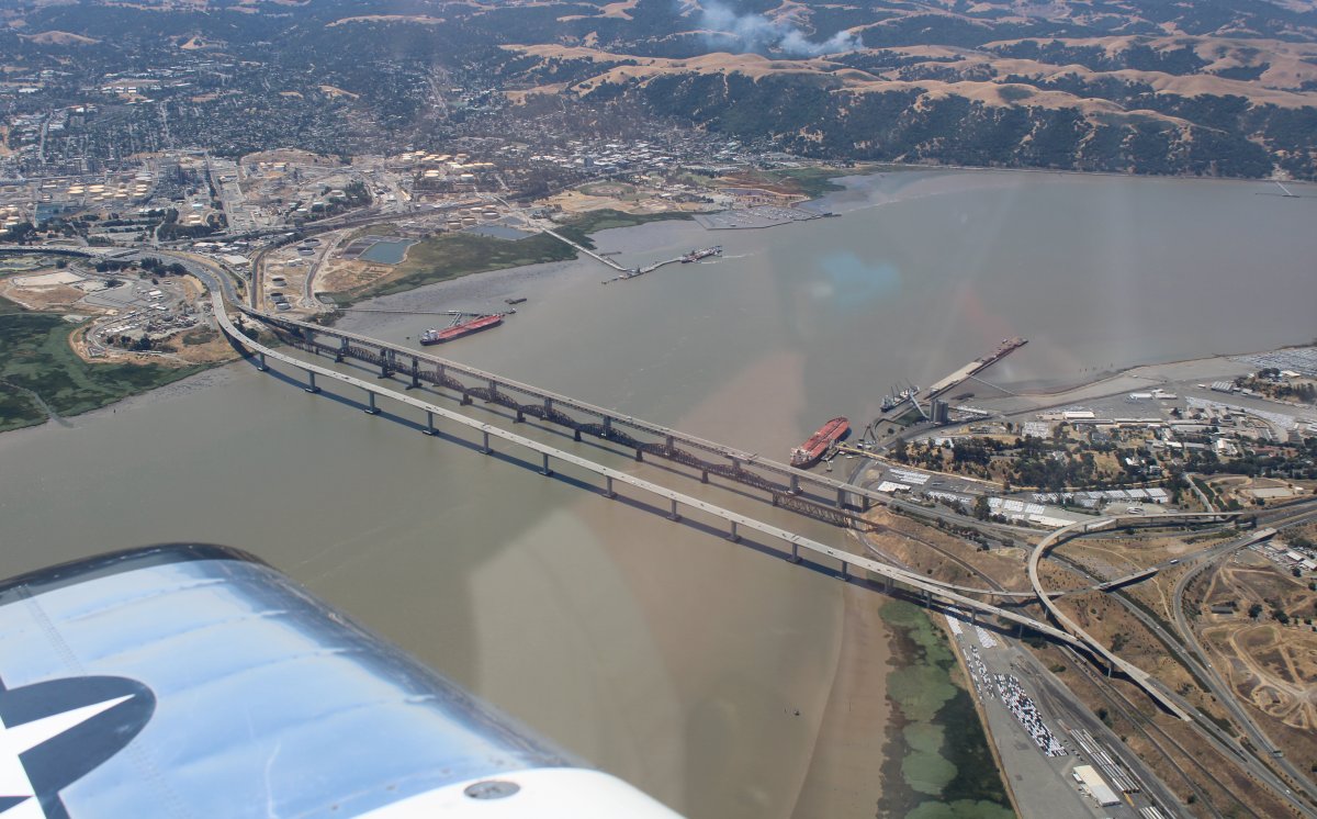
| About to cross the Benecia Bridge over Suisun Bay. Back when I was a kid, there used to be lots of ships tied up in Suisun Bay's "mothball fleet" but they are almost all gone now. There are only four ships left. |
| |
 |
|
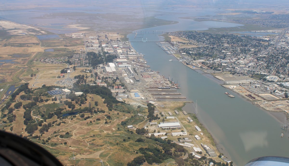
Passing by Mare Island, which used to be the Mare Island Naval Shipyard, responsible for shipbuilding, repair, overhaul, and maintenance of many different kinds of seagoing vessels including both surface combatants and submarines. It was the first United States Navy base established on the Pacific Ocean. During World War II, it was the primary base for construction and maintenance of the Navy's Pacific fleet of submarines. Seventeen nuclear subs were built here during the Cold War. The base closed in 1996 as part of the Navy's complete departure from the San Francisco Bay Area. |
| |
 |
|
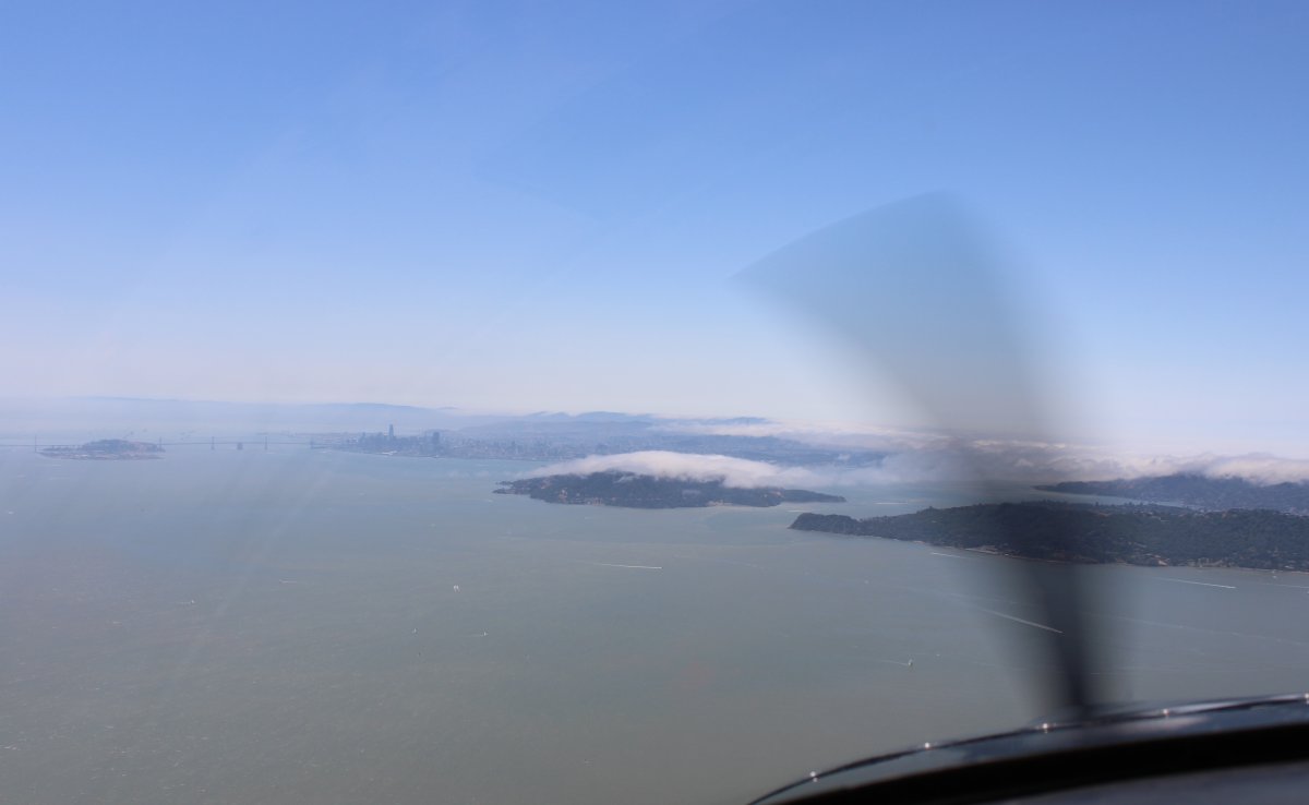
| We continued west out into the Bay, then turned south. The San Francisco skyline is visible in the distance. |
| |
 |
|
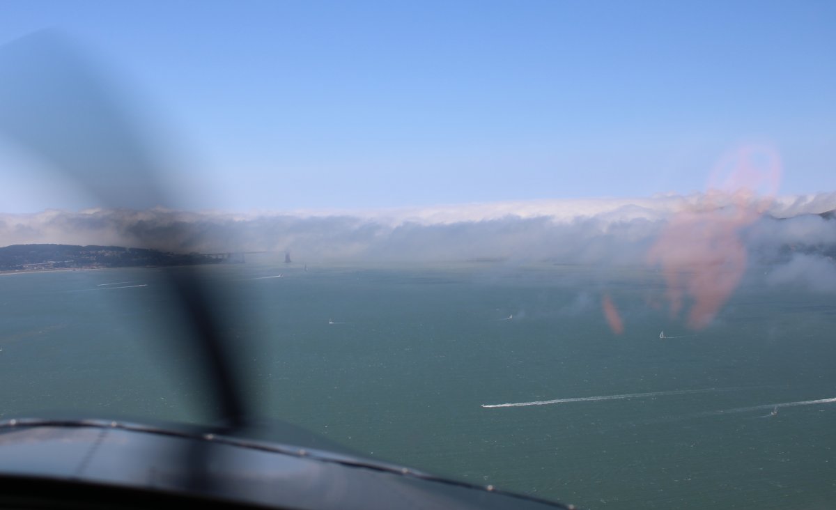
| I had hoped to check out the Golden Gate Bridge but as you can see, coastal fog is not going to allow that. You can just see the left part of the bridge. |
| |
 |
|
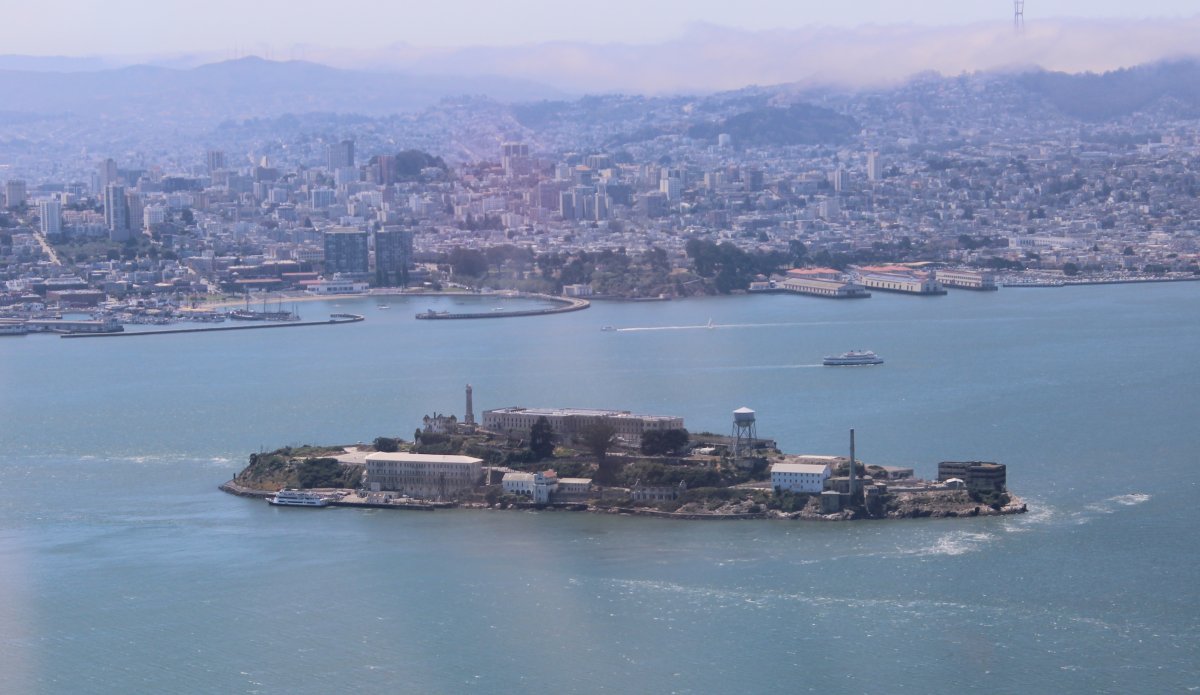
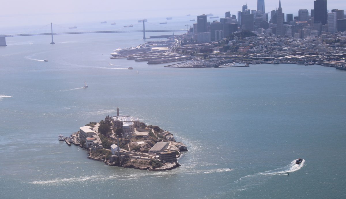
| But we did get a good look at Alcatraz. The Rock. |
| |
 |
|
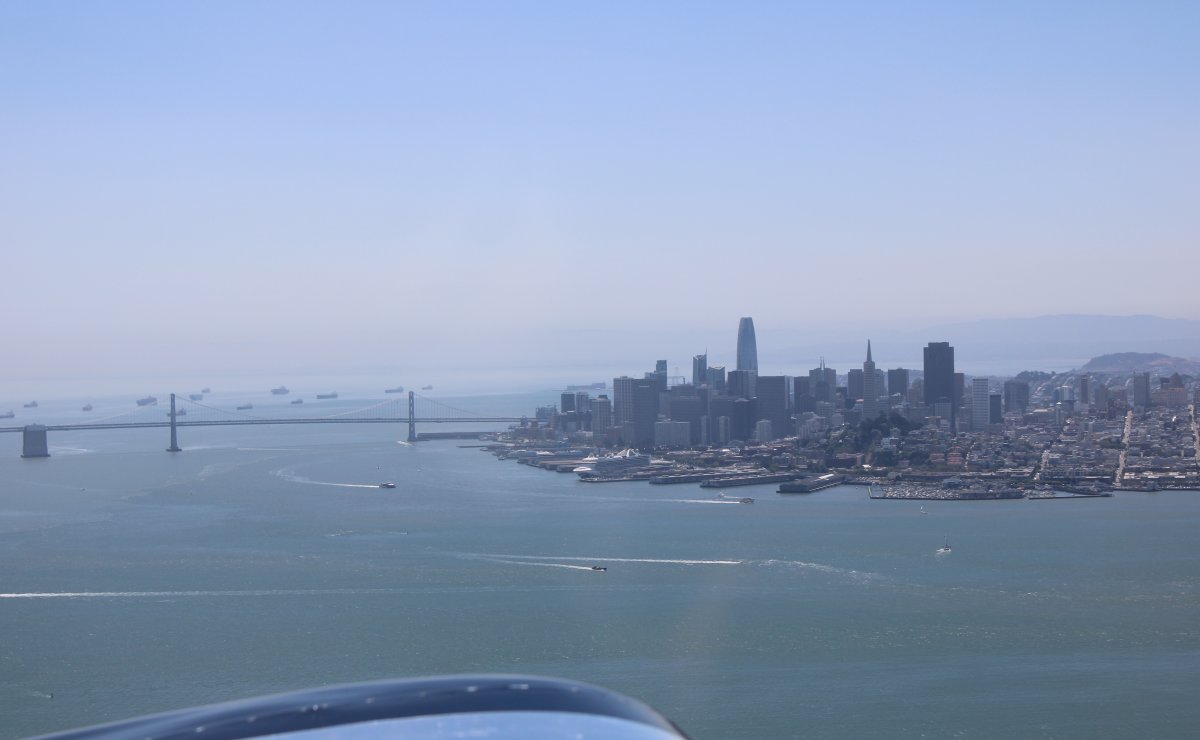
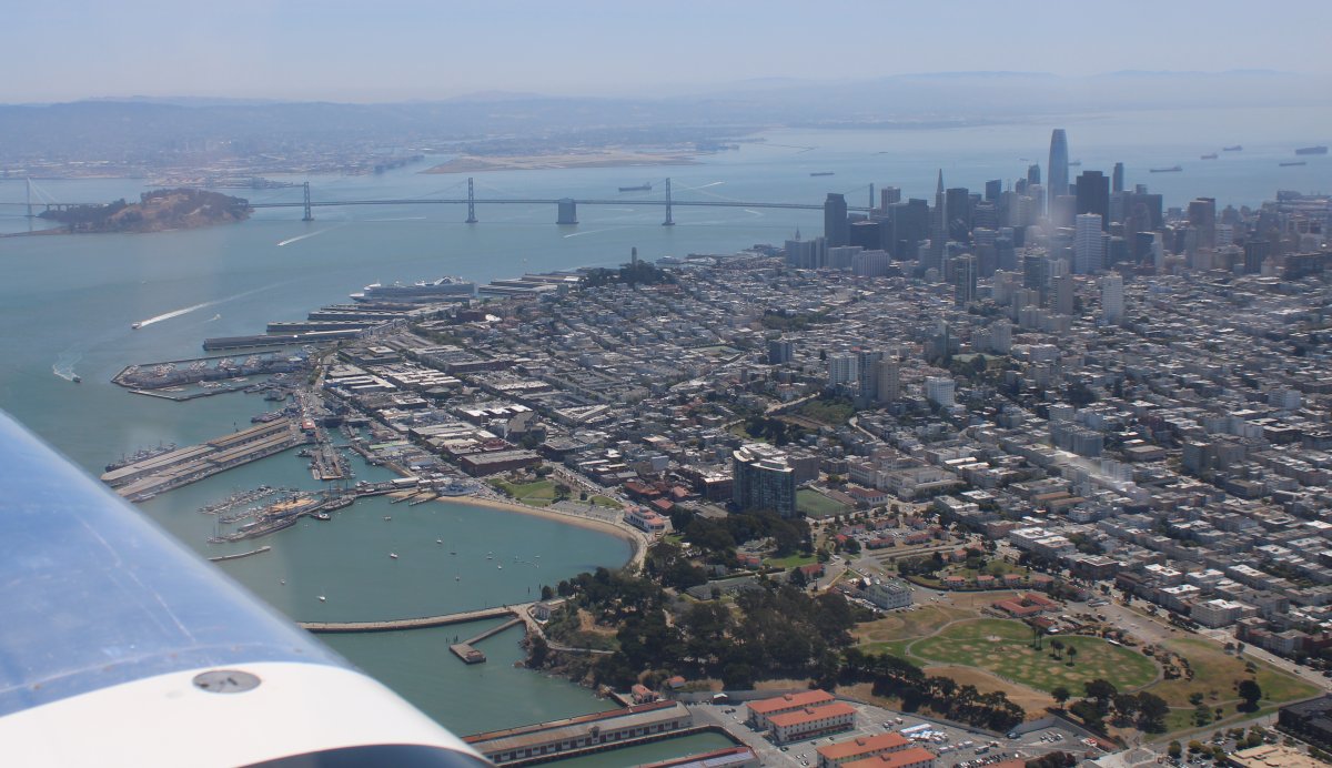
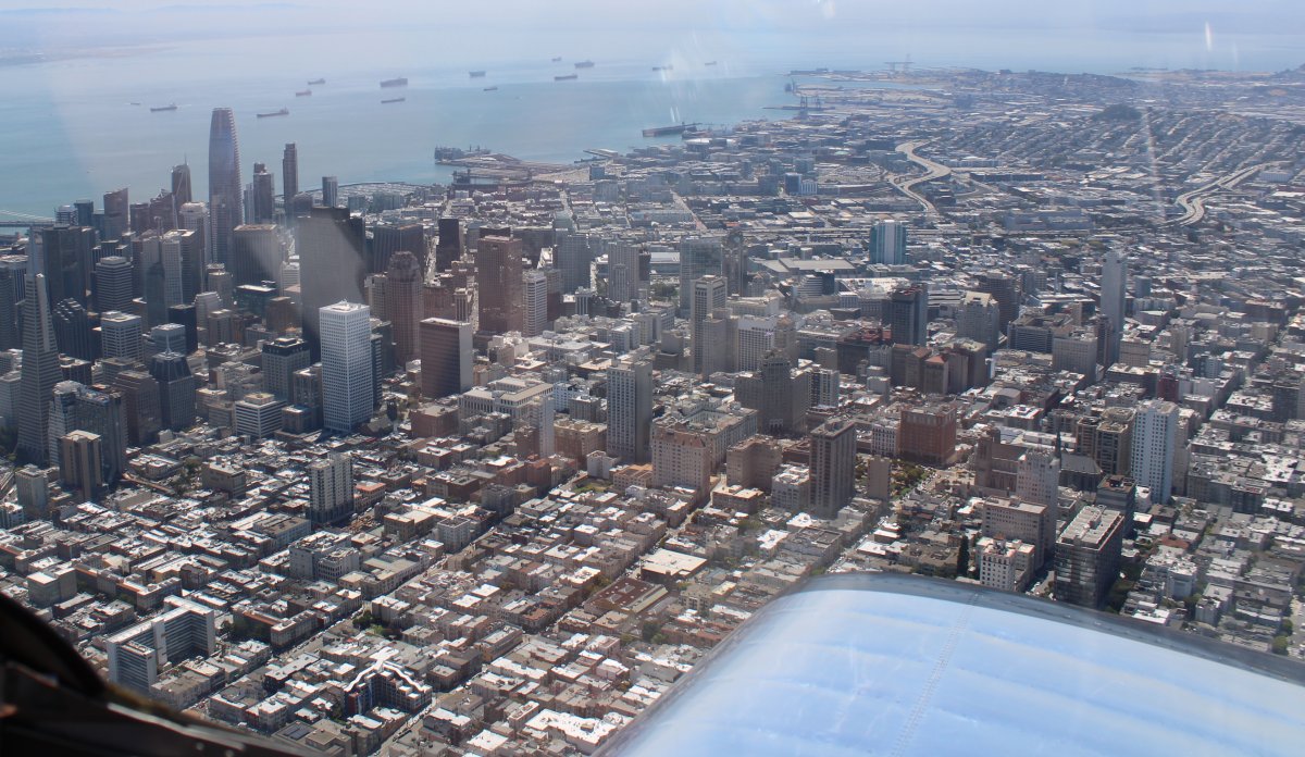
The tallest building in San Francisco is now the Salesforce Tower. It was just completed in 2018 and is 970 ft tall. It is also the second-tallest building west of the Mississippi River.
I'm very familiar with the Salesforce software because I use it at my work. It's good software.
|
| |
 |
|
| |
| |
 |
|
| |
| |
 |
|
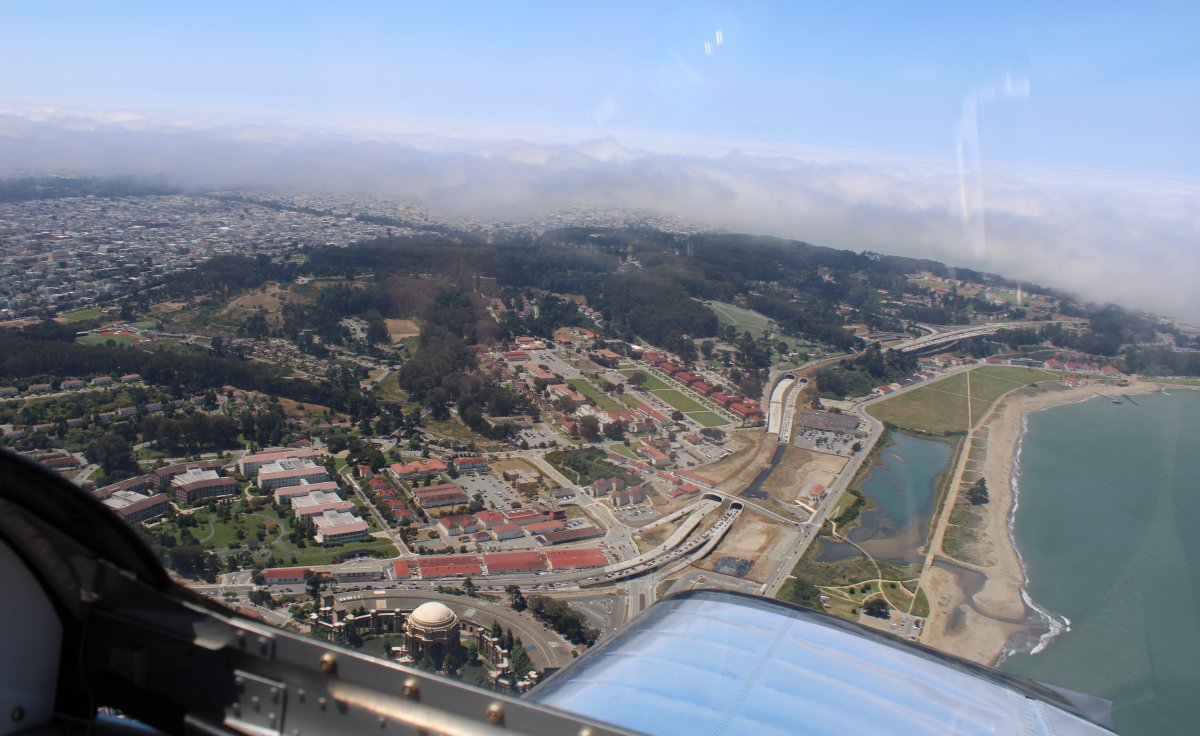
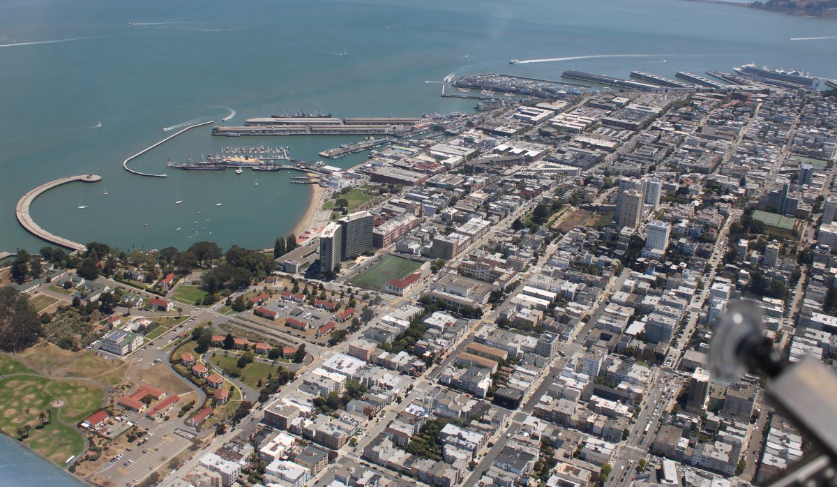
| Looking down at the Presidio which used to be a U.S. Army Fort. It was transferred to the National Park Service in 1994. |
| |
 |
|
| Flying over the North Beach area of San Francisco. Because San Francisco International Airport is south of the city, as long as you are below 3,000 feet you are clear of their Class B airspace. |
| |
 |
|
|
The famous Fisherman's Wharf area is top center.
|
| |
 |
|
| The financial district and all the big buildings. |
| |
 |
|
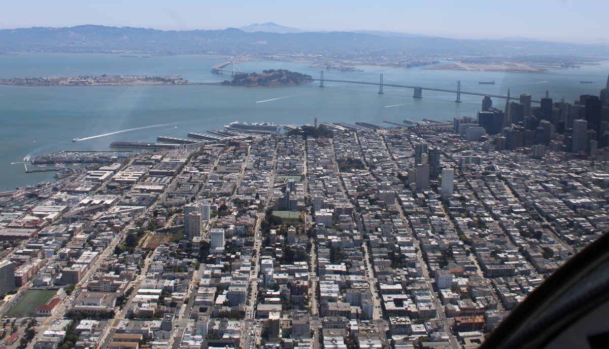
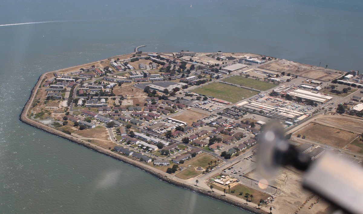
The northern tip of Treasure Island which is an artificial island just north of little Yerba Buena Island in the San Francisco Bay. It was built in 1936–37 for the 1939 Golden Gate International Exposition. The island's World’s Fair site is a California Historical Landmark.
Treasure Island was originally intended to become a second airport for San Francisco, augmenting the existing San Francisco Municipal Airport, now SFO. But with World War II looming, the Navy took it over and it became Treasure Island Naval Station. The Navy did build a Naval Auxiliary Air Facility to support fixed wing planes, seaplanes, blimps, dirigibles and airships. The Naval Station closed in 1997.
|
| |
 |
|
|
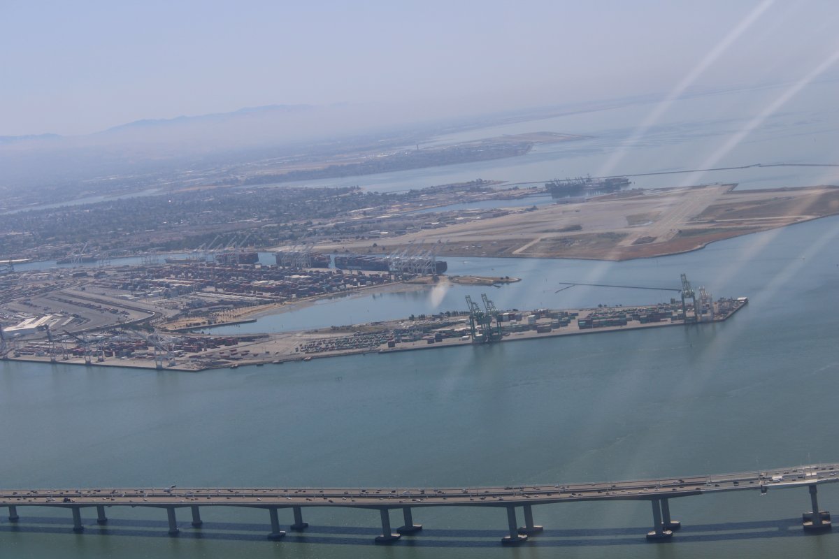
Looking south at what's left of the Alameda Naval Air Station. I landed here once in 1985 as part of a P-3 crew when we deployed from Brunswick, Maine all the way to Okinawa. It took us four days -- three overnight stops: here, Pearl Harbor, and Guam -- to get there. The P-3 is not a jet!
The airport was initially built in 1927 for public use. The Navy began taking it over in the late-30s. An aircraft carrier berthing pier was built in 1940. In April 1942, USS Hornet (CV-8) loaded at Alameda the 16 B-25 aircraft that would take part in the Doolittle Raid on Japan. During the Vietnam War portion of the Cold War and its later post-Vietnam era, the base was homeport to the aircraft carriers Coral Sea, Enterprise and Carl Vinson. NAS Alameda also housed a major aircraft overhaul facility employing thousand of civilian employees that was known as Naval Air Rework Facility (NARF) Alameda and later renamed Naval Aviation Depot (NADEP) Alameda.
The base and runways were closed in 1997. The airfield was not reutilized as a civilian airport. The USS Hornet (CV-12) was given to the former air station to be used as a museum ship, the USS Hornet Museum. You can just barely see the USS Hornet on the other side of the vacant airfield.
|
| |
 |
|
|
We headed east across the hills towards Mount Diablo but turned south in the valley before reaching it.
|
| |
 |
|
|
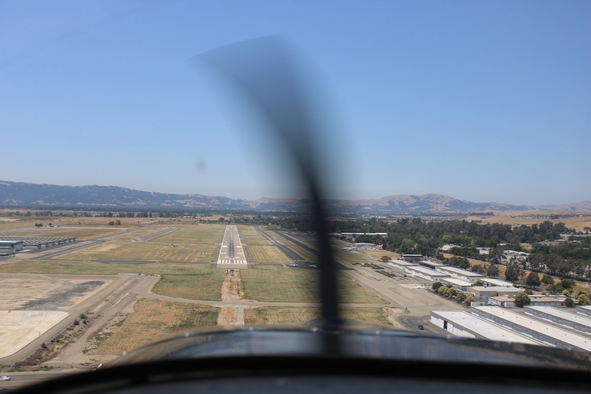
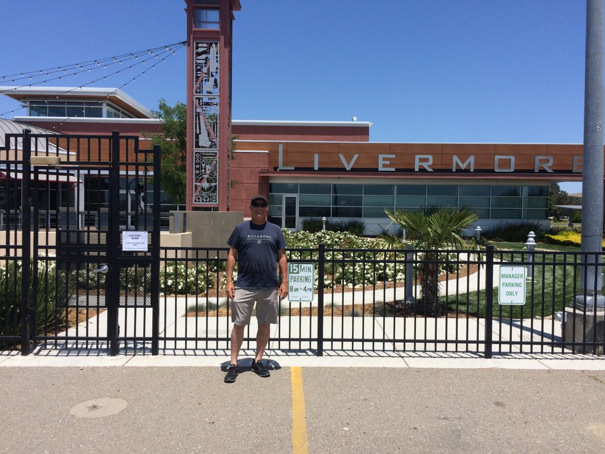
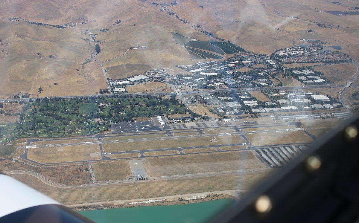
Our destination was Livermore Airport (KLVK).
43 years ago, on July 20, 1976, an 18 year old kid soloed here at Livermore Airport in a Cessna 150. I can still remember how I felt taking off from this runway by myself.
It was a busy, towered airport then, and it still is a busy, towered airport.
|
| |
 |
|
|
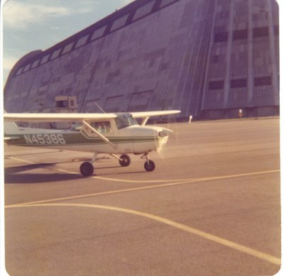
The plane I soloed in, a Cessna 150 N45386 belong to the Moffett Field Naval Flying Club, was practically new, only a year old.
|
| |
 |
|
|
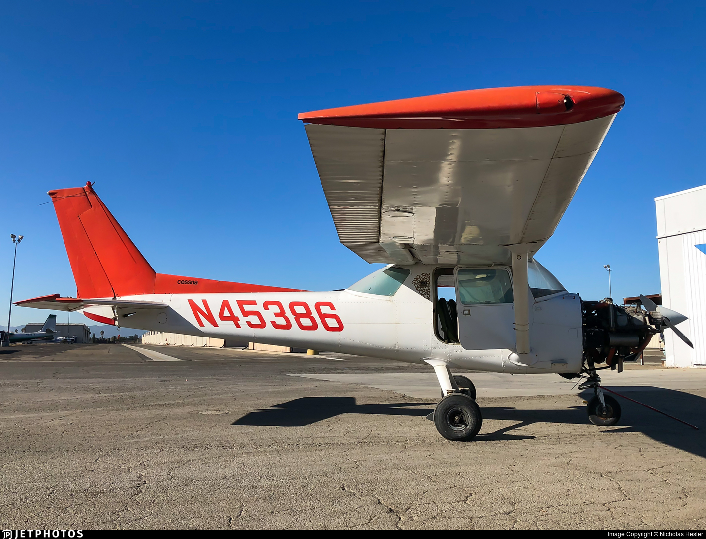
Here is the last known picture of the N45386 in November 2018 at Reid-Hillview Airport, owned by San Jose State University. The plane is now reregistered.
When I think of some of my landings as a student pilot, it is amazing to me that the plane lasted over 40 years!
|
| |
 |
|
| Rob in front of what appeared to be the new Terminal. We walked down the street to Beeb's Sports Bar and Grill at the Golf Course for lunch. |
| |
 |
|
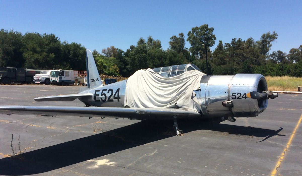
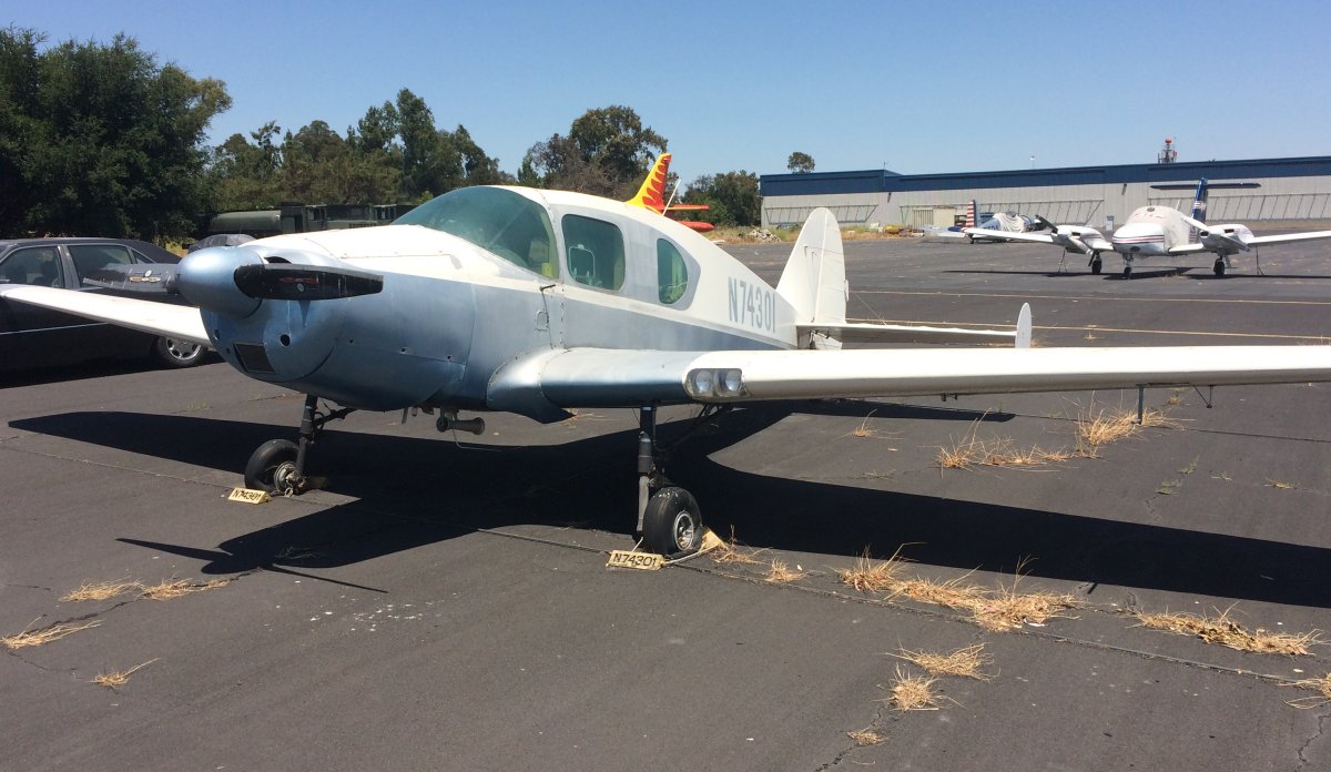
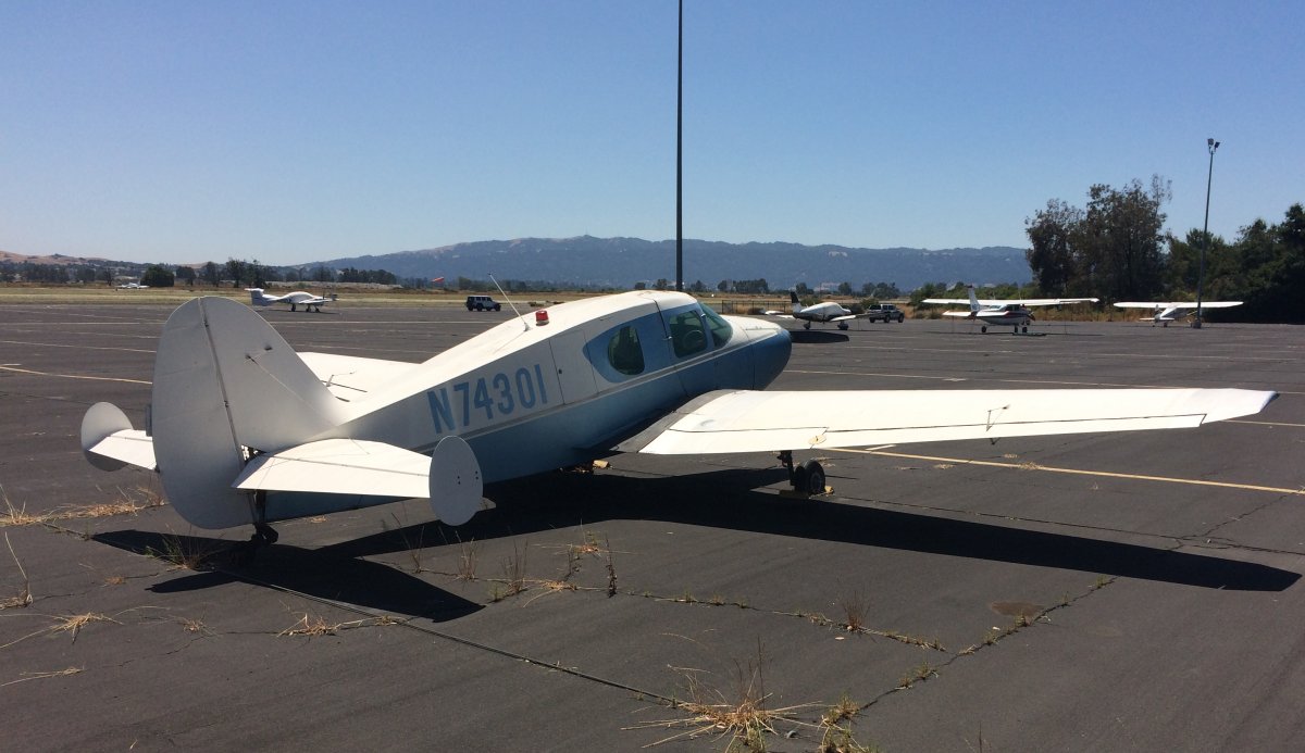
| Back at the airport, we checked out some interesting airplanes on the ramp. |
| |
 |
|
|
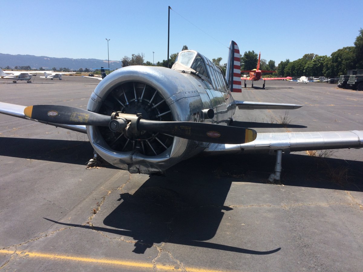
I don't know what happened to this Vultee BT-13 Valiant but look how the landing gear is sheared off and prop is bent.
|
| |
 |
|
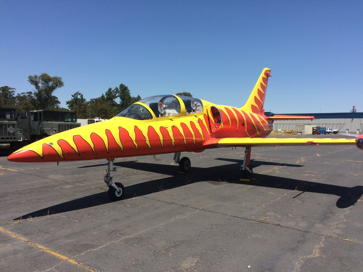
| A wild paint scheme on this L-39 jet. |
| |
 |
|
|
Flat tires like this are always a bad sign.
|
| |
 |
|
| I would be surprised if this airplane ever flies again. |
| |
 |
|
|
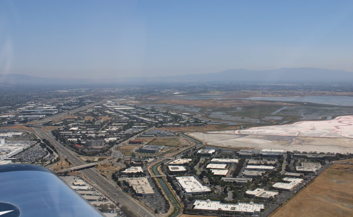
Heading southwest across I-880 through some very complicated airspace. When I flew around here as a student back in 1976-7, San Jose, Reid-Hillview and Moffett Field were the only towered airports. Now all the other airports like Palo Alto and San Carlos have towers too. Plus San Jose and Oakland has Class C airspace. And then of course there is San Francisco's Class B to worry about. You better know what you are doing flying around here. It would be very difficult to avoid busting someone's airspace without GPS.
Straight ahead, there used to be a little dirt strip airport called Fremont. It's long gone now, of course. But I remember the first time my instructor told me to land there. I was used to Moffett Field's 10,000 ft runway and when I saw the little dirt road he wanted me to land on, I thought "you gotta be kidding me. Is it even legal to land at a place like this?!"
|
| |
 |
|
Moffett Field has been a big part of my life. My Dad, a career Naval Officer and P-3 Pilot, was stationed here nine years. We lived in nearby Sunnyvale for six years where I went to elementary school. Later we lived on the base for three years -- the house still stands. I graduated from Mountain View High School not far out the front gate. My friends and I goofed off while Steve Jobs and Steve Wozniak were inventing the personal computer in a house garage five miles away! I worked my first jobs here. I washed planes for the Flying Club here and then took lessons and got my ticket. I came back in 1994 for the decommissioning ceremony.
Now Moffett Field is a Federal Airfield. I wanted to do a low pass down one of their long runways. I knew they are not very busy -- the Tower frequency was silent -- so I figured I'd give it a shot. First I asked the Tower for a transition through their airspace. Granted. Then I asked if I could do a low pass down one of their runways. I think that surprised them but they said OK. So I did.
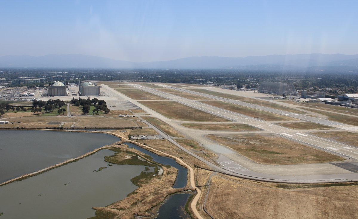
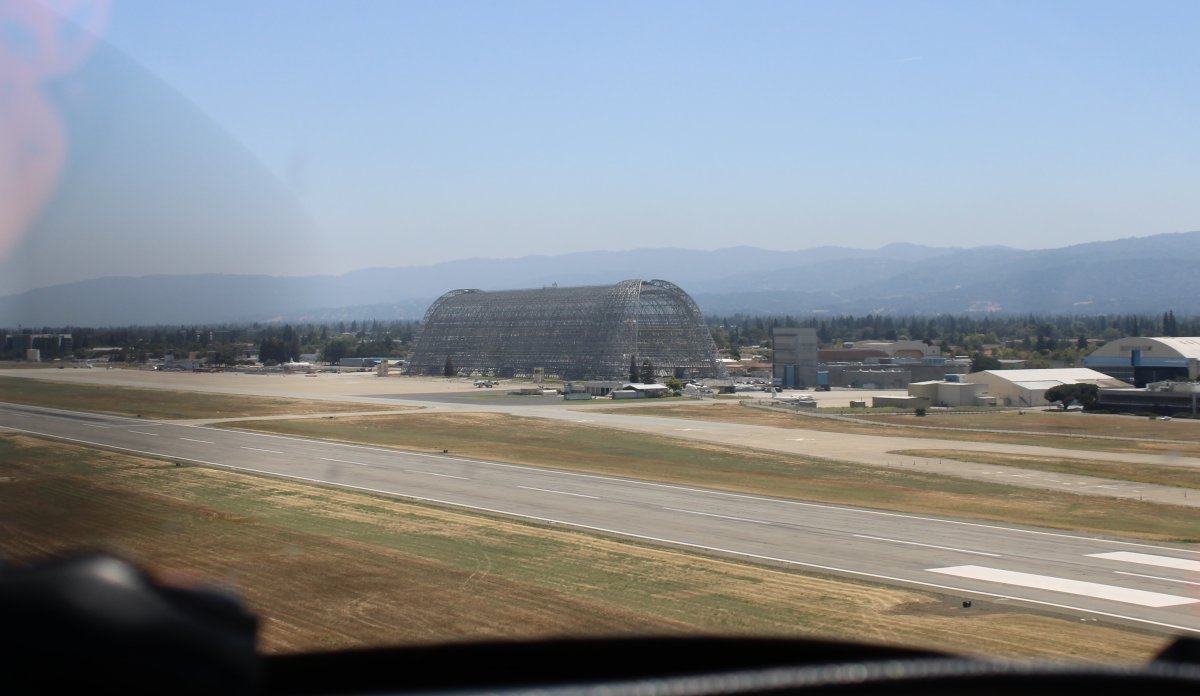
Here I'm rolling in for a low pass on 32 Left.
Hangar One is on the right and Hangars 2 and 3 are on the left.
|
| |
 |
|
|
From the end of World War II until its closure, NAS Moffett Field saw the development and use of several generations of land-based anti-submarine warfare and maritime patrol aircraft, including the Lockheed P2V Neptune and
Lockheed P-3 Orion. Until the demise of the USSR and for some time thereafter, daily anti-submarine, maritime reconnaissance, Fleet support, and various training sorties flew out from NAS Moffett Field to patrol along the Pacific coastline, while Moffett's other squadrons and aircraft periodically deployed to other Pacific, Indian Ocean and Persian Gulf bases for periods of up to six months.
Back in Moffett's heyday, there were six P-3 squadrons stationed here plus the big RAG (Replacement Air Group squadron VP-31). Moffett Field was a busy place. Now it's a ghost town.
|
| |
 |
|
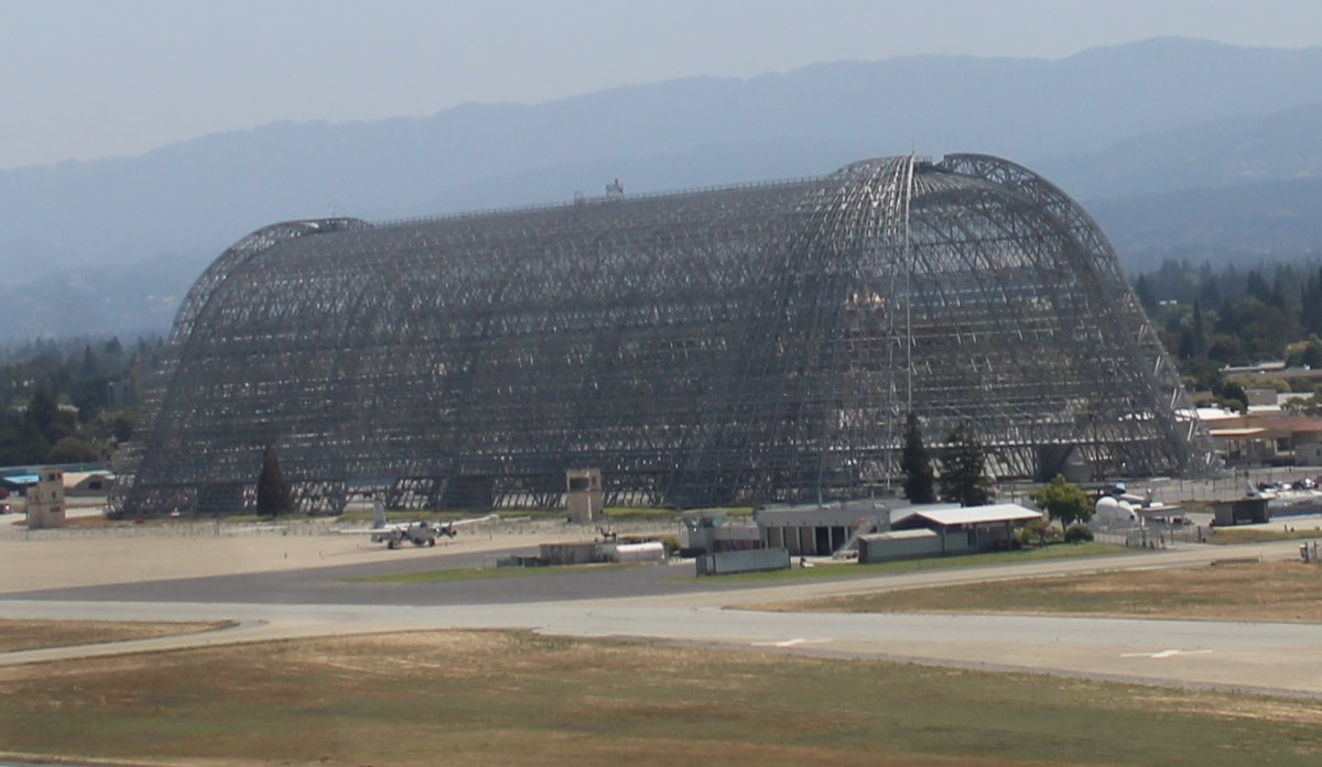
Hangar One was built during the Depression era for the rigid airship USS Macon. The Macon was "flying aircraft carrier", carrying five single-seat Curtiss F9C Sparrowhawk aircraft for scouting purposes. Serving only a year, the Macon was lost in a storm off Big Sur.
The Moffett Field flying club operated out of that little building in front of the P-2V Neptune. I used to watch the P-3s taxi by as I washed the flying club planes: four C150s, a Cessna 206, a Mooney, a Bonanza. In those days, it cost $15 an hour to rent the C150 wet, and $15 an hour for the instructor.
You have probably noticed Hangar One has no skin. The structure was leaking toxic chemicals so they removed the skin in 2011. As I understand it, Google will pay for the effort to to renovate and restore Hangar One.
Google signed a 1.16 billion dollar 60-year lease for Moffett Federal Airfield and Hangar One. Plus Google pays $1.3 million a year to NASA to park their Boeing 767-200 and Gulfstream V jets at Moffett Field. Googleplex -- the corporate headquarters complex of Google and its parent company Alphabet Inc. -- is less than a mile to the west of Moffett Field.
|
| |
 |
|
|
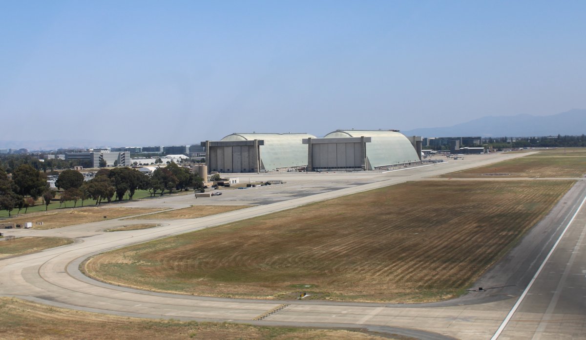
Hangars Two and Three were built at the beginning of World War II to house blimps used for coastal anti-submarine patrolling. Similar hangars were built at bases along both coasts; seven still stand today.
The Hangars are still some of the largest unsupported wooden structures in the country.
|
| |
 |
|
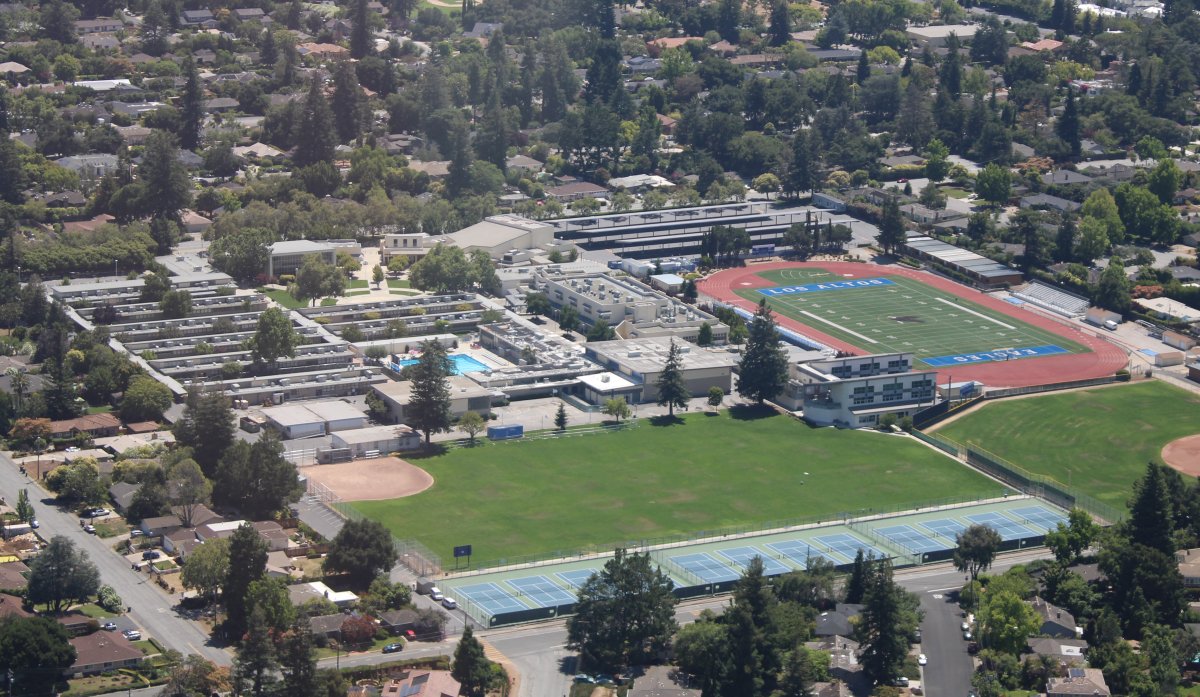
Mountain View High School has long been torn down but I did use to go over to Los Altos High School where I was in the orchestra. Plus our football team beat them on that field down there in an
exciting 8-7 win that helped send us to the Central Coast Section playoffs (which we ended up winning). My brother-in-law caught the winning touchdownpass in that end zone down there! He was wide
open in the center of the end zone and went to his knees to ensure he did not drop the game-winning pass. |
| |
 |
|
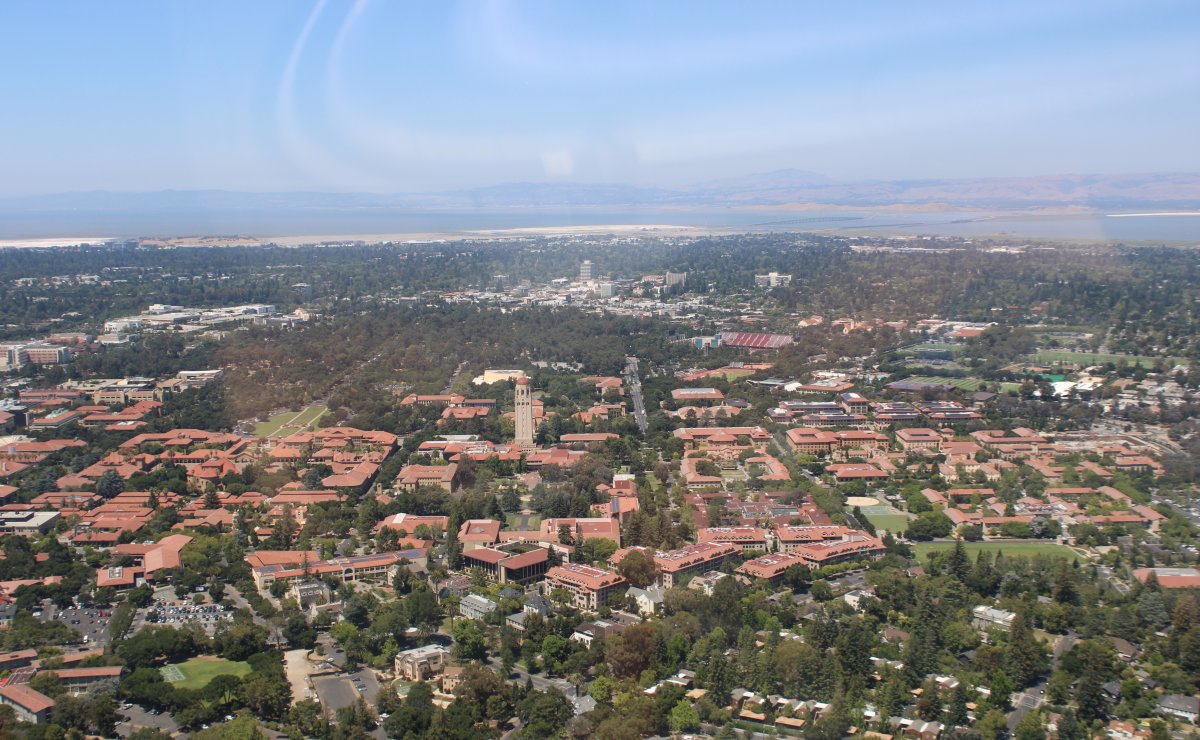
| Just out of Moffett Field Class D airspace to the west is Stanford University where my Dad went. Stanford is very visible from the air with all the adobe red roofs and iconic Hoover Tower. |
| |
 |
|
|
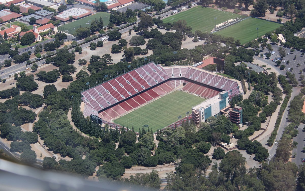
And the football stadium. My parents had season tickets to Stanford football for 30+ years and saw all the great ones play: Jim Plunkett, John Elway, Andrew Luck.
|
| |
 |
|
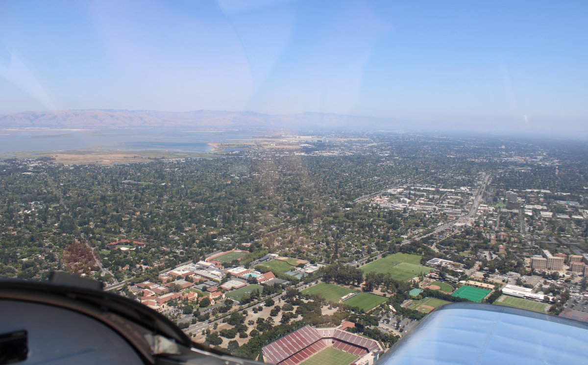
Looking east with Stanford stadium at bottom and Moffett Field at top. I had to get a transition north through Palo Alto Tower's Class-D airspace to get back to Sacramento. Usually it seems like Tower's
just say "transition granted" and then forget about you. But this Tower gave me traffic advisories and helped keep me from busting San Jose's Class C. |
| |
 |
|
|
Passing by Livermore Airport again on our way home.
|
| |
 |
|
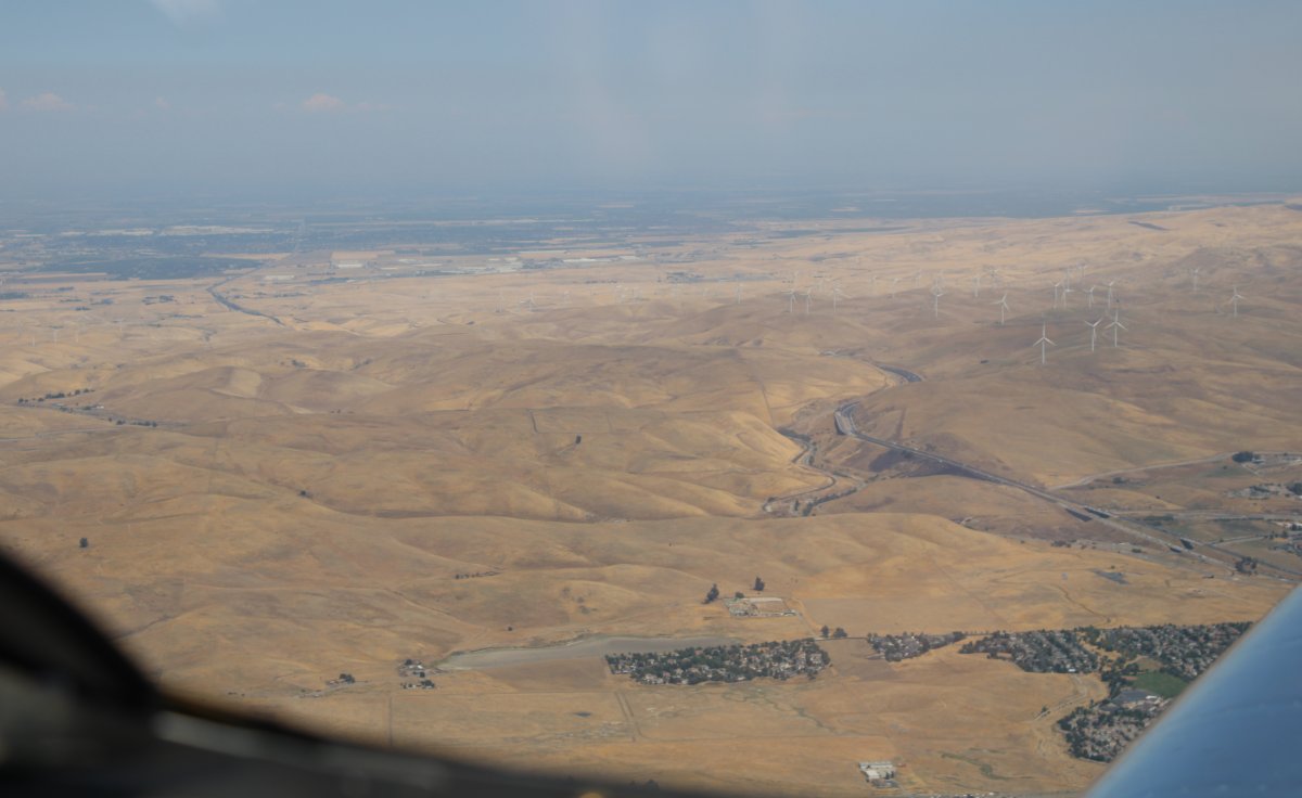
| I-580 snakes through the coastal hills through Altamont Pass to get to the central valley where it meets up with I-5 running north-south. |
| |
 |
|
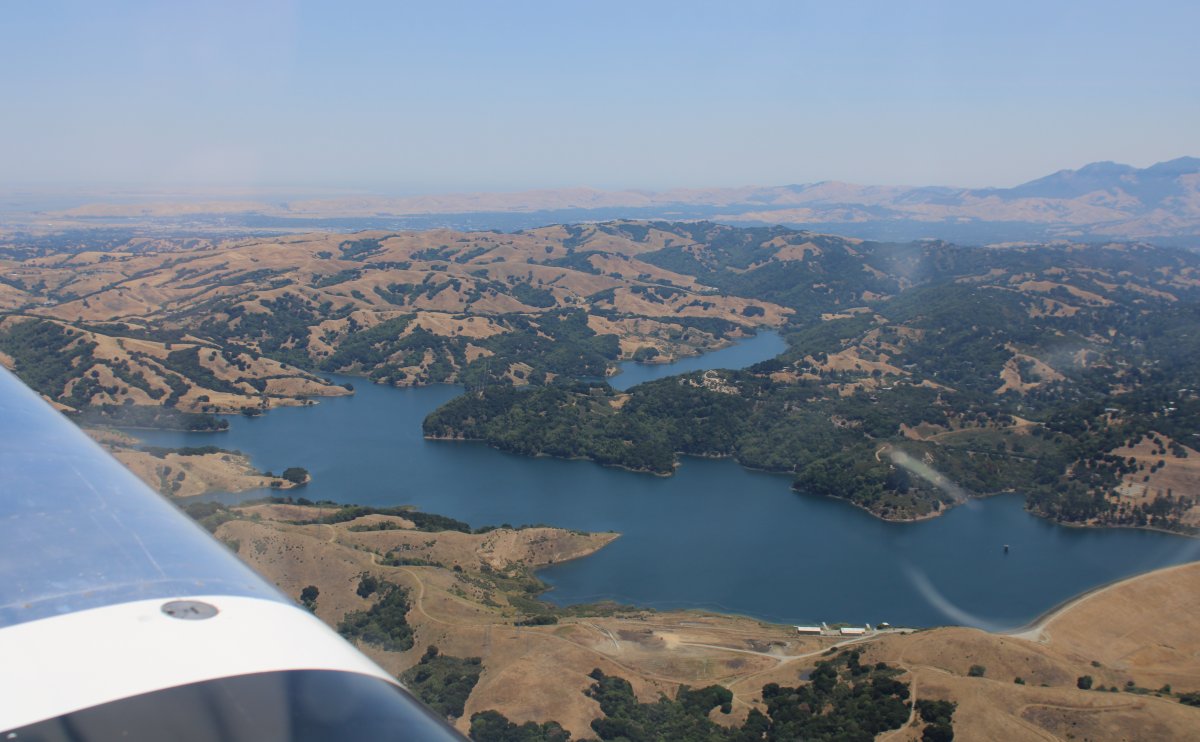
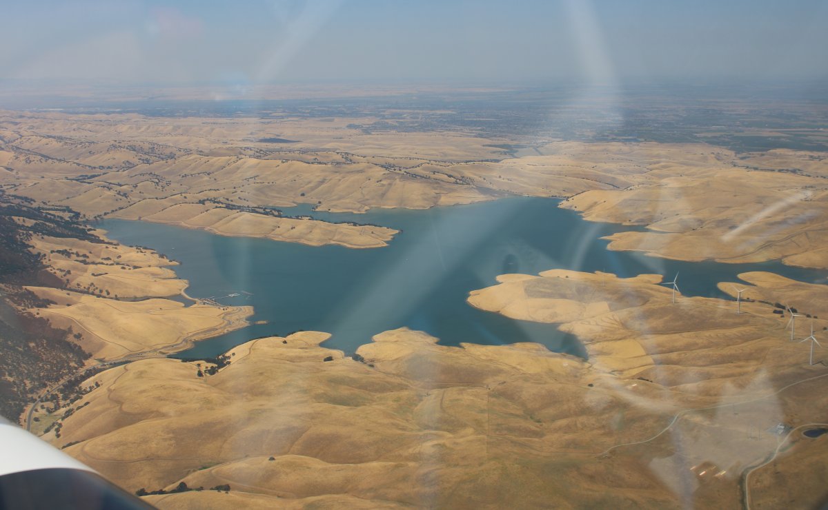
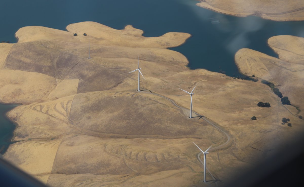
| Approaching Los Vaqueros Reservoir. |
| |
 |
|
| |
| |
 |
|
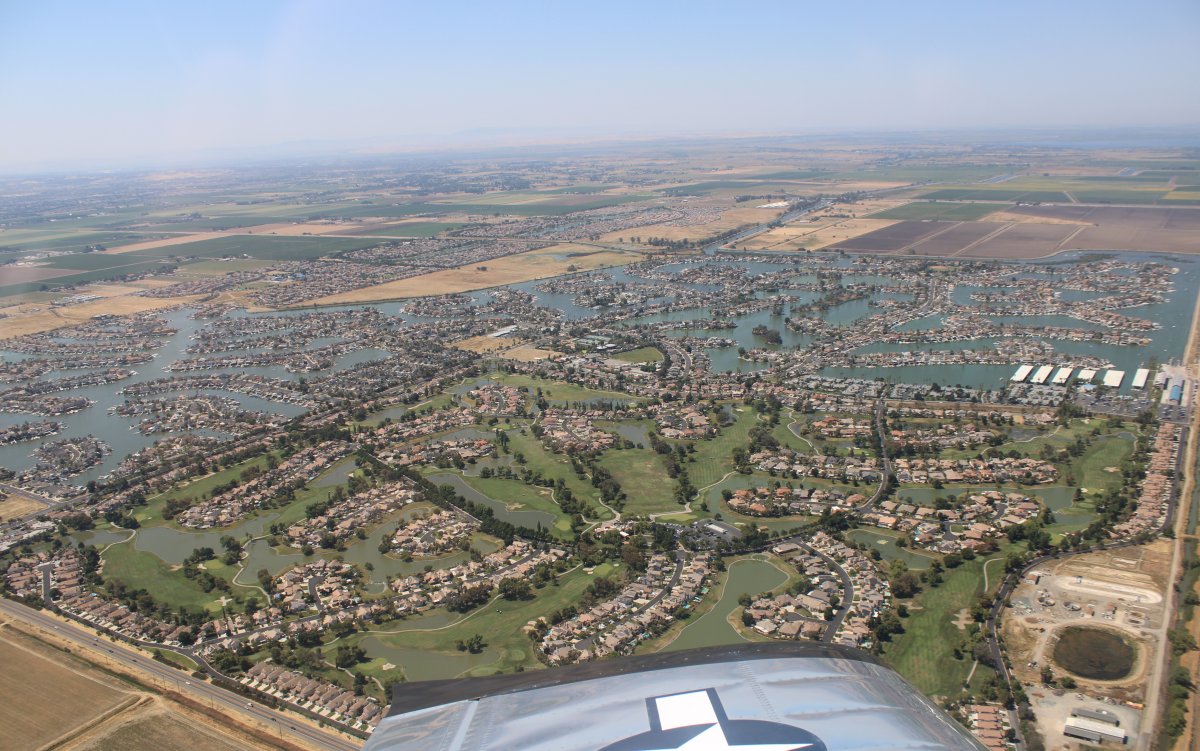
An amazing site in the Sacramento–San Joaquin River Delta area -- all these waterfront and golf course houses. This is Discovery Bay, a waterfront community built on a network of man-made dikes, surrounded by fresh water, with a golf course and country club in the southeast corner. It was begun as a planned community in 1964. |
| |
 |
|
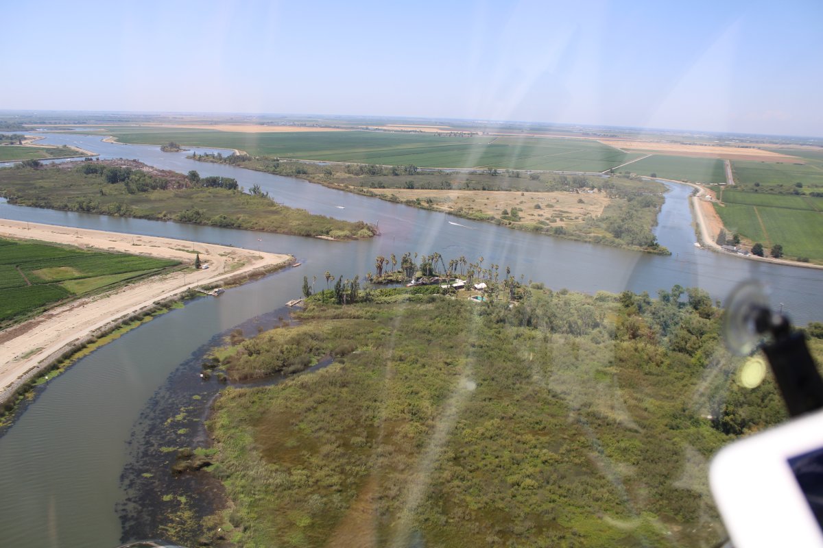
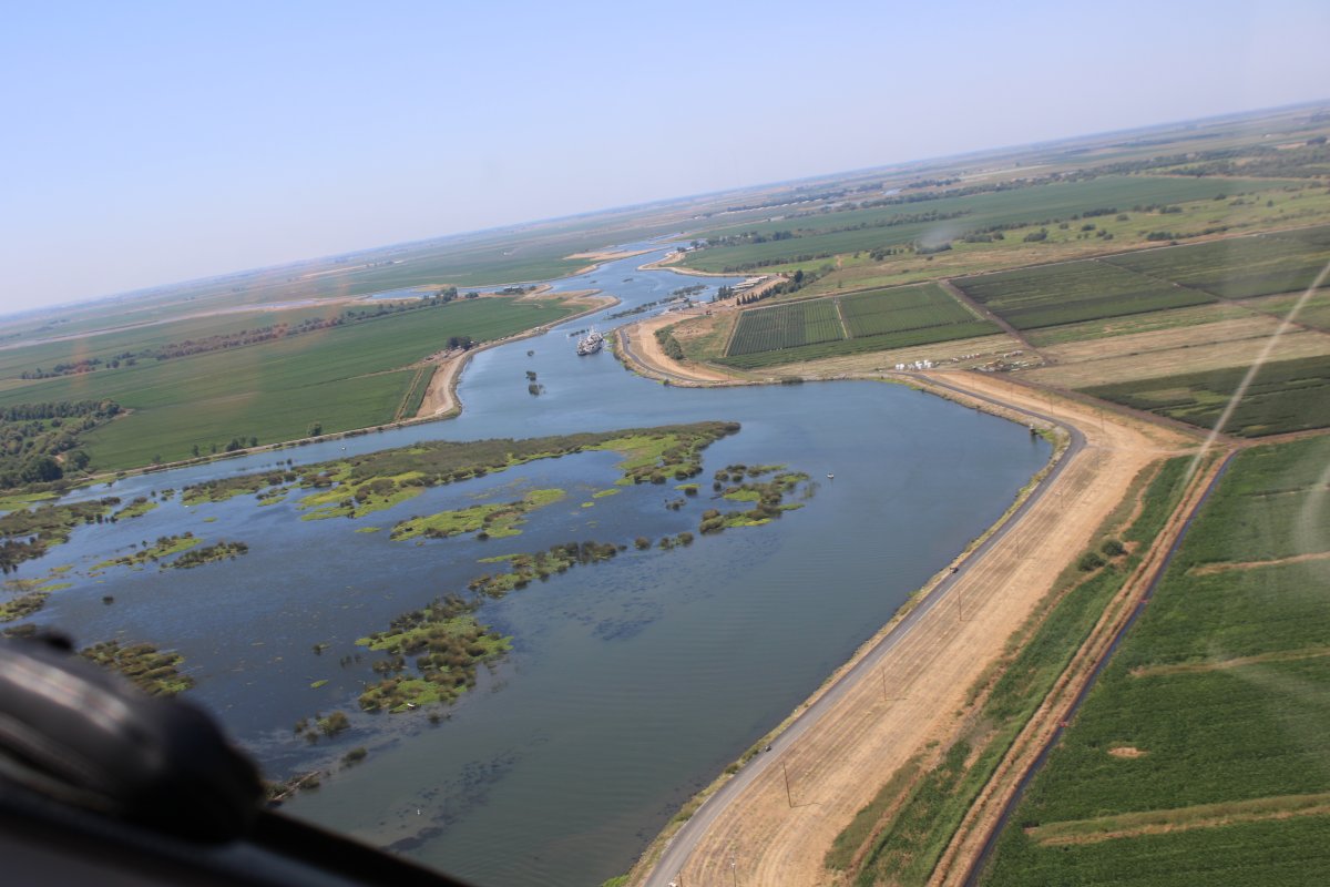
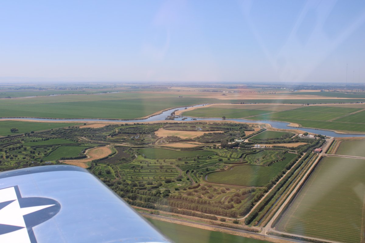
| I had heard of "the Delta" but never really knew where it was. We overflew it on our way back to Cameron Park. So we went down to 500 feet and followed the waterways that were going our direction. |
| |
 |
|
|
|
| |
 |
|
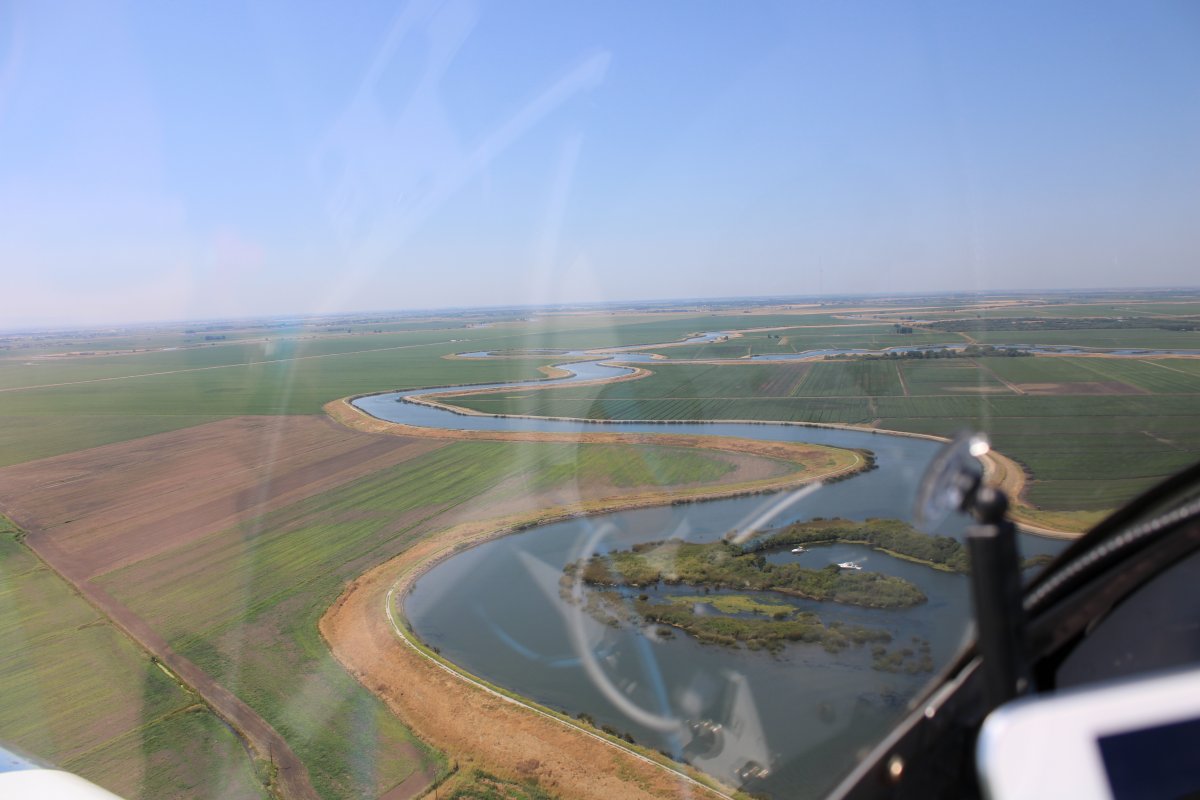
| Rob had fun flying the RV and following the turns in the waterways. |
| |
 |
|
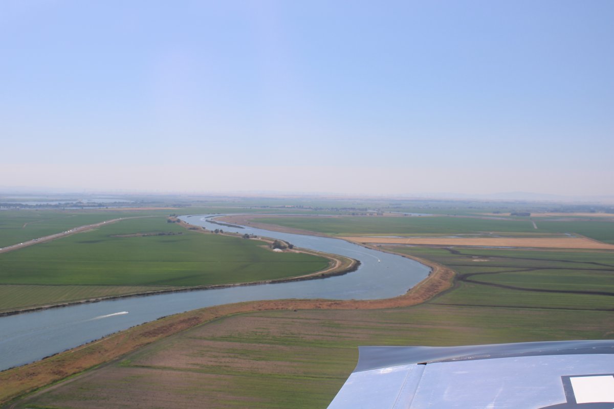
| The Delta is a fun place for boaters. |
| |
 |
|
| We were landing at Cameron Park a little over an hour after taking off from Livermore. Not bad. |
| |
 |
|
| |
| |
|
|
|
|
|
|