June 26, 2019 - Flight West Day One
Niagara Falls, Lake Eirie, Detroit, Bad Axe - N. Michigan
|
|
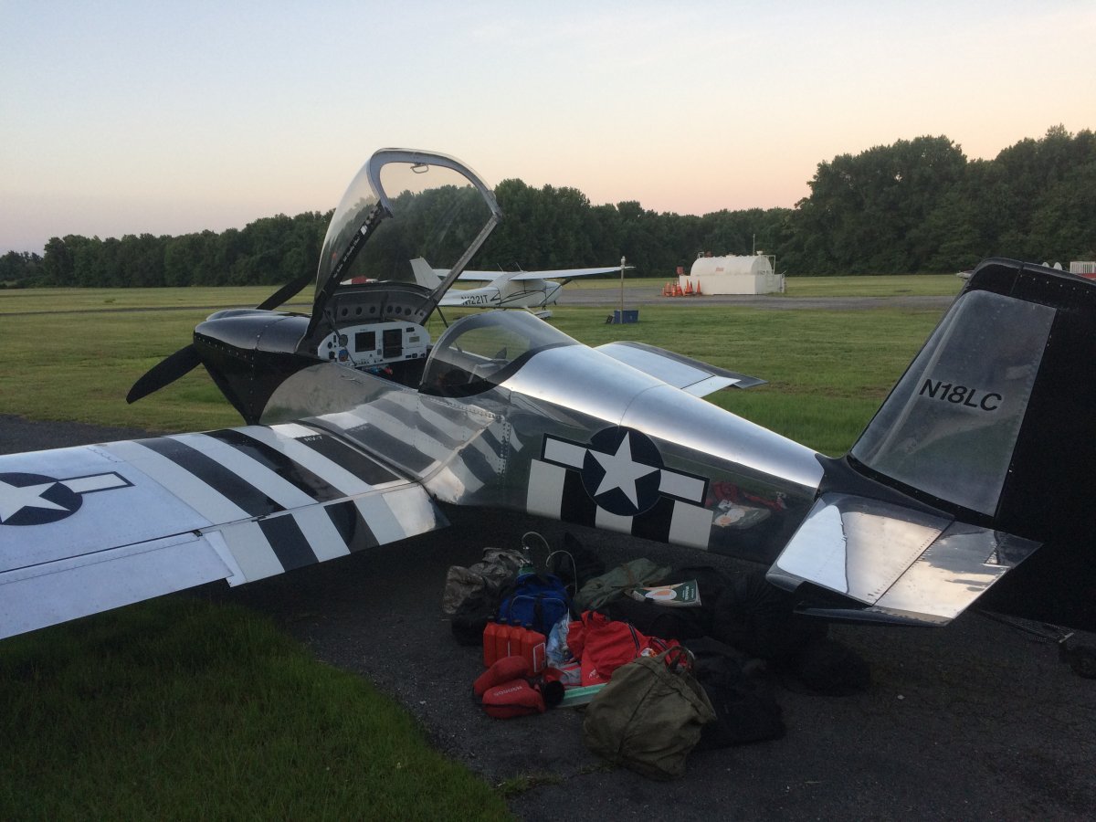
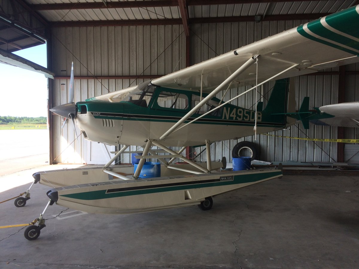
It's been three years since my last long cross-country. Too long. So today I head west. I'm calling this one the "Flight West" since I'm covering so much ground. It will be my longest one yet, in terms of miles travelled. On the long cross-countries, it's best to get an early start. So I got up at 4:30AM, and was at the airport by 5:30AM. It took a few minutes to finish loading the plane and get everything ready to go.
Because I would be flying over a lot of remote country and landing at airports without facilities, I was loaded for bear -- but no bear spray -- as far as survival equipment and tools. Add the clothes and flying gear, I was carrying a lot of stuff. I hate to carry the extra weight in the plane but there was no alternative. Better to have it and not need it than need it and not have it.
|
| |
 |
|
|
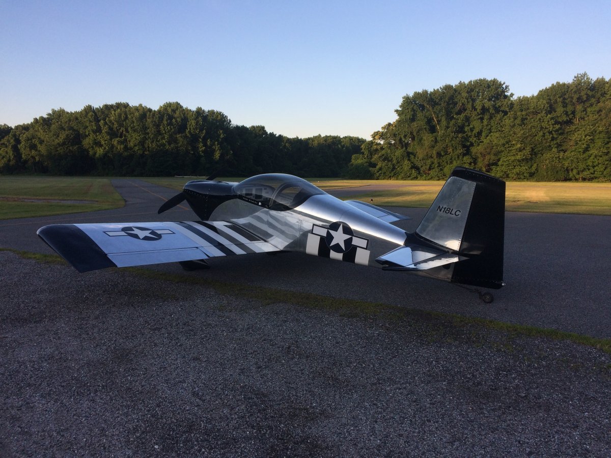
Well, here we go. Got it all in the plane. I took off at 6:30AM. Let the adventure begin!
|
| |
 |
|
|
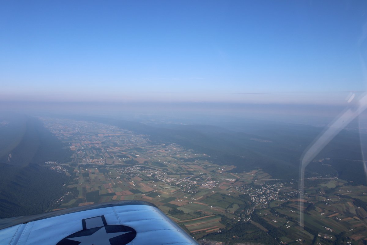
My initial destination was Niagara Falls so this was a transit leg. I climbed up high to make speed and headed northwest. The first half of the leg was familiar territory so there was no point in being low.
Here I'm passing over classic Pennsylvania terrain -- long tree-covered ridges running east to west with populated valleys in between.
|
| |
 |
|
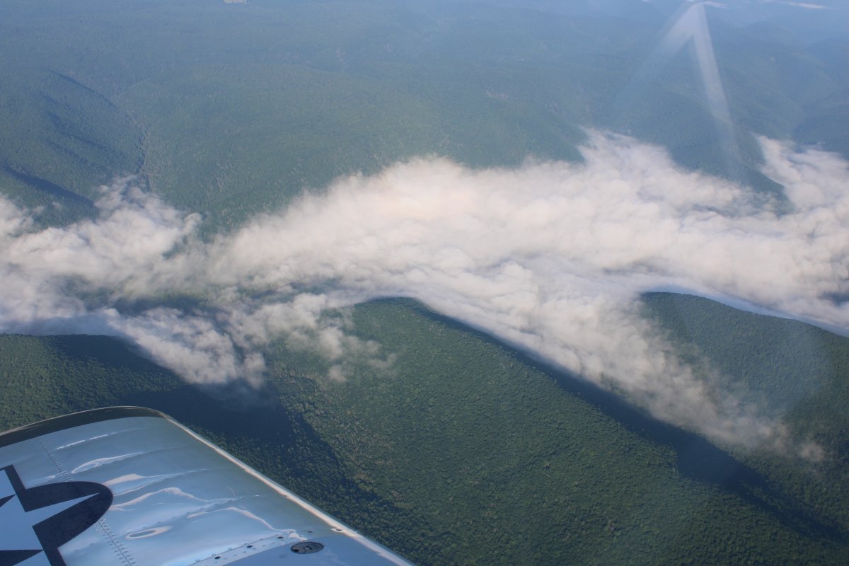
| After awhile I came to areas with nothing but trees, and some low cloud cover to make things interesting. |
| |
 |
|
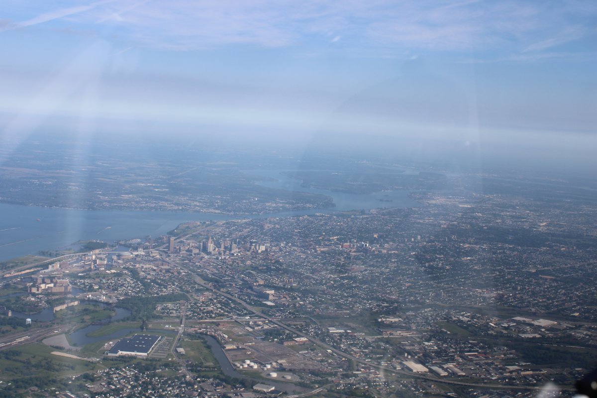
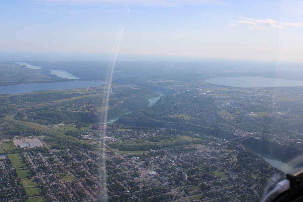
| Approaching Buffalo with Lake Erie to the left and Niagara River at center top. |
| |
 |
|
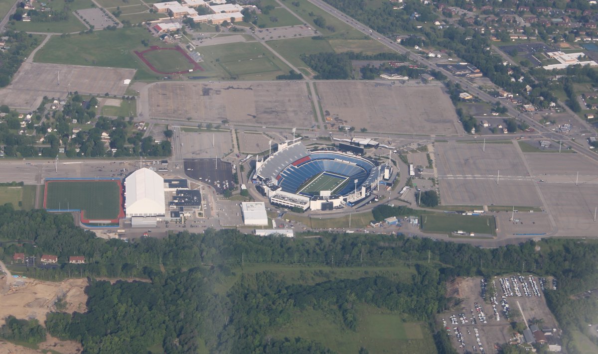
| Looking down at the Buffalo Bill's football stadium and practice facility, south of town. |
| |
 |
|
|
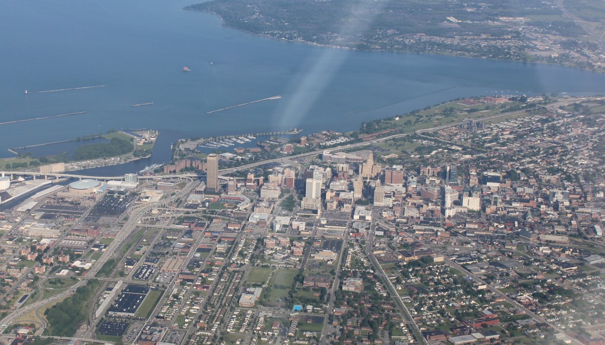
A close-up of Buffalo.
|
| |
 |
|
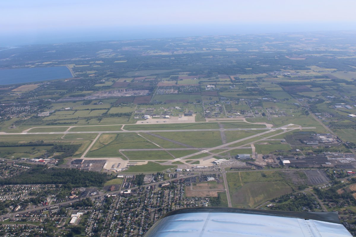
| Looking down at Niagara Falls International Airport which is northwest of Buffalo. It is a towered-airport so I had to stay over their Class D airspace. |
| |
 |
|
|
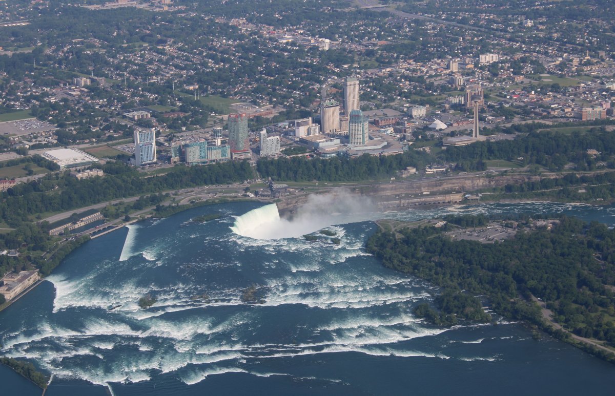
Approaching the famous falls. There are well-defined procedures for overflying Niagara Falls: fly above 3,500 ft, fly a racetrack pattern clockwise, broadcast position on 122.05 and monitor it, do not exceed 130 kts. Apparently it is a popular thing for pilots to do, and there are sightseeing helicopters as well, so I'm guessing the procedures are to prevent airplanes/helicopters from running into each other. You actually cross over into Canadian airspace. But not too many people were flying when I flew over at 8:30AM or so; in fact, I was the only one in the sky! I never heard anyone on the Unicom frequency.
I flew just south of Navy Island then headed west. Soon this was visible. Do you know the Niagara River flows north? Makes sense. The Great Lakes empty into the Atlantic Ocean, not vice versa.
|
| |
 |
|
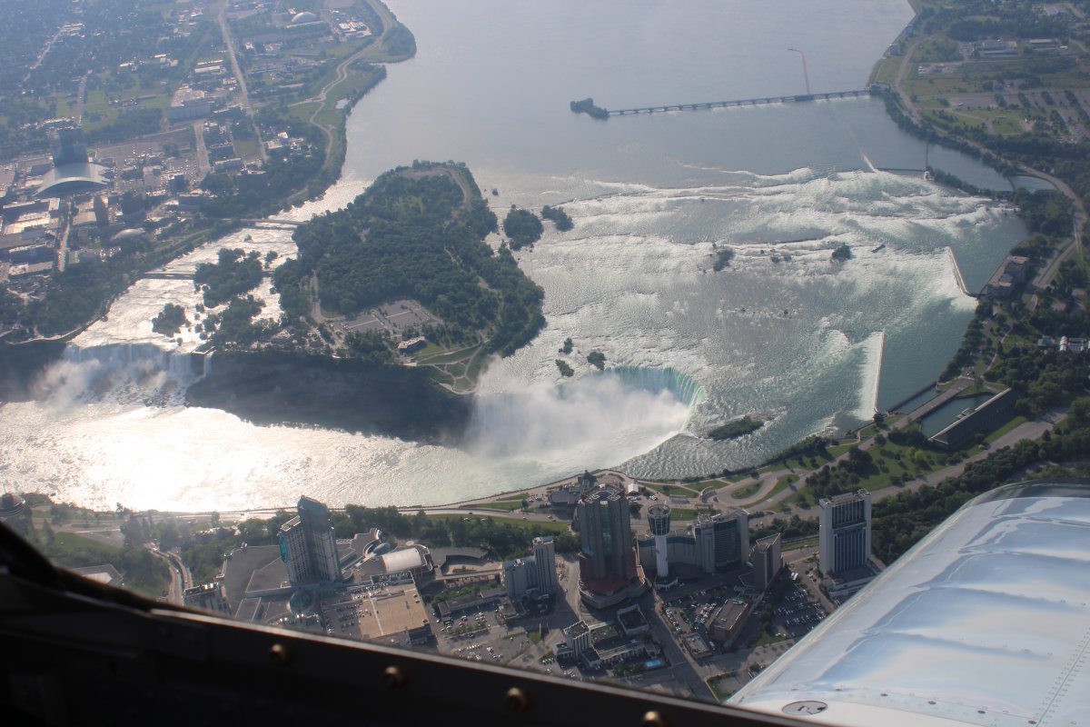
| I got established on the racetrack pattern and am now coming the other way on heading 051. |
| |
 |
|
| We visited Niagara Falls as a family back in 2000 I think. It is pretty amazing to see, especially standing right next to it, or from the Maid of the Mist boat. I think it is one of those things you have to see at least once in your life. |
| |
 |
|
| |
| |
 |
|
|
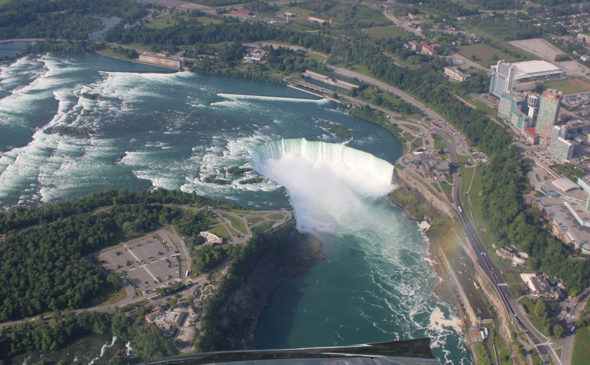
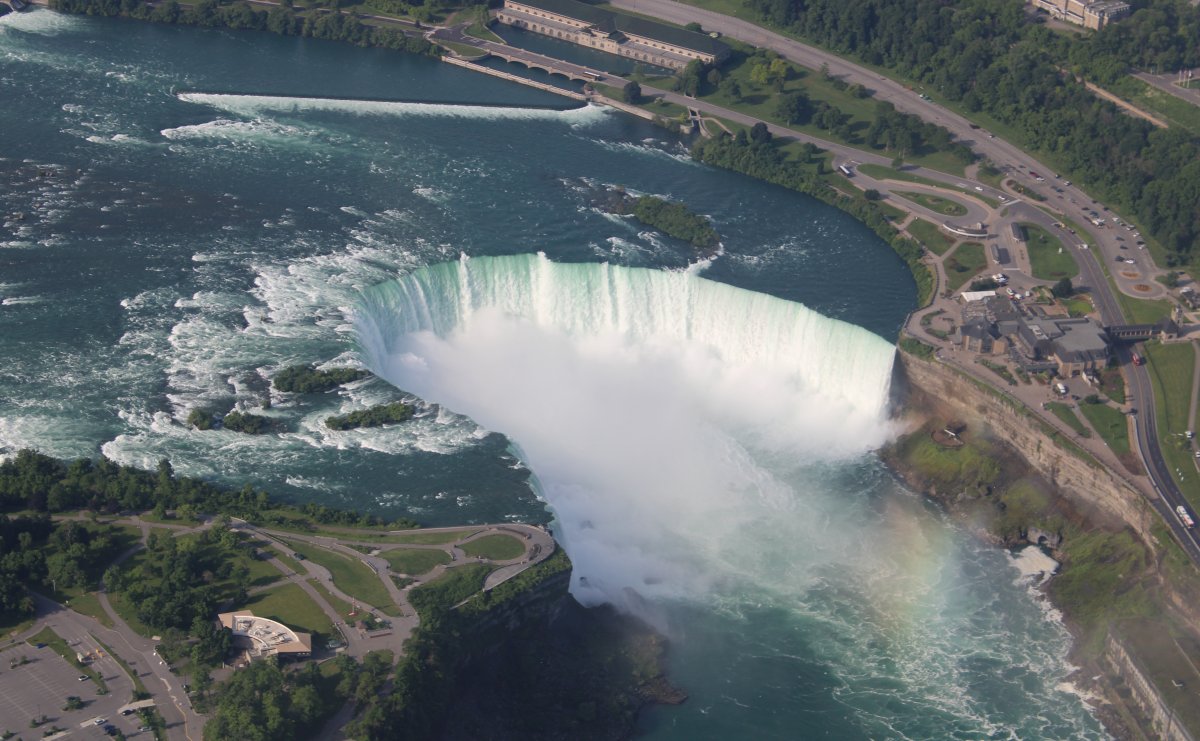
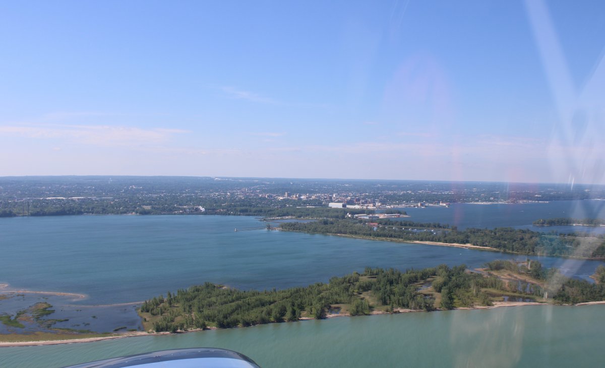
Looking north as the Niagara River flows past a little lake on each side to big Lake Ontario.
|
| |
 |
|
| |
| |
 |
|
|
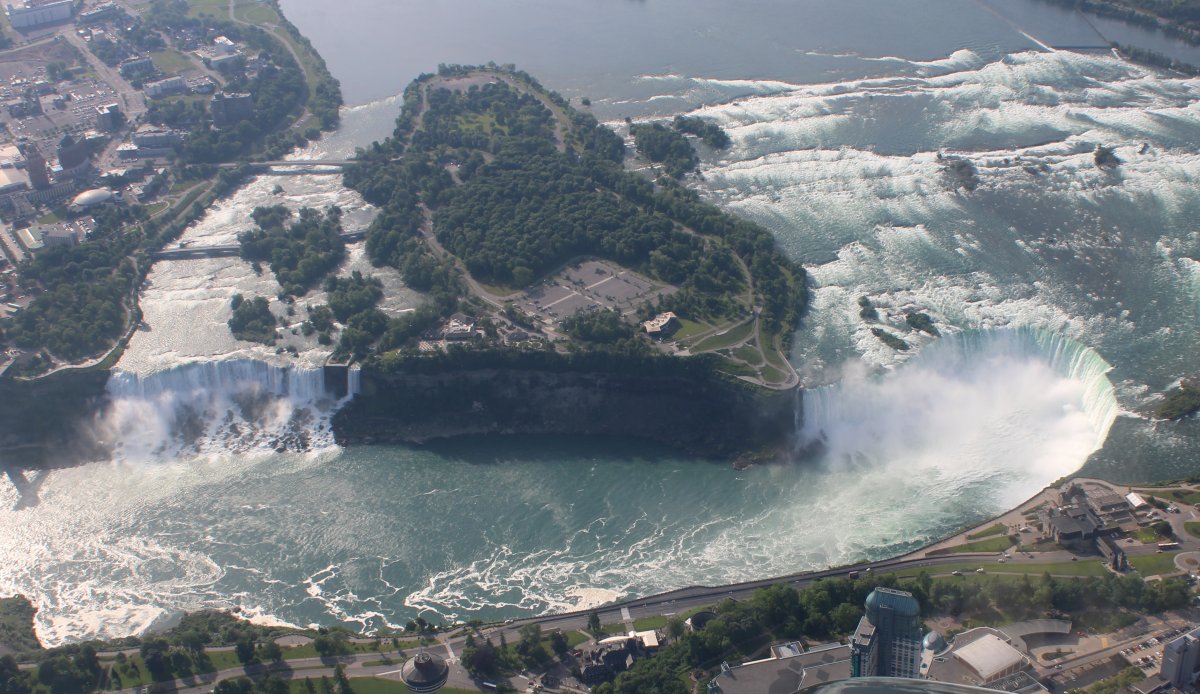
And here is the money shot!
|
| |
 |
|
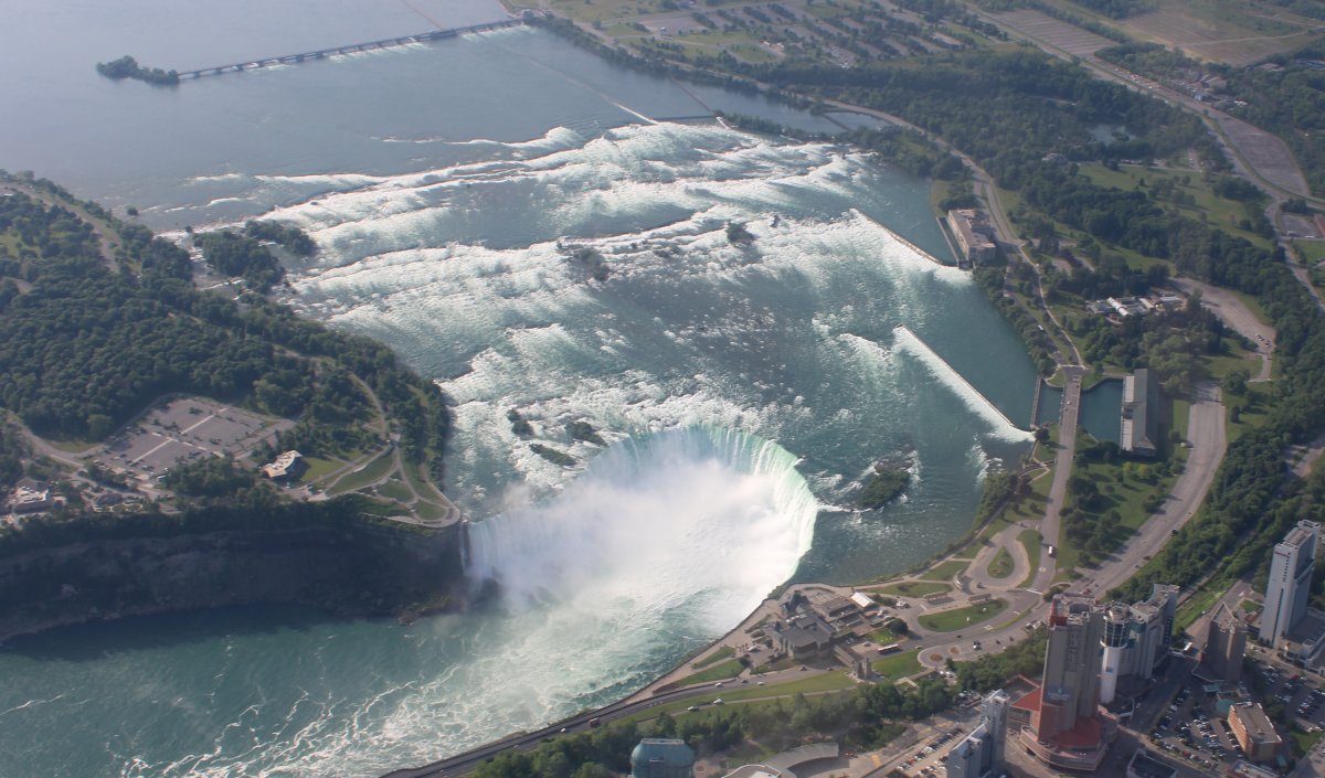
| After two trips around the Niagara Falls racetrack, I headed south back over Buffalo and then started following the southern shore of Lake Erie. |
| |
 |
|
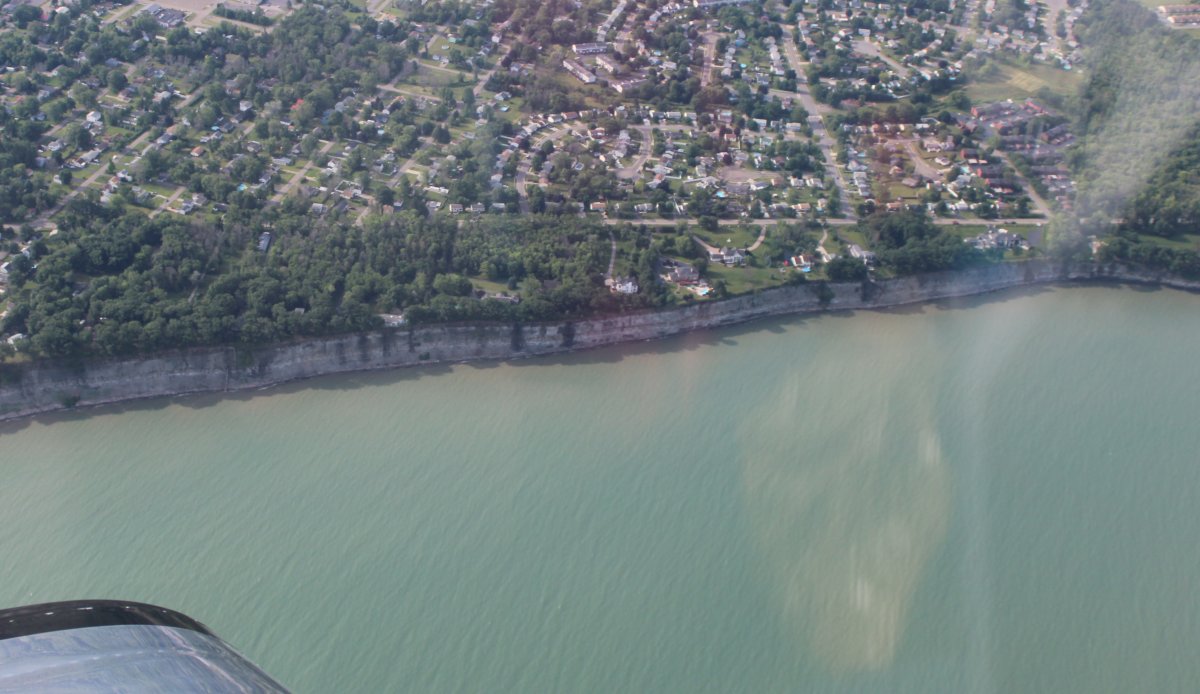
| Hey, look, mini-Cliffs of Dover! |
| |
 |
|
|
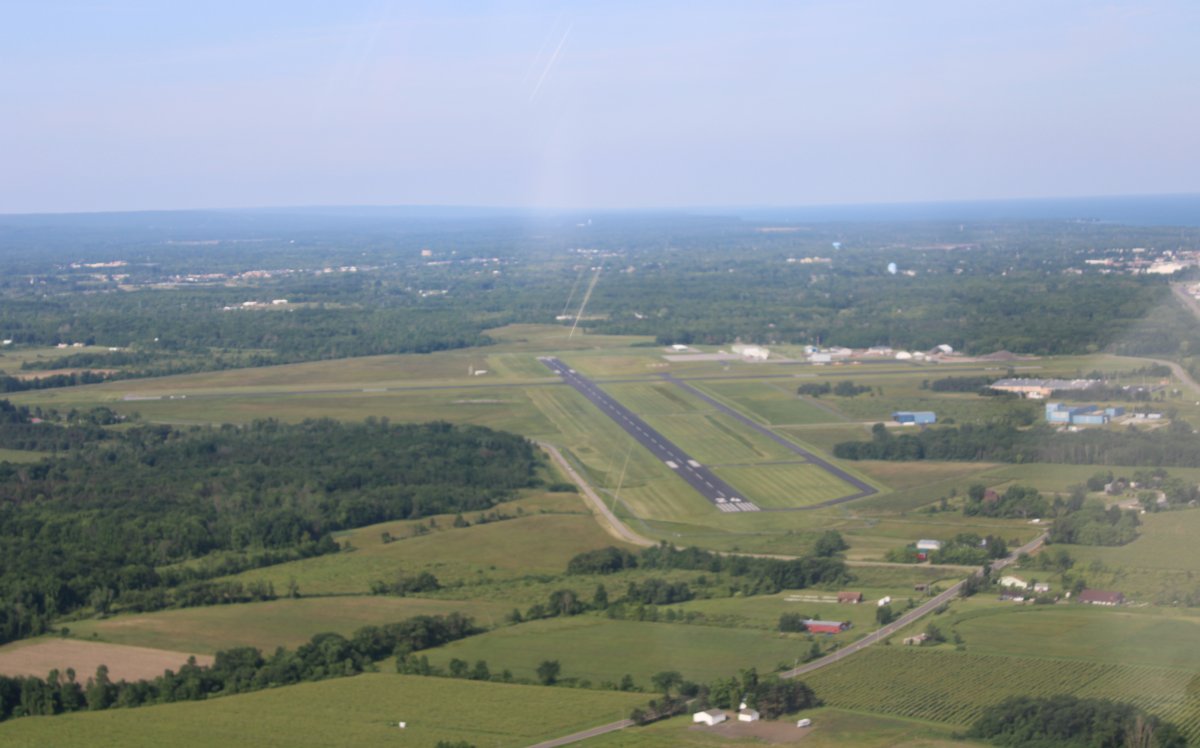
Approaching Dunkirk Airport for a fuel top-off. Winds were surprisingly stiff, but down the runway.
|
| |
 |
|
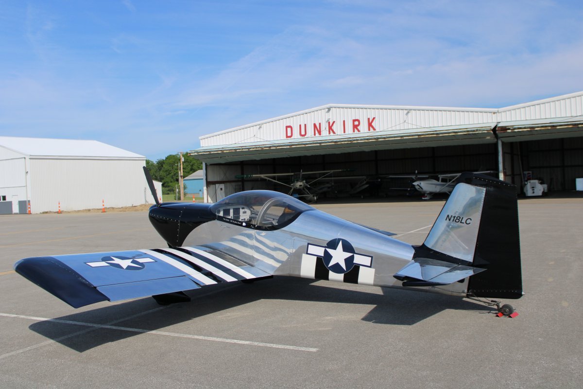
| On the ground at Dunkirk Airport. Nice airport. Friendly manager, decent fuel prices. I topped off the RV, looked around a little, then hit the road. Places to go, people to see! |
| |
 |
|
|
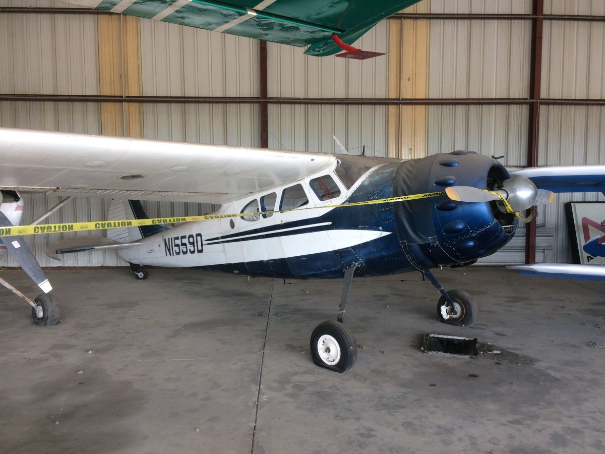
You hate to see a great plane like the Cessna 195 be a dust-covered hangar queen. The flat tires always tell the tale.
|
| |
 |
|
| Now this is more like it. A Citabria on amphibious floats! |
| |
 |
|
|
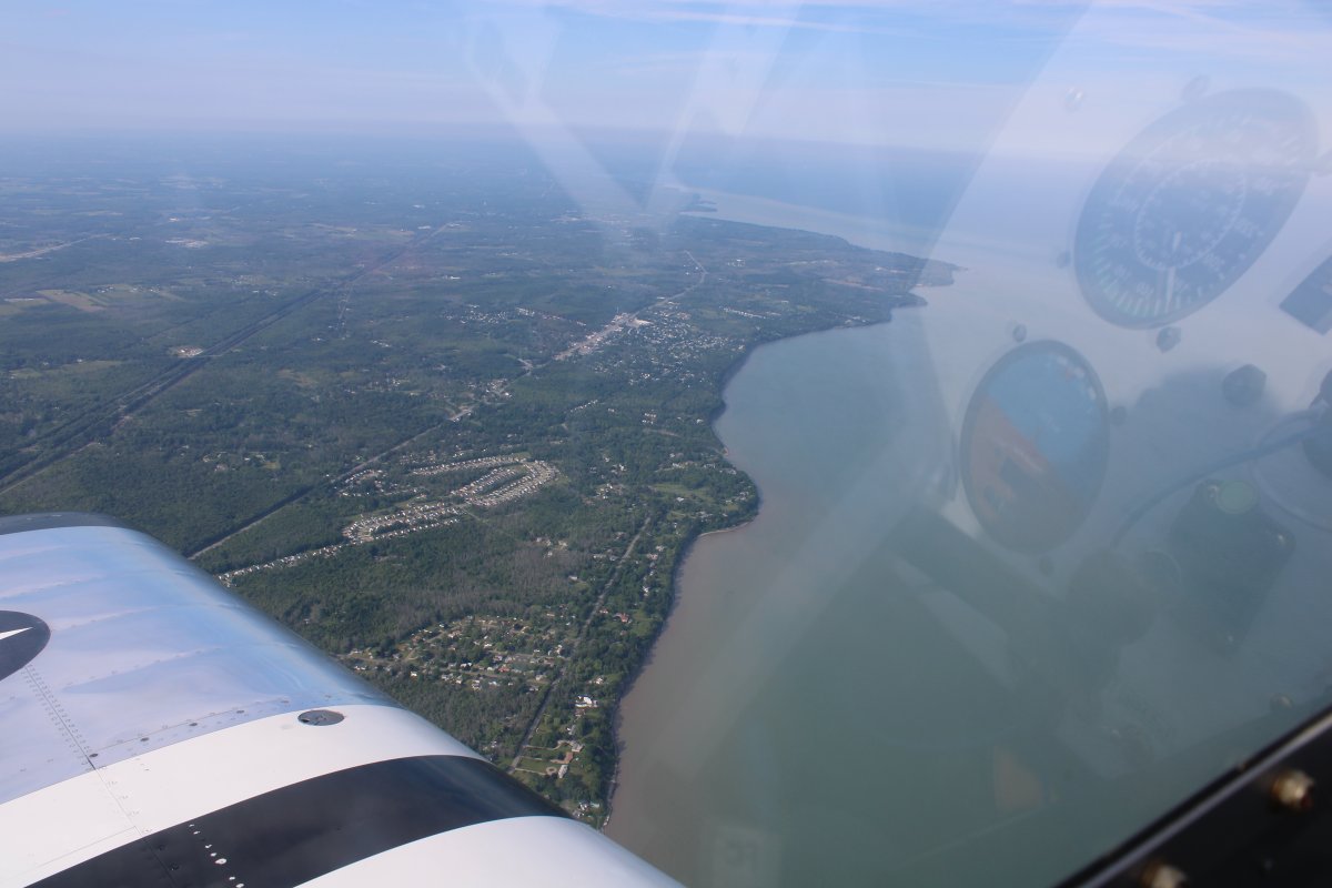
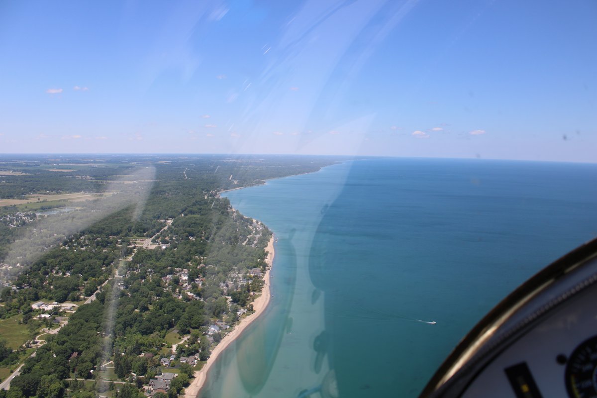
Leaving Dunkirk, I resumed flying the southern coast of Lake Erie, this time down low at 500 feet or so.
Here I'm passing by Erie, Pennsylvania. I have to swing out over the Lake a little because I'm too lazy to get a transition through the towered airport in Erie.
|
| |
 |
|
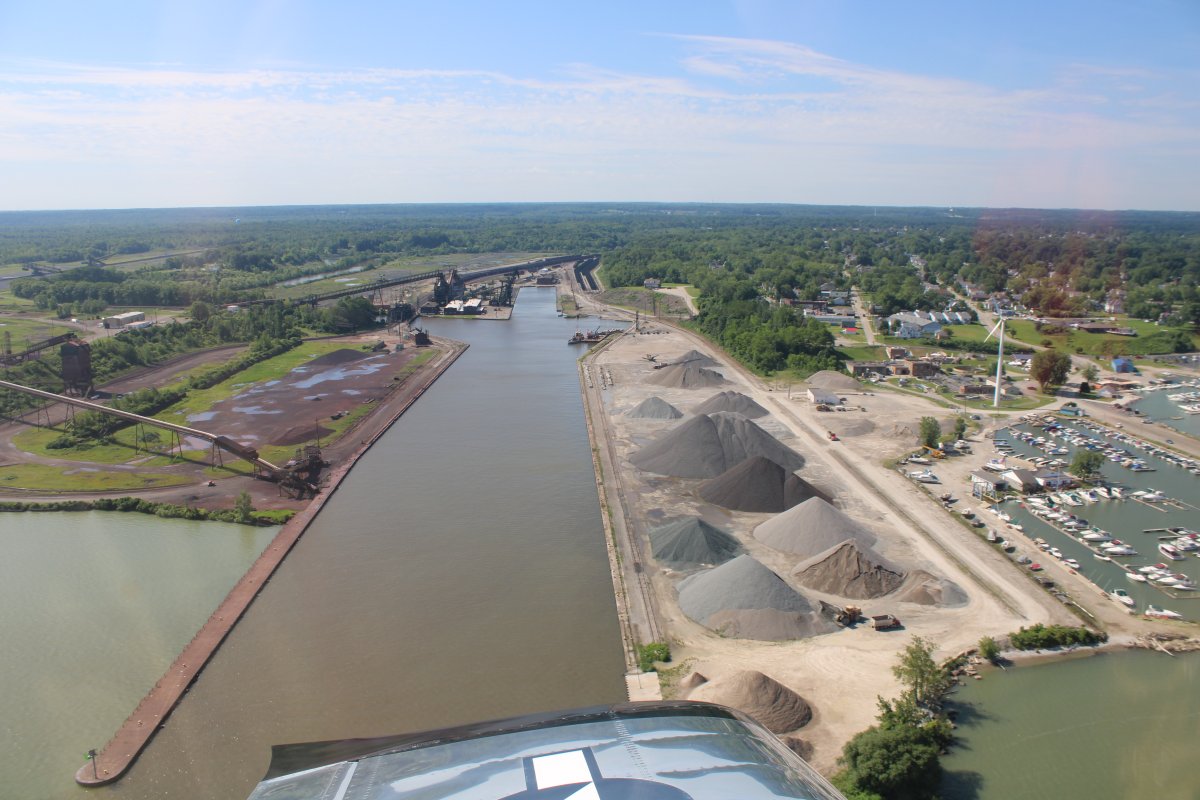
| An industrial harbor. I guess ships can pull up and get topped off with iron ore, coal, or whatever this plant produces. |
| |
 |
|
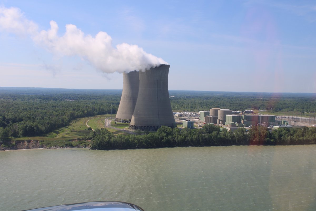
| Nuclear power plant. |
| |
 |
|
|
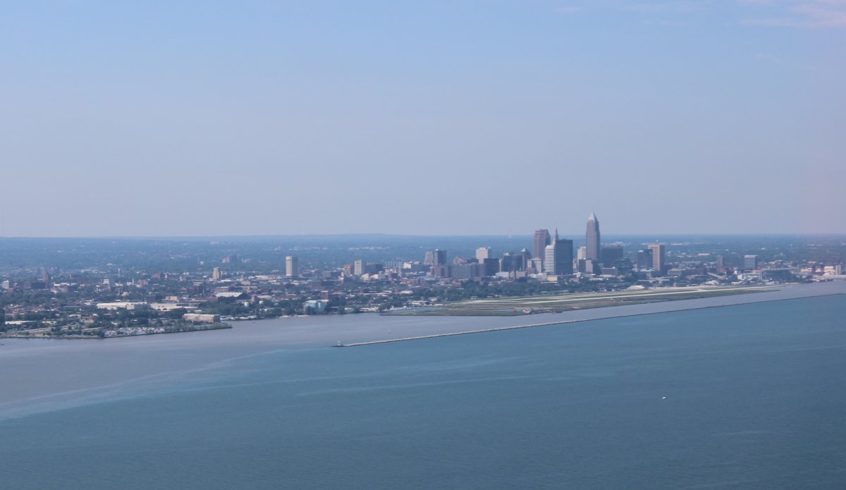
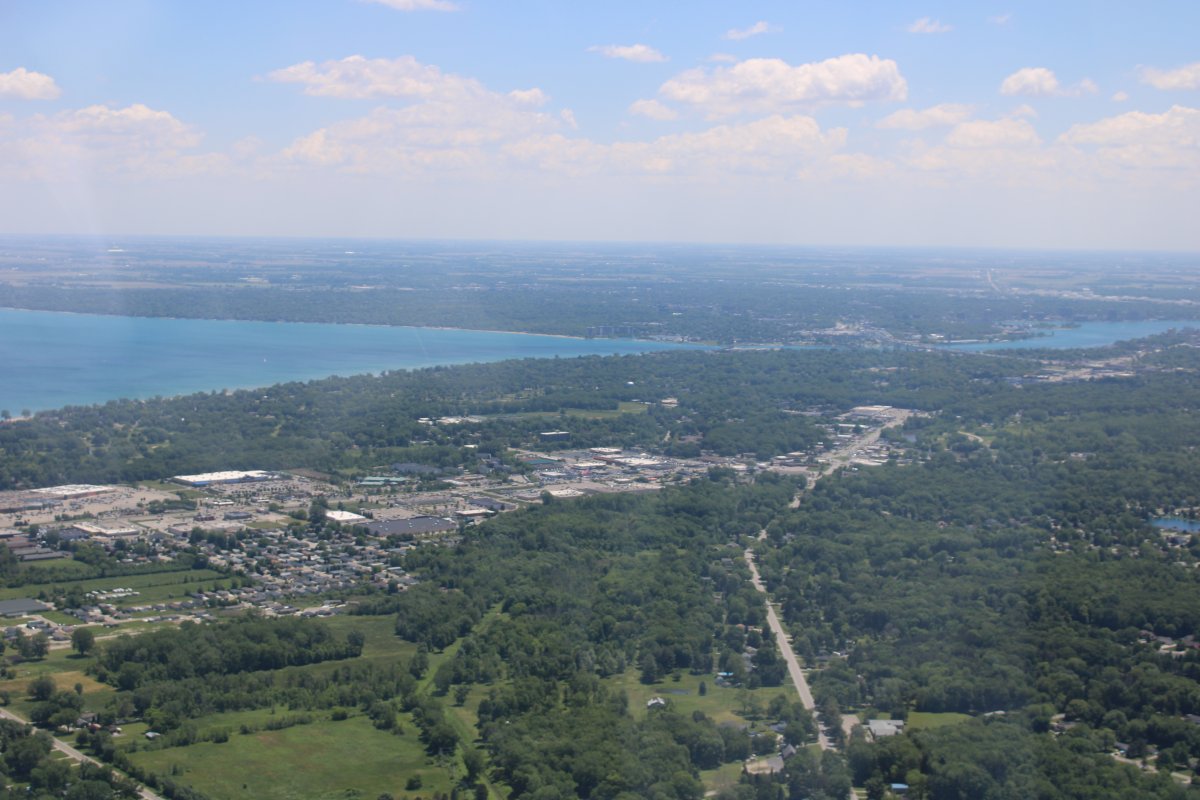
Passing by Burke Lakefront Airport and Cleveland, Ohio. Never been to Cleveland. Doesn't look all that big. I'll have to go one of these days.
|
| |
 |
|
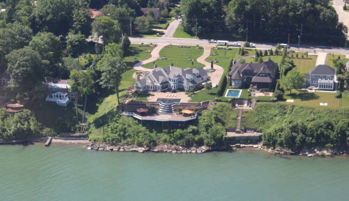
| Nice houses on the Lake! |
| |
 |
|
|
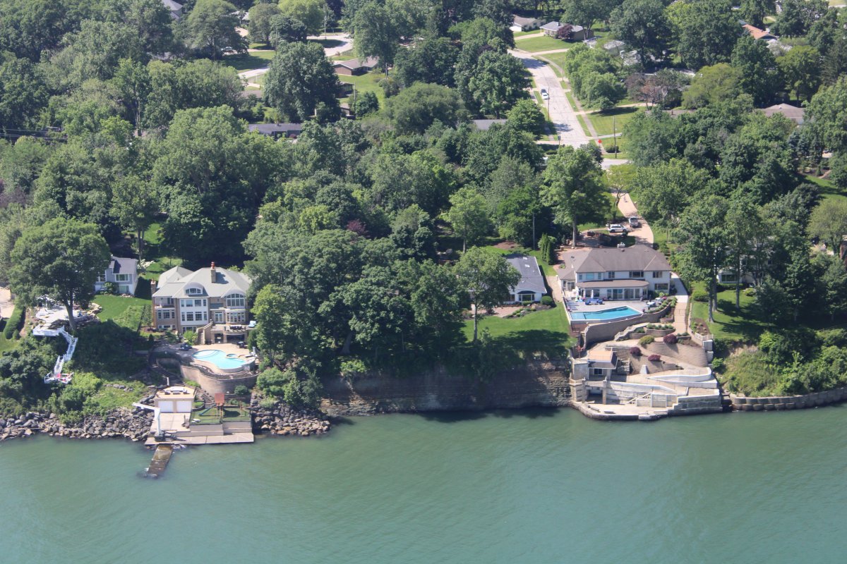
More nice houses.
|
| |
 |
|
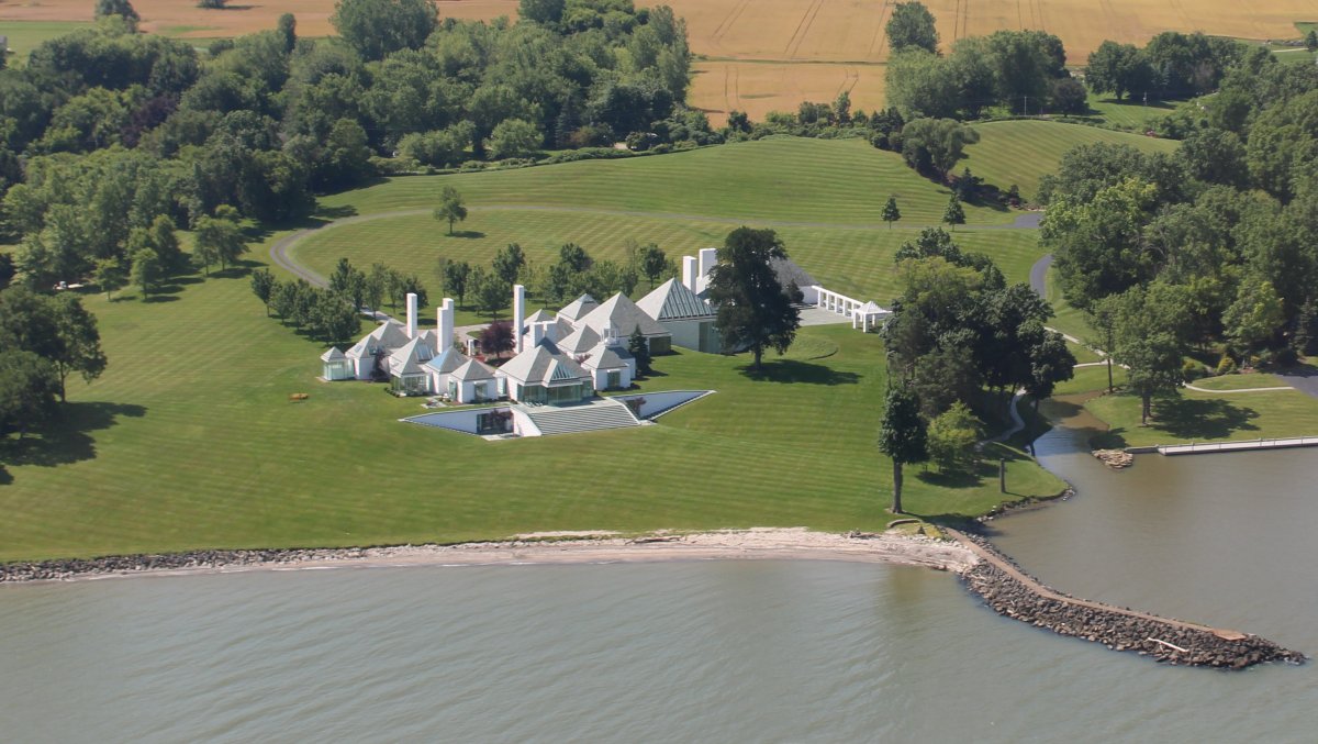
| Awesome waterfront estate but I don't really care for the architecture. |
| |
 |
|
|
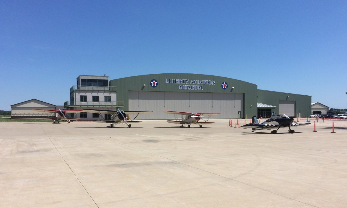
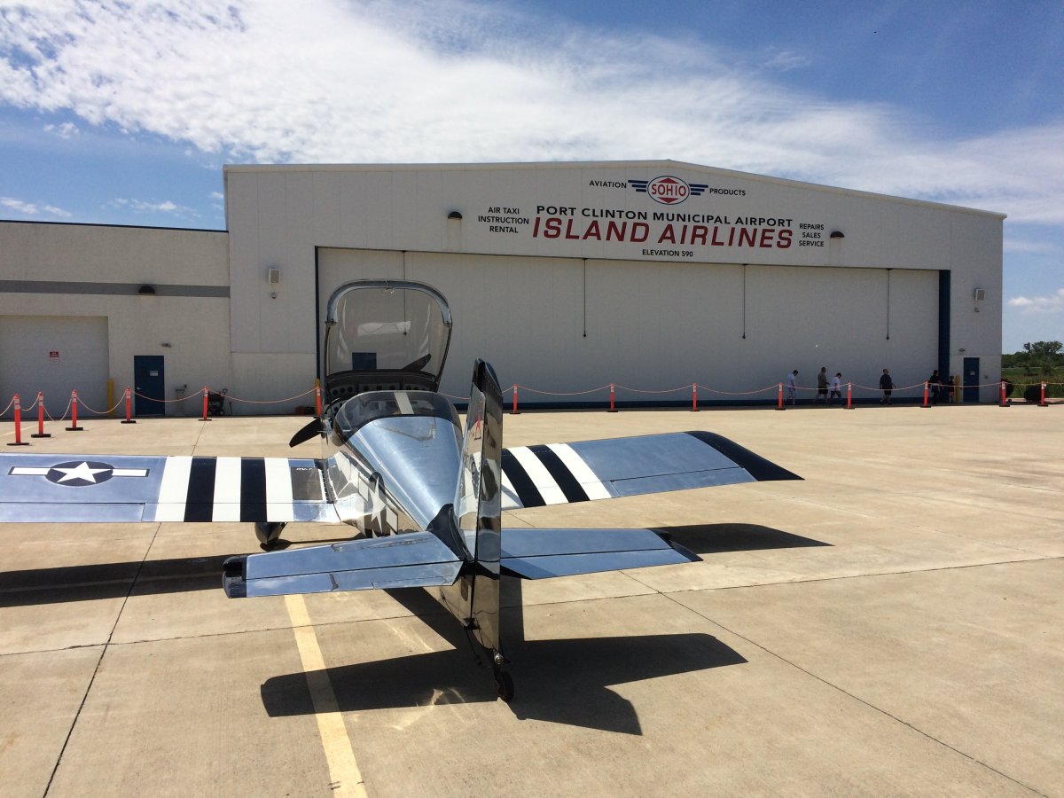
A short time later I crossed Sandusky Bay and landed at Erie-Ottawa Airport serving Port Clinton. This is one of the many airports I encountered where you are not really sure what to call it on the Unicom frequency. Do you call it Erie-Ottawa? Or Port Clinton, as some pilots were doing?
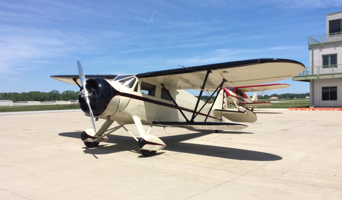
Anyways, I was familiar with the airport, having stopped here coming back from AirVenture. I knew they had a neat on-field diner and so I stopped for a late breakfast/early lunch. The FBO and fuel are on one side of runway 18/36 and the Diner and Aviation Museum are on the other side. I taxiied to the other side and parked next to three absolutely gorgeous Wacos.
|
| |
 |
|
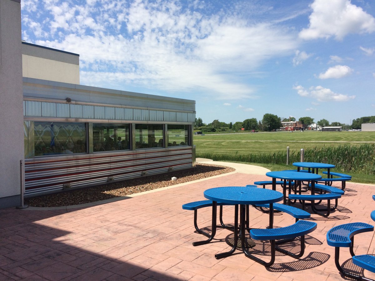
| The Tin Goose Diner adjoins the Liberty Aviation Museum and overlooks one end of runway 18/36. |
| |
 |
|
|
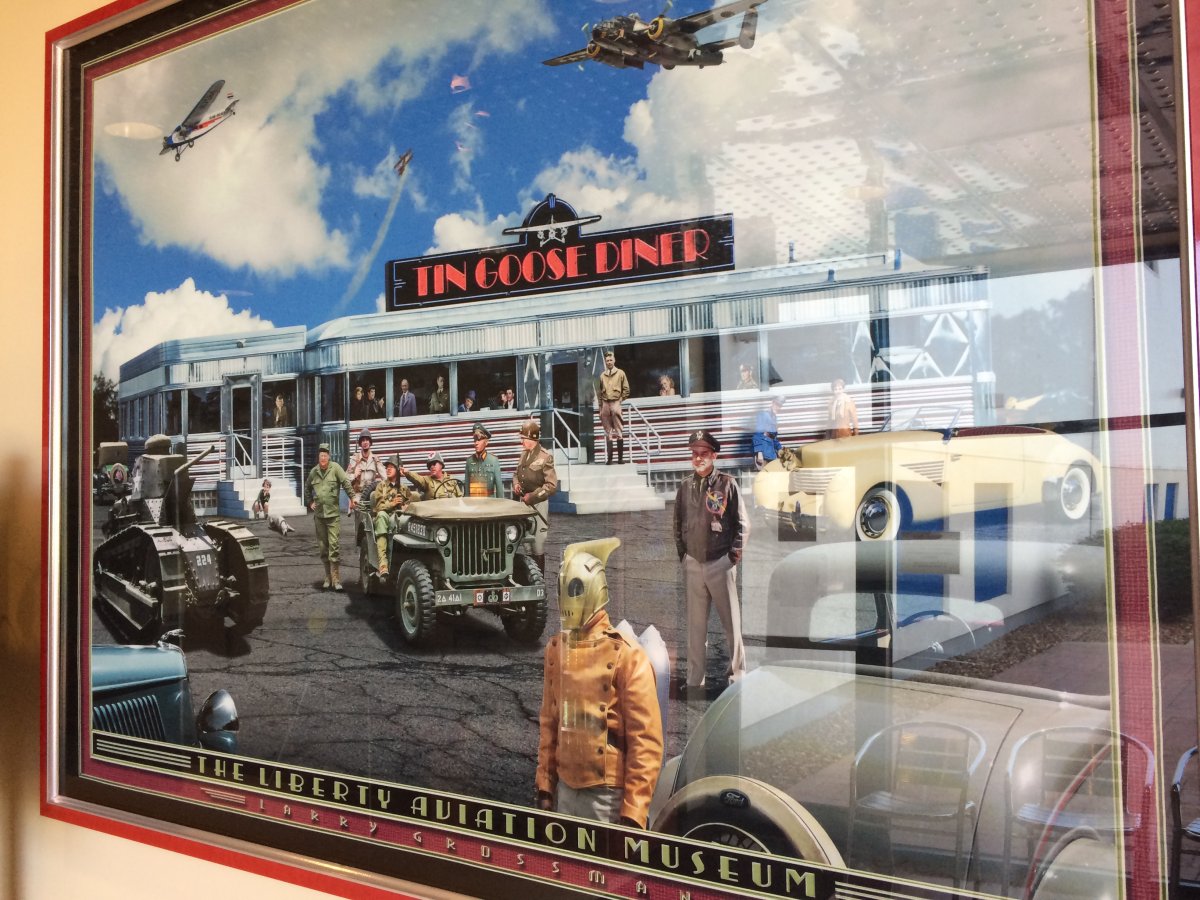
I liked this large painting that hangs at the Diner entrance. If you look closely, you can see such famous people as Charles Lindbergh, Jimmy Doolittle, & Generals Patton and Rommel.
|
| |
 |
|
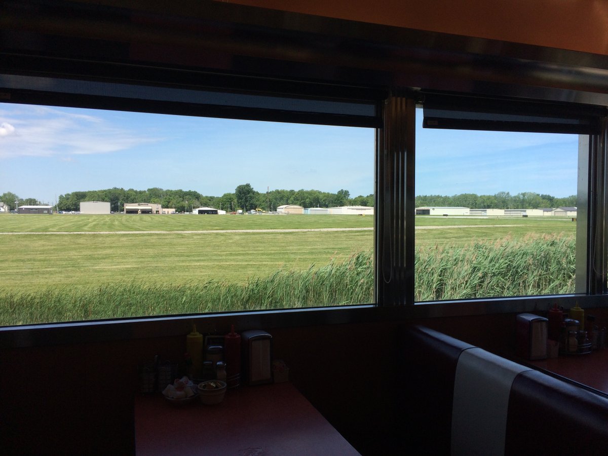
| The view from the Diner. I had some chicken fried steak, eggs and coffee and was a happy man when I left. |
| |
 |
|
|
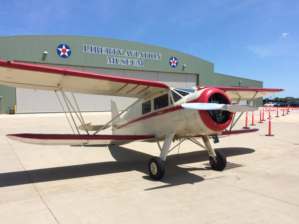
A closer look at one of the Wacos.
|
| |
 |
|
|
I would like to tour the Liberty Aviation Museum someday but I just didn't have the time today. It looks like a great museum.
|
| |
 |
|
|
|
| |
 |
|
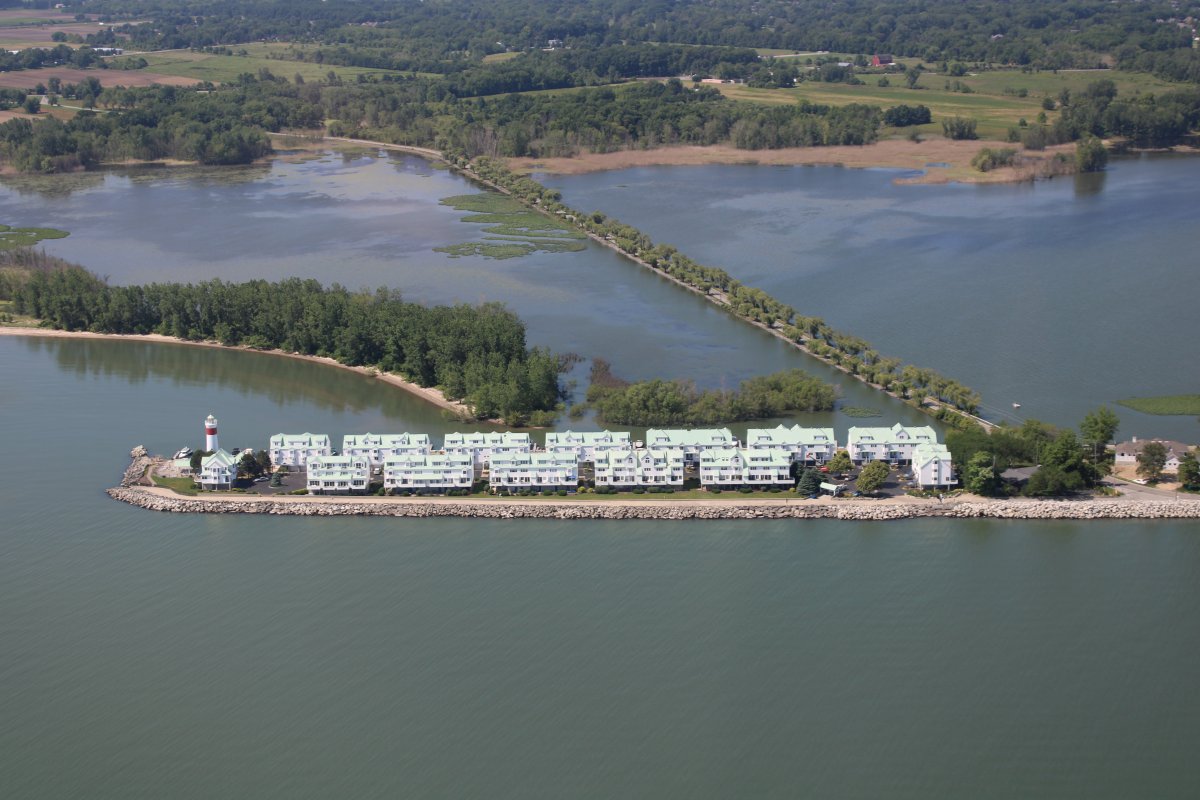
| Continuing on my way, I passed by these interesting apartment buildings. I'm sure they have a great waterview, but what about those ferocious Lake Erie storms? |
| |
 |
|
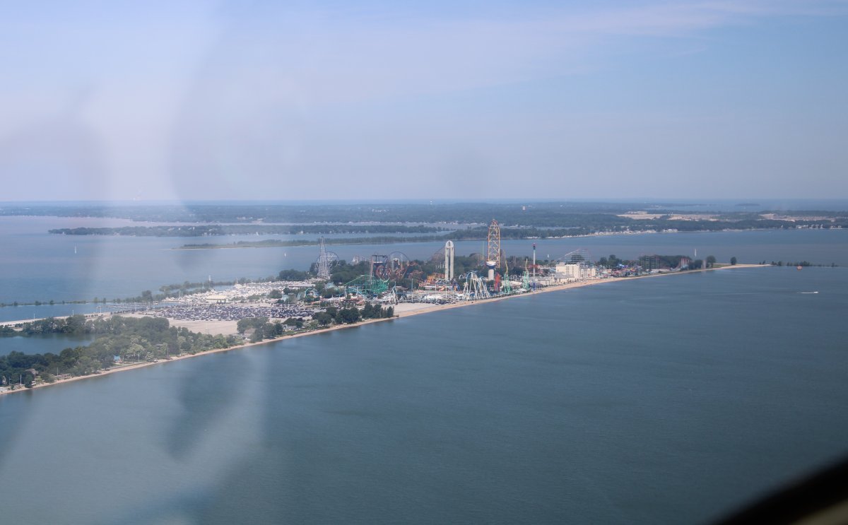
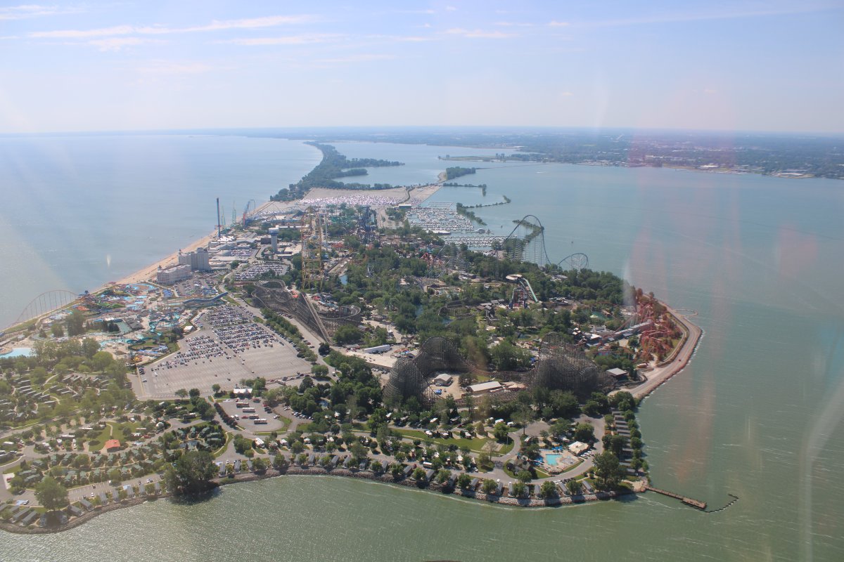
| And then I came across this, and immediately knew what it was: Cedar Point Amusement Park. I knew it because we spent a day here 20 or so years ago. I didn't realize at the time how much of a "Point" it really was! Anyways, they had some pretty wild rides back then and I know they have added more since then. |
| |
 |
|
|
Opened in 1870, Cedar Point is the second-oldest operating amusement park in the United States behind Lake Compounce in Connecticut.
|
| |
 |
|
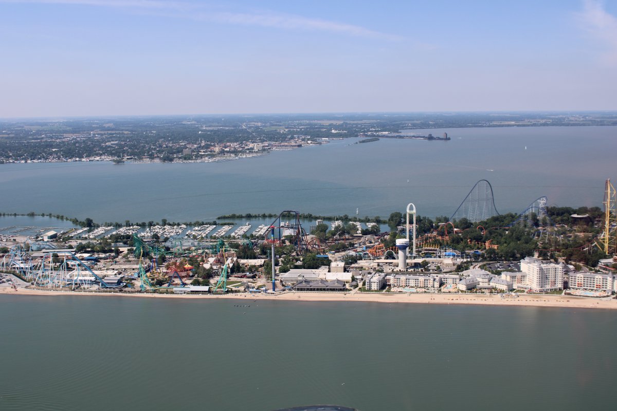
| Known as "America's Roller Coast", the park features a world-record 72 rides, including 17 roller coasters – the second-most in the world behind Six Flags Magic Mountain. It is the only amusement park in the world with six roller coasters taller than 200 feet. The park is the most visited seasonal amusement park in the United States with an estimated 3.6 million visitors in 2017. Who knew? |
| |
 |
|
|
Yep, there are a lot of roller coasters down there.
|
| |
 |
|
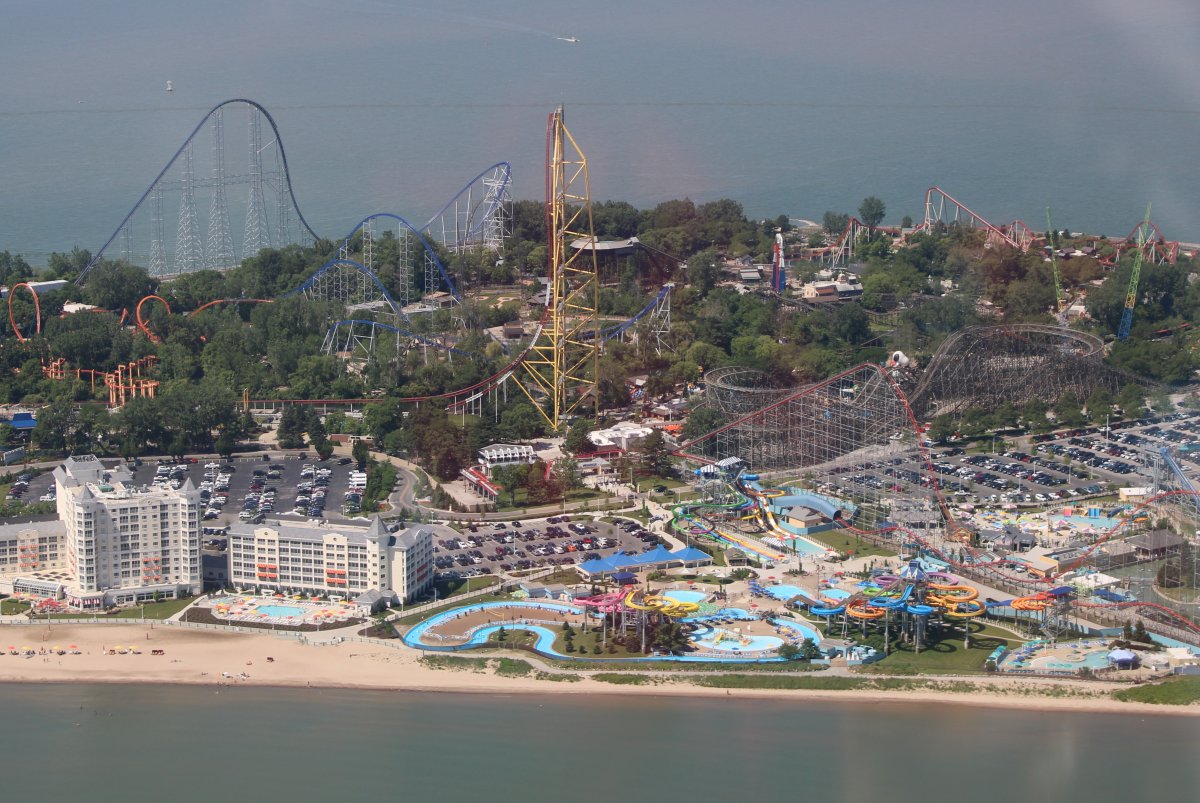
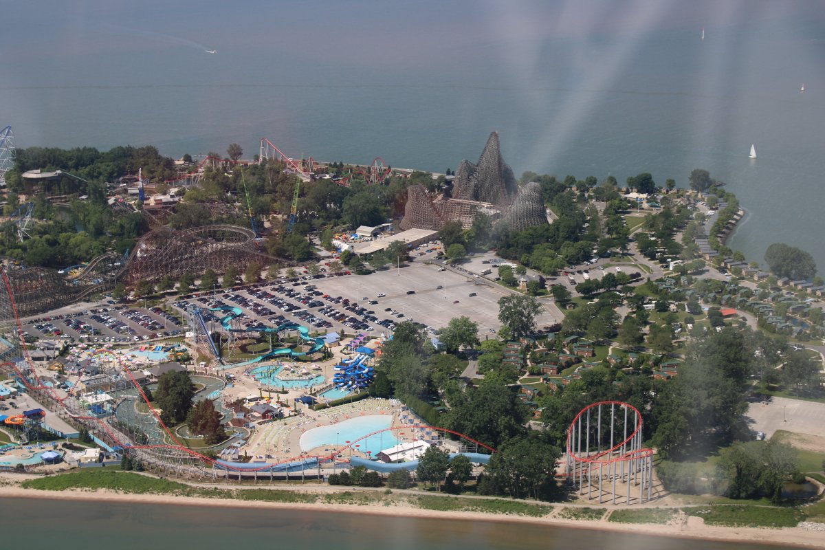
| Looking east back at Cedar Point. Roller coasters are cool, but if you really want to experience a big vertical drop, come fly with me, LOL. |
| |
 |
|
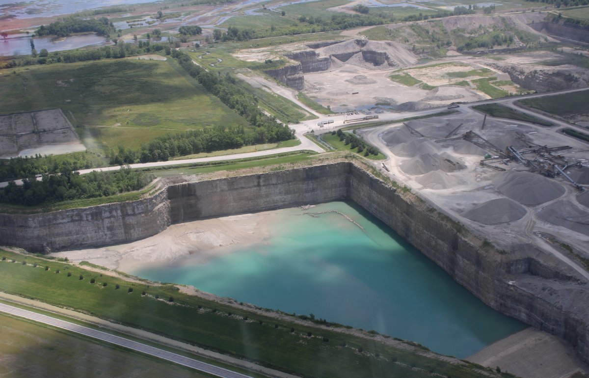
| Soon I came to the western edge of Lake Erie, near Toledo, and turned north-northeast towards Detroit. I passed this huge quarry. I wonder what they dug out of it? |
| |
 |
|
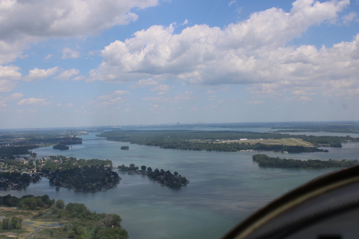
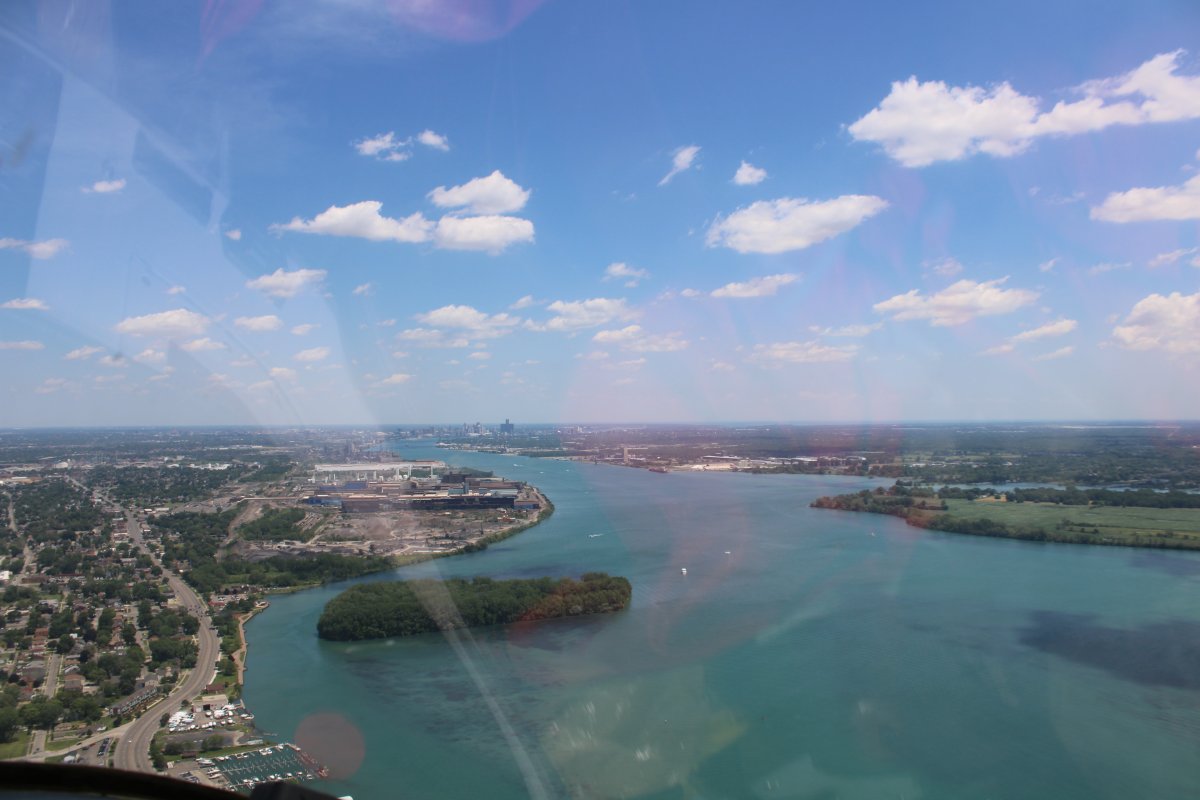
| Approaching Detroit via the Detroit River. The city skyline is visible in the distance. Grosse Ile island and airport is at center right. |
| |
 |
|
|
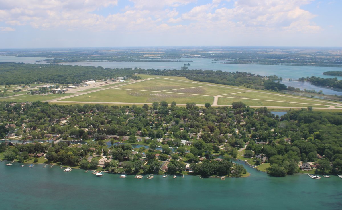
A closer look at Grosse Ile Municipal Airport.
|
| |
 |
|
| Continuing up the Detroit River. Canada is on the right side. |
| |
 |
|
|
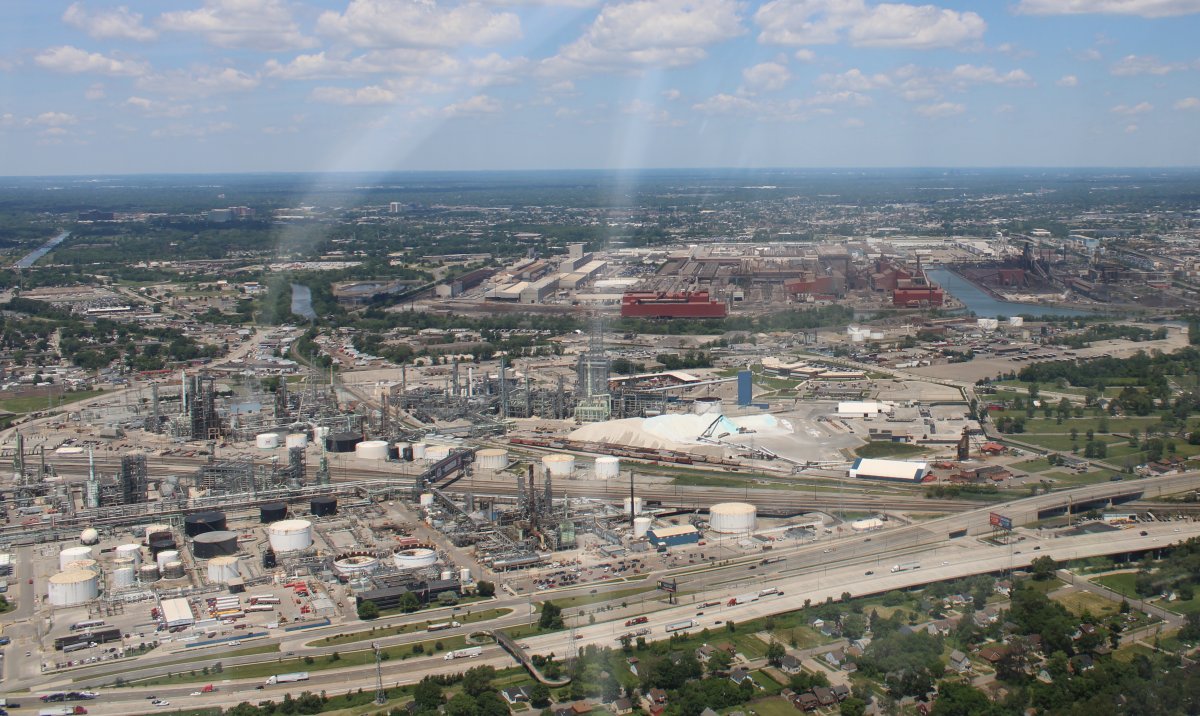
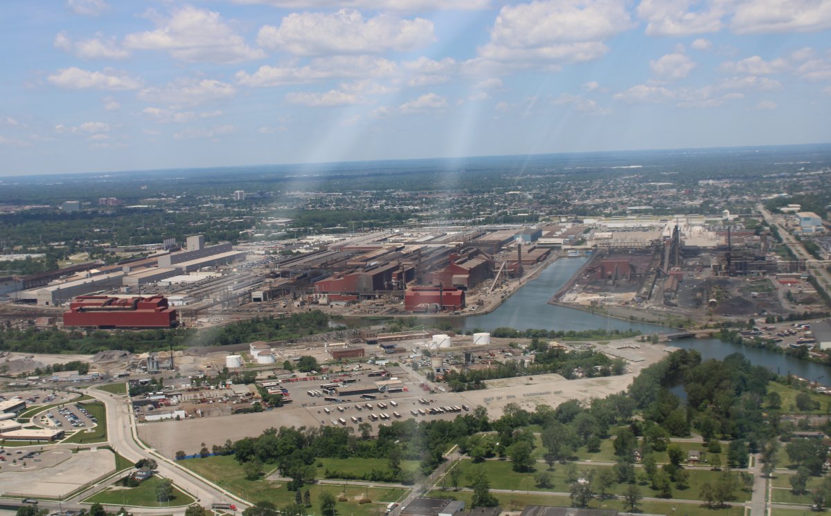
Passing by a big industrial complex.
|
| |
 |
|
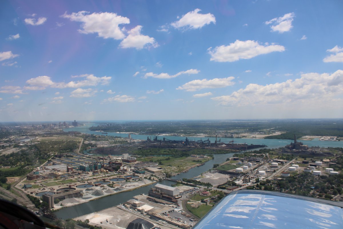
| The Detroit River starts veering off towards the northeast. |
| |
 |
|
| That's the Ambassador Bridge at center right. Windsor, Canada is on the right side. The bridge is the busiest international bordercrossing in North America in terms of trade volume, carrying more than 25% of all merchandise trade between the United States and Canada. Surprisingly, it is privately owned. |
| |
 |
|
| |
| Another big industrial complex. |
| |
 |
|
|
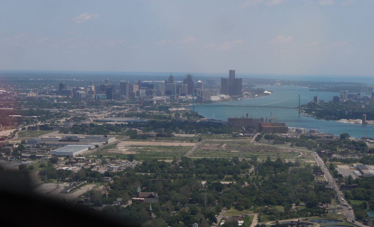
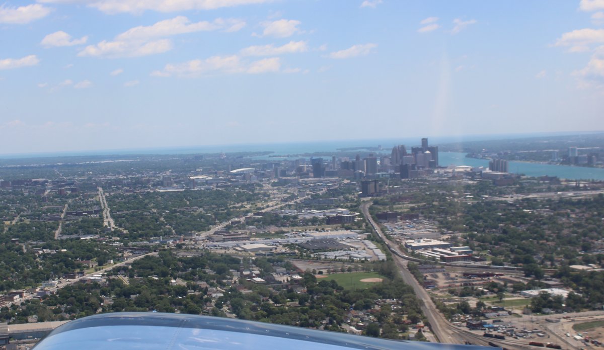
This is as close as I got to Detroit city.
|
| |
 |
|
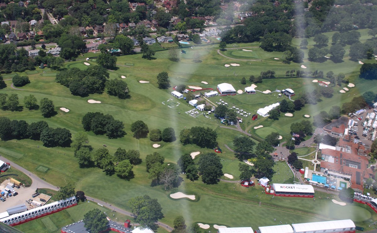
| A golf course with some sort of event going on. |
| |
 |
|
|
Now north-northeast of Detroit, passing overhead Ray Community Airport on my way to the east coast of Lake Huron.
|
| |
 |
|
| From the right, the Detroit River flows into Lake Huron on the left. |
| |
 |
|
|
Now flying north up the east coast of Lake Huron.
I had gotten bounced around pretty good over Detroit, and realized I was tired. So I decided to give up on the coastal flying -- which wasn't that interesting here -- and angled northwest towards Huron County Airport in the middle of the big peninsula that juts north into Lake Huron.
|
| |
 |
|
|
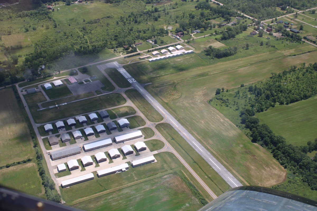
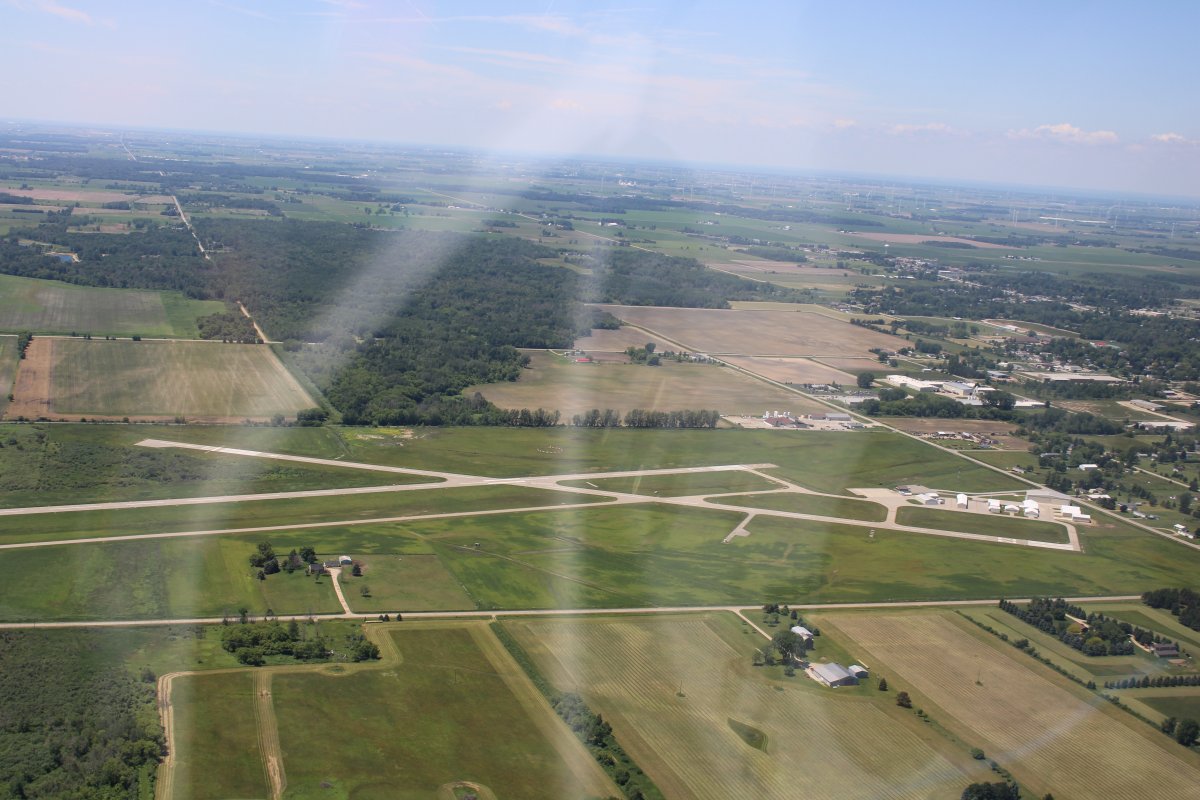
Overhead Huron County Airport (or is it Bad Axe?) that sits by itself in the middle of Michigan's thumb.
I landed around 2PM. My planned destination for today was Mackinac County Airport, or maybe even Duluth. I would discover the next morning how bad a plan that was! Way too ambitious. But right now I was out of gas and I'm not talking about the airplane. Plus the afternoon flying was already hot and bumpy down low. (That's the main reason I get an early start on the long cross-countries -- the best flying is in the mornings) The airport manager, Chris, was on hand and very helpful and friendly. When he said they had a courtesy car available and there was inexpensive lodging in town, I decided I'd had enough fun for the day. I tied down the airplane, checked into a nice, new motel in the town of Bad Axe,had a nice dinner at a restaurant recommended by Chris and rested the rest of the day.
|
| |
 |
|
| |
| |
|
|
|
|
|
|