July 5, 2011
- Sacramento to Iowa |
|
I departed Sacramento early on Tuesday morning for the long flight back
to Maryland. My plan was to do it in two days with no
sightseeing. I'd be heading pretty much due east following
Interstate 80. The first day I was hoping to make it to Red Oak,
Iowa and then on to Maryland the second day. This flight would
be very similar to what I did five years ago in the Citabria, only in
two days instead of four. My parents drove me to the airport early
in the morning, I fueled the plane up and then I was off. I started
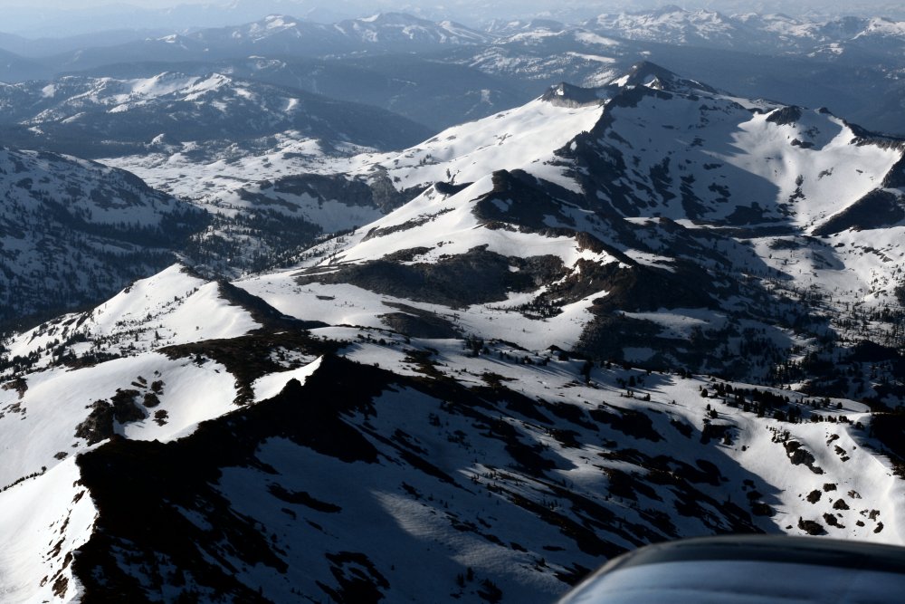
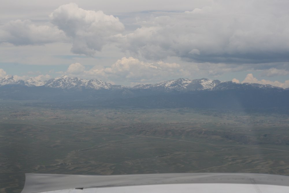
climbing immediately to get high enough to make it over the Sierra Nevada
mountains. Five years ago I could hardly see straight
ahead because of the bright sun, but it wasn't as bad this time.
I crossed the Sierras at 11,500 feet and had this nice view of the
still snow-covered mountains. They had a lot of snow this year, as
you can see.
|
|
 |
|
|
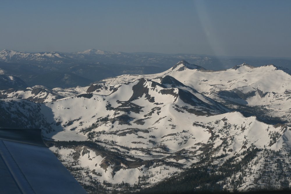
I believe some of the Tahoe ski-resorts were
still operating as late as a few weeks ago. |
|
 |
|
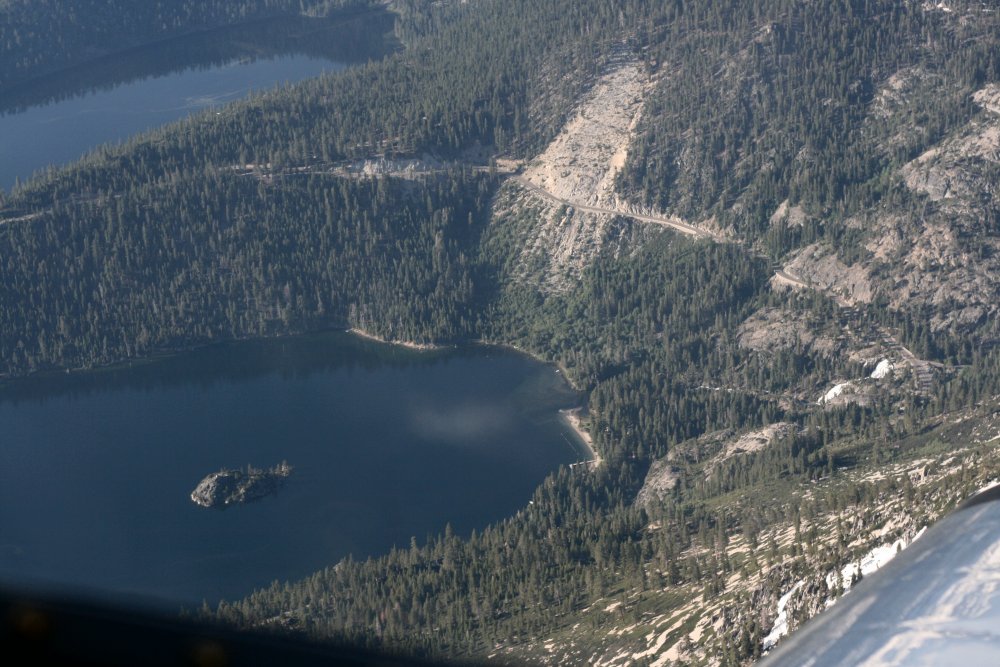
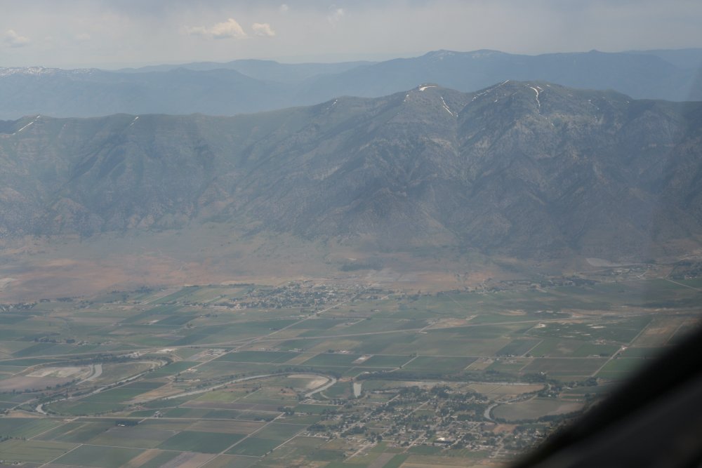
| Looking down at
Emerald Bay in
Lake Tahoe where we vacationed a few years ago.
The family hiked down the steep path to Vikingsholm Castle and then back up
in an arduous trek uphill in the hot sun that will go down in family
history! |
|
 |
|
|
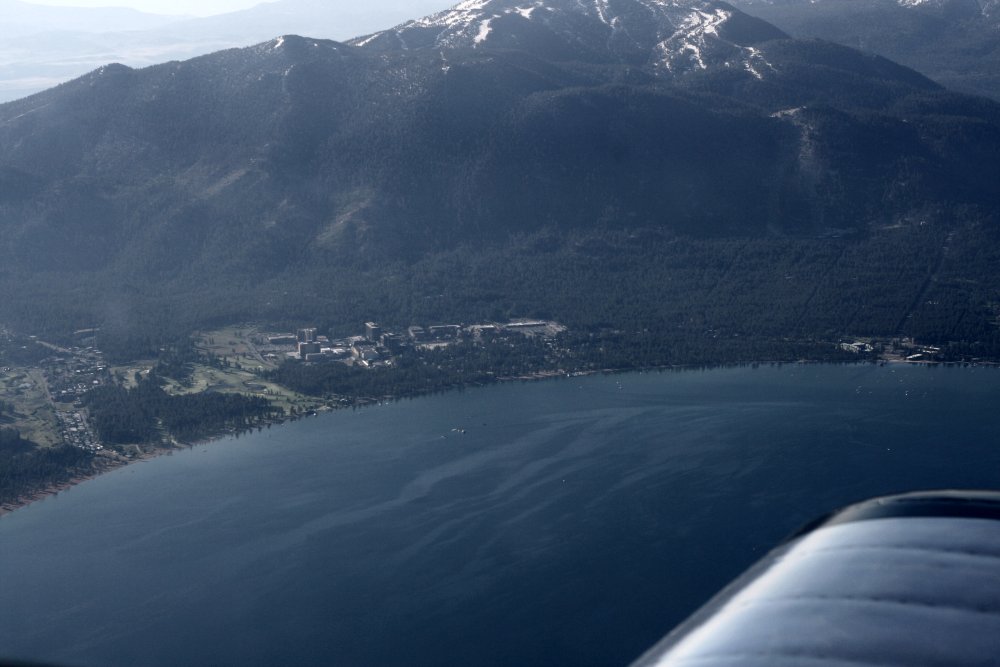
South Lake Tahoe. |
|
 |
|
|
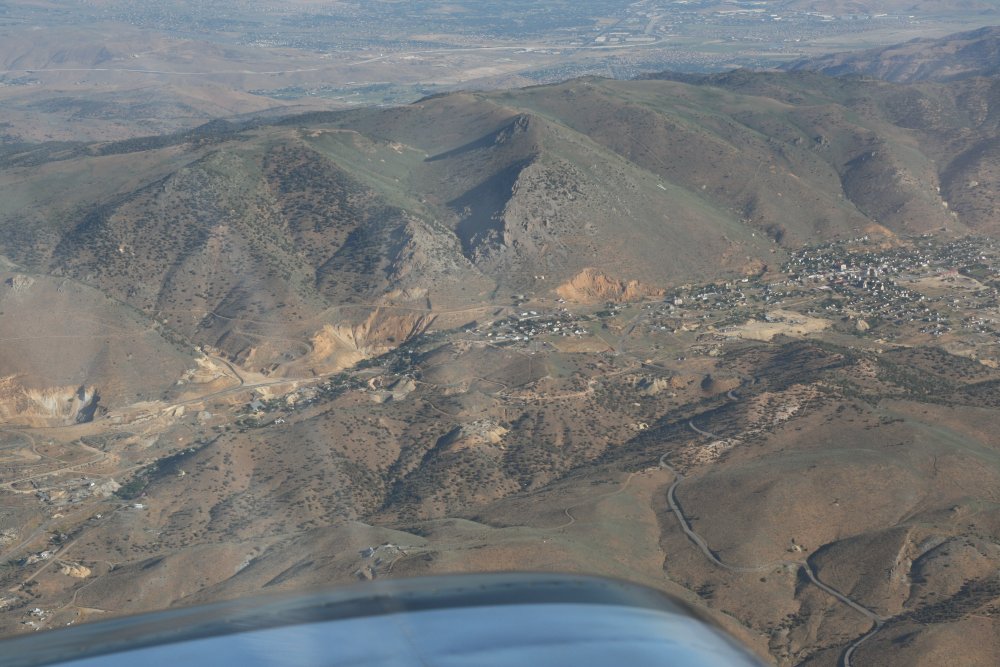
Carson City, where the big silver mine and the "Mother Lode" was mined
from1860 - 1890. Now it is a interesting tourist destination
with old fashioned saloons and tours.
I flew a glider over this area a couple of years ago -- operating
out of Minden -- but the air was so hazy from forest fire smoke you
couldn't see very well. |
|
 |
|
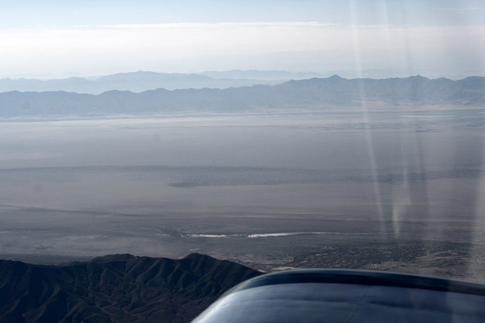
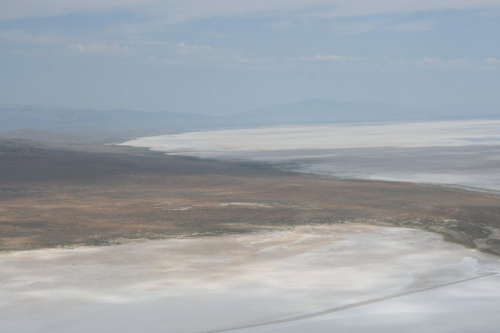
| Carson Salt Flats
which fall under restricted air space. |
|
 |
|
|
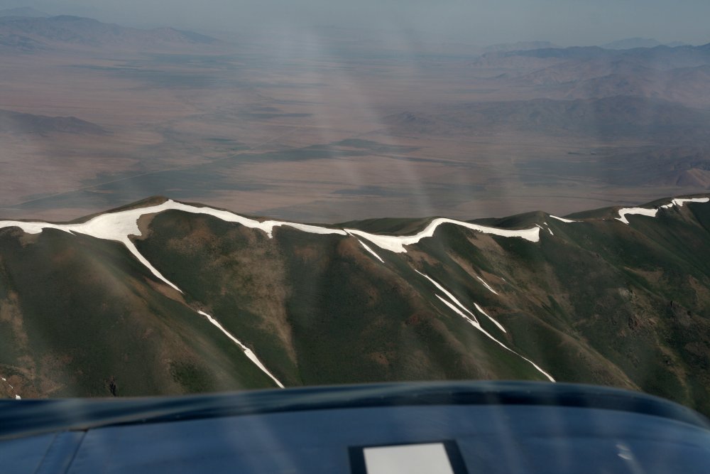
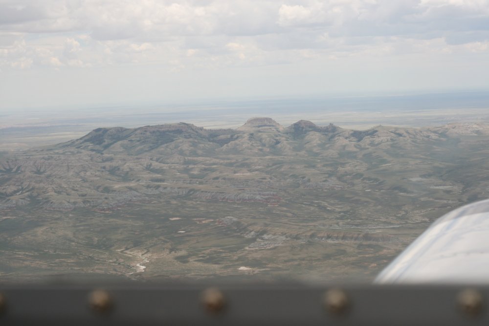
Some snow still remains on one of the Nevada ridges.
In the Citabria I had flown alongside I-80 at 1000 feet but on this
trip, with the higher performance RV, I flew higher and cut some
corners. |
|
 |
|
|
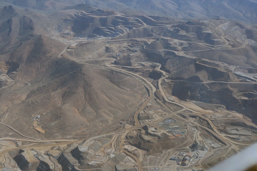
A huge mining operation. |
|
 |
|
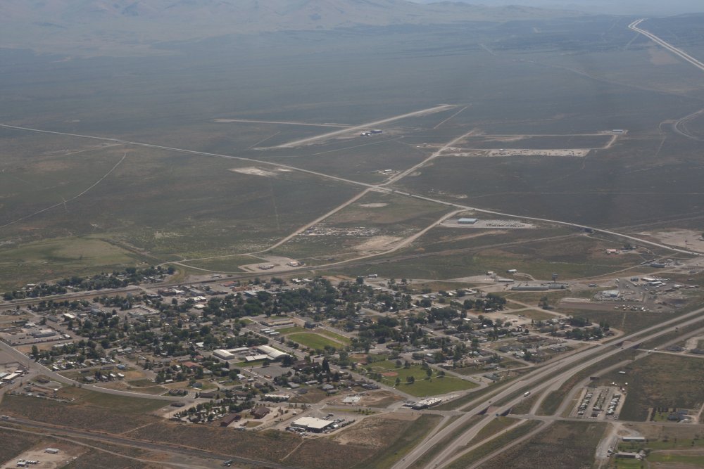
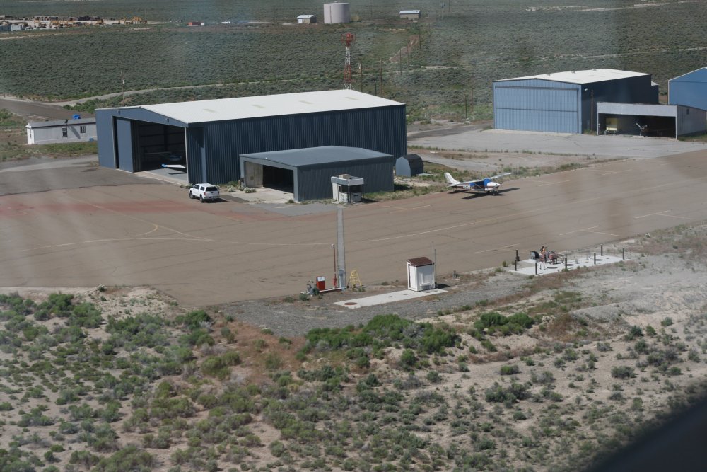
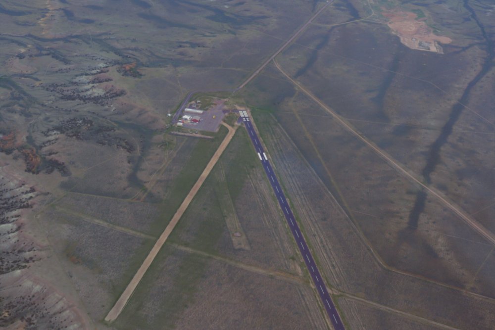
| The town of Wells,
with the airport in the distance. |
|
 |
|
|
I stopped at Wells to get gas -- which
was the lowest for the entire trip -- and to stretch my legs. Not
much in the way of facilities, but Wells does have the essentials:
self service fuel & restroom. A local pilot offered me a ride
into town but I was going a long way today and couldn't spare the
time. |
|
 |
|
|
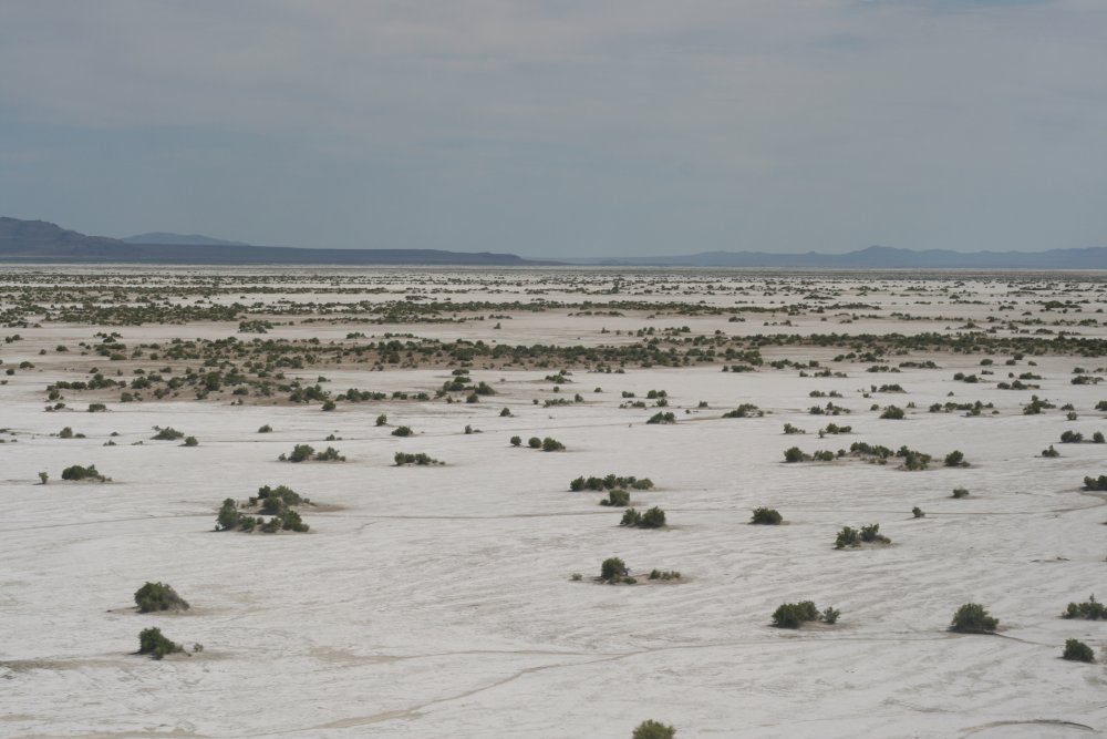
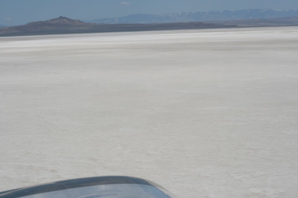
I left I-80 at Wells and headed due cross the north part of the Great
Salt Lake and avoid the Salt Lake City Class B airspace to the
north. Five years ago it had been a pain to get around it at
low-level to the south.
But first there was the Bonneville Salt Flats which must be flown at
low level! |
|
 |
|
| Yep, it's flat
all-right. |
|
 |
|
| I climbed when the
flats ended to have a little altitude over the lake. |
|
 |
|
|
Over the Great Salt Lake. |
|
 |
|
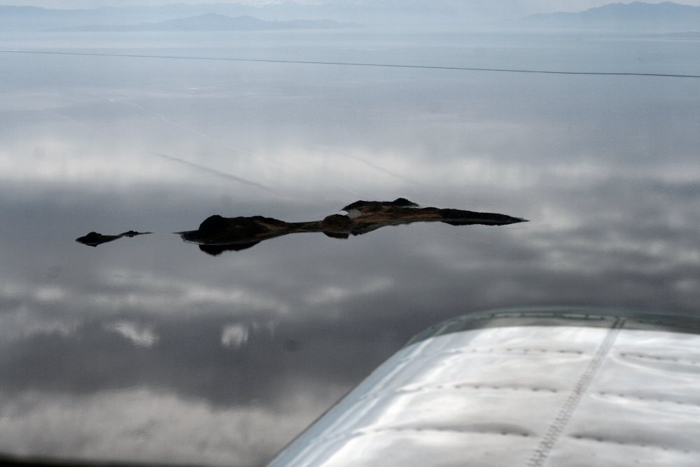
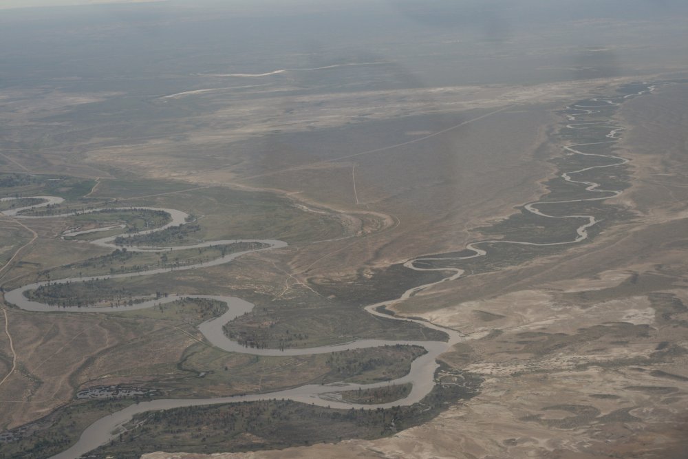
| But my main purpose
in flying across the north part of the lake was to fly over Promentory
Point -- where the Transcontinental Railroad was connected back in
1976. It wasn't too hard to find from the air. This area is
fairly undeveloped. The railroads no longer come this way but you
can still see the original route below. |
|
 |
|
|
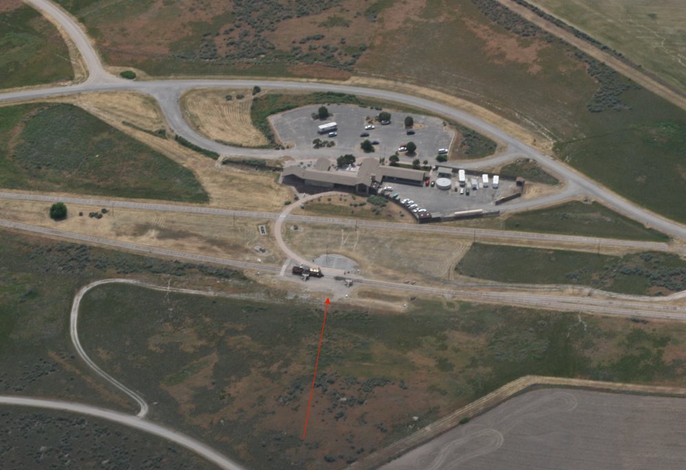
The red arrow points to the famous
site where the Central Pacific and Union Pacific linked up. There is
a visitor's center but no nearby airsport so No Can Do on that one,
Kimosabe. |
|
 |
|
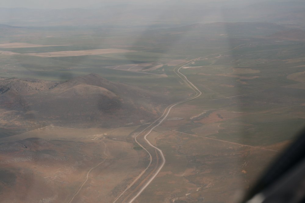
| To the East were
the Wasaatch Mountains. About this time I started getting rained
on. I flew through rain for about 30 minutes or so. |
|
 |
|
| I continued east
until reaching Fort Bridger airport. Five years ago when flying
the Oregon Trail I had not flown the section of the trail that
runs from South Pass to Fort Bridger. So I decided to do it on
this trip. Just a little past Bridger airport I turned
northeast and got on the trail. |
|
 |
|
| It was kind of fun
to be looking for ruts again. I had my chart from five years ago
with the Oregon Trail route marked on it. |
|
 |
|
|
The trail is running from top left to
bottom right. |
|
 |
|
|
Flying through South Pass, the
snow-covered Rockies in the distance to the north. |
|
 |
|
| Looking to the
south while flying through South Pass. |
|
 |
|
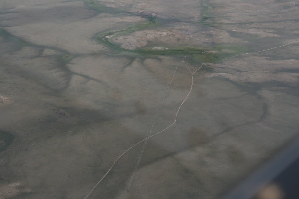
| It was pretty easy
to follow the trail in some places! Five years ago while flying
through South Pass, I never saw any ruts. But I nailed it today and
followed the trail the entire way through. |
|
 |
|
|
The trail crosses a little river
bed. |
|
 |
|
| The trail runs
straight as an arrow across the high desert. |
|
 |
|
|
I made it through South Pass and am
now flying parallel to the Sweetwater River. |
|
 |
|
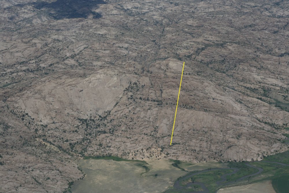
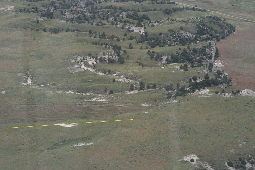
| This big rock
mountain was a landmark on the Oregon Trail called Split Rock. I was
trying to figure out why they called it Split Rock. I finally
realized it is because of a big vertical fracture in the rock -- parallel
and to the left of the yellow line. Yeah, Split Rock. Makes
sense. |
|
 |
|
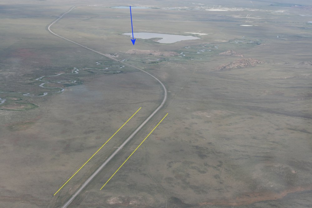
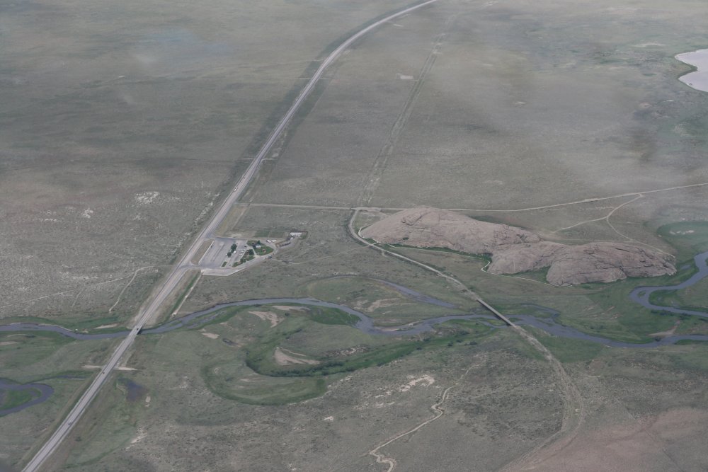
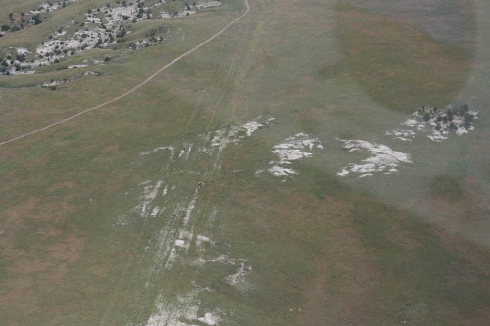
| After Split Rock,
the trail makes a left to the north towards Independance Rock and Casper,
Wyoming. The blue arrow points to Independance Rock. You can
see ruts between the yellow lines. |
|
 |
|
| A good look at
Independance Rock -- one of the most famous landmarks on the Oregon Trail
-- and highly visible ruts leading from Independance Rock to the top of
the picture. |
|
 |
|
|
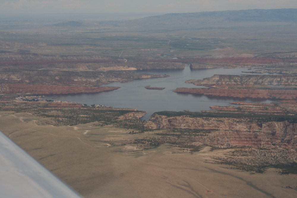
I'd greatly enjoyed flying the Oregon
Trail again, but I'd seen enough, and it was time to take a more direct
route east towards my goal of Red Oak, Iowa.
I turned east and soon came across
this scenic reservoir and canyon. |
|
 |
|
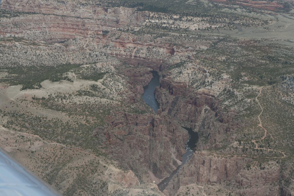
| My plan was to
stop at Guernsey for fuel. Just prior to Guernsey was this pretty
canyon. |
|
 |
|
|
Approaching Guensey Airport -- upper
left corner. The Oregon Trail came right through here. There
are two places worth seeing -- Guernsey Ruts and Register rcok -- if you
have the time. |
|
 |
|
|
I announced I was five miles out on Unicom and someone
started talking to me like a Tower. So I did what they
said. Why not? |
|
 |
|
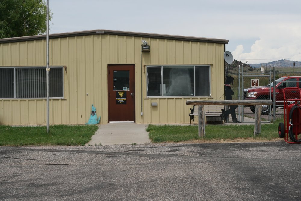
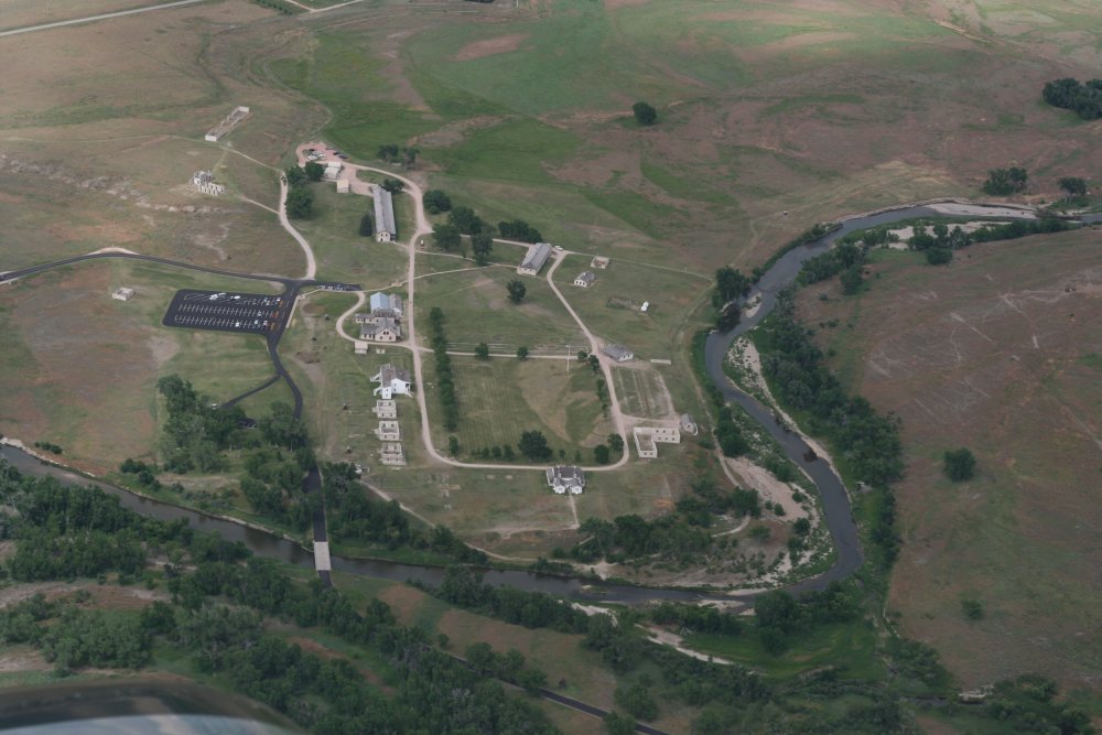
| The Guernsey FBO
building. I borrowed the courtsey car for a quick run into town for
lunch. |
|
 |
|
|
There is the tower I was telling you
about. The Army flys helicopters out of his airport. There is
also a bombing range to the northwest. |
|
 |
|
| I saw ruts just to
the south of the airport
after takeoff. (above the horizontal yellow line) |
|
 |
|
|
No mistaking these ruts. If you
have stayed with this web log from the beginning, by now you have probably
developed a fairly good eye for ruts yourself! |
|
 |
|
| A little ways
further east, I flew over Fort Laramie, which I had visited five years
ago, but not gotten an aerial picture of. A nice stop, if you ever
are in the area. |
|
 |
|
|
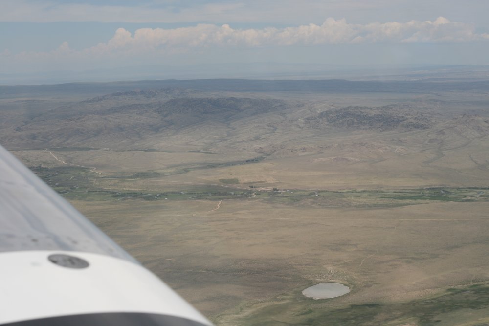
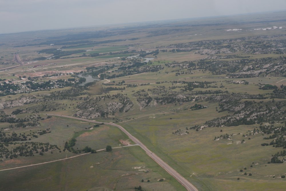
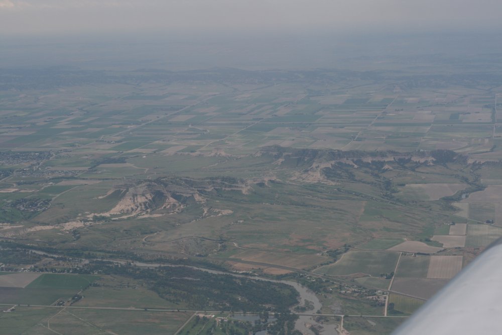
I wasn't really flying the trail, but I was flying parallel to it. Here
is Scotts Bluff and the North Platte River.
I wanted to check out Chimney Rock, but I realized after Guernsey that I
was running out of time. I sitll had 500 miles to go to get to Red Oak,
Iowa and it was already late afternoon. No Chimney Rock this
trip. |
|
 |
|
|
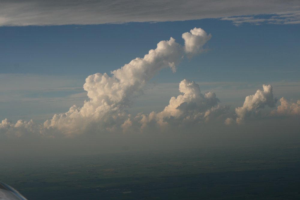
Now that I'm getting into the Midwest, weather started making an
appearance. This is where having XM Satellite weather on my GPS paid
for itself. I could see convective activity -light green and dark
green (rain) and yellow and red (thunderstorms) -- on my moving map ahead
of me and alter my course accordingly.
Unfortunately, there was a lot of yellow and red
right where I wanted to go: the Council Bluffs/Omaha area and Red
Oak just to the east of it. I continued towards it hoping that it
would blow away from the area, but it kept hanging around. On
my GPS, Red Oak was just showing light rain, but Omaha was experiencing a
thunrderstorm. As I got closer I could actually see the weather
ahead -- dark and ominous.
Even though it was already about 6PM, I decided to
land at an airport and take a break to review the situation. The
airport - Columbus - looked good according to the AOPA directory with a
courtesy car. Maybe I could just stay there even though it was short
of my goal.
|
|
 |
|
|
I landed at Columbus, which was a
good size airport, but it was deserted. The FBO building was
locked. A sign gave directions to a restroom that was supposed to be
unlocked but of course it was locked. I couldn't even see a way to
get outside of the chainlink fence that prevented entry, or exit, to the
ramp area! So this airport was not a good stop for the night.
I have said many times that an airport ought to have a little area for
transient pilots that is unlocked 24x7, with a restroom with phone numbers
to recommended motels, restaurants and taxi service. That's not much
to ask, is it?
At Guernsey, I had called Red
Oak and talked with the airport manager who graciously said he would make
sure the courtesy car would be available, where to find the keys, and even
gave me directions to a Super8 motel. So I wanted to get to Red
Oak where I knew I had a car and a place to
stay. I checked the weather on my GPS and
Omaha was now clear of thunderstorms so I decided to continue on.
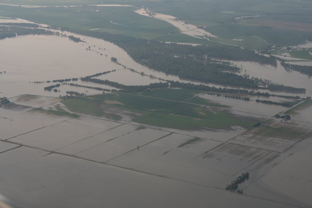
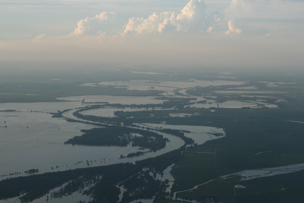
Omaha is on the Missouri River and it
had definately had flooded over the banks. |
|
 |
|
| Looking south
where the storms had moved. |
|
 |
|
|
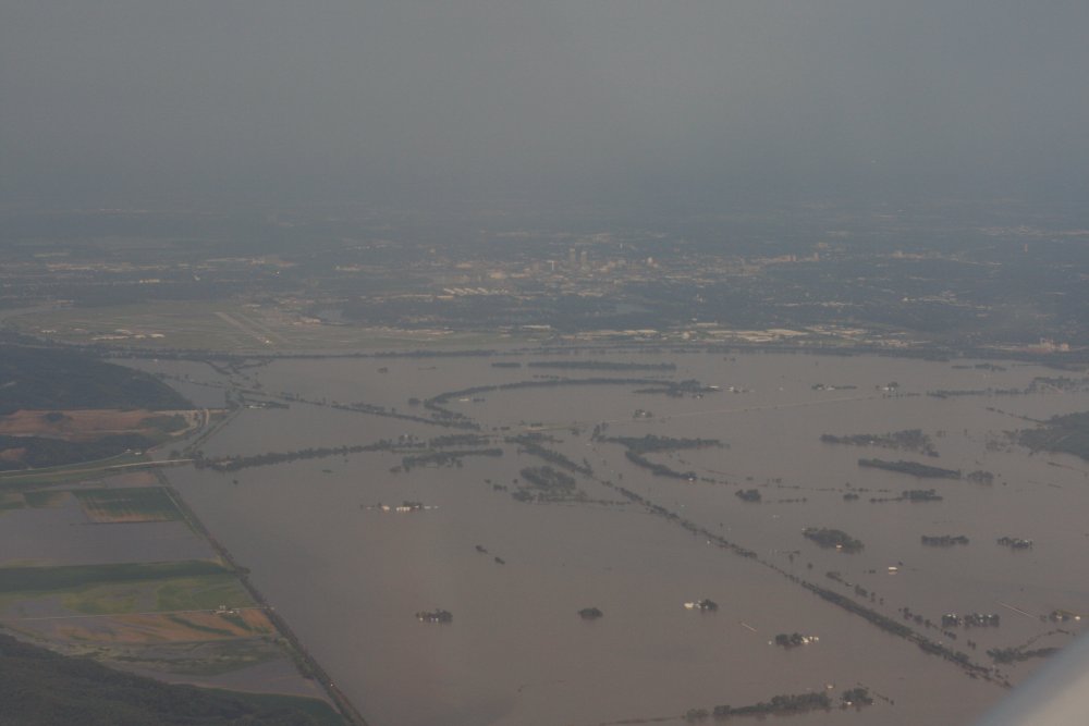
I passed Omaha airport to the
north -- you can see the runway left of center. From
here, it was a quick easy shot to Red Oak. It had just stopped
raining when I arrived. Unlike Columbus, there were actually people
at this airport as the Civil Air Patrol squadron was just finishing up a
meeting. The car and keys were just where the airport manager
had said, and after putting the RV to bed, I was soon on my way to
the Super8. It had been a long day. I was so tired, I
didn't even go out to dinner, but just ate some snacks I had with
me. |
|
 |
|
|
|
|
|
|
|
|