July 4, 2019 - Flight West - Day Nine Part I
|
|
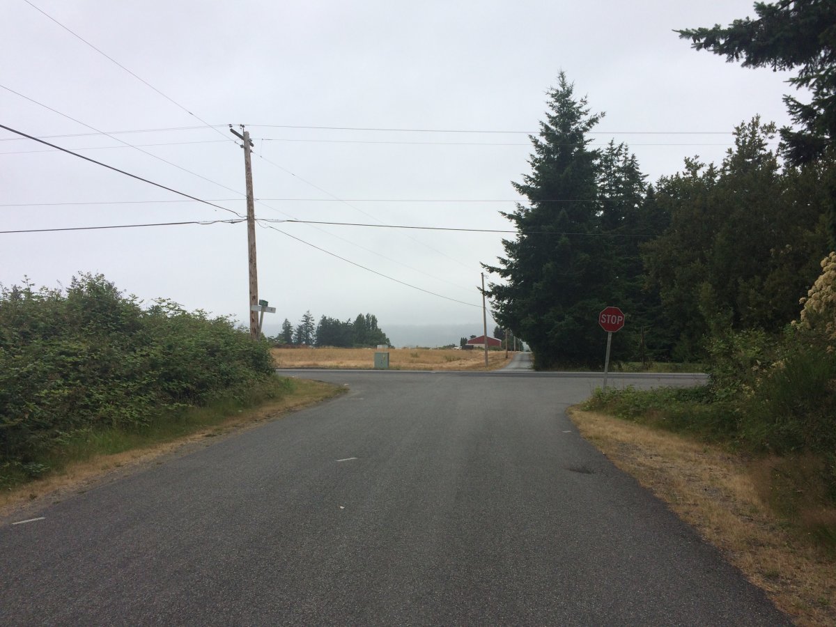
As you know, I like to get an early start, but this morning it was not too be. This was the view from the end of Stan's street around 8AM. Normally you can see across the Sound to another island straight ahead. The morning coastal overcast was very much present this morning.
The weather yesterday morning and this morning really cost me in terms of not being able to visit some places I had wanted to visit. Here are some of them: 1) Going on a tour of Vans Aicraft Company in Aurora, Oregon, 2) landing on the sandy beach runway at Copalis, Washington, 3) landing on the dry lake bed in Alvord Desert, Oregon, 4) visiting the Evergreen Aircraft Museum in McMinnville, Oregon, 5) the San Juan islands north of Whidbey Oh well, guess I'll have to come back.
|
| |
 |
|
|
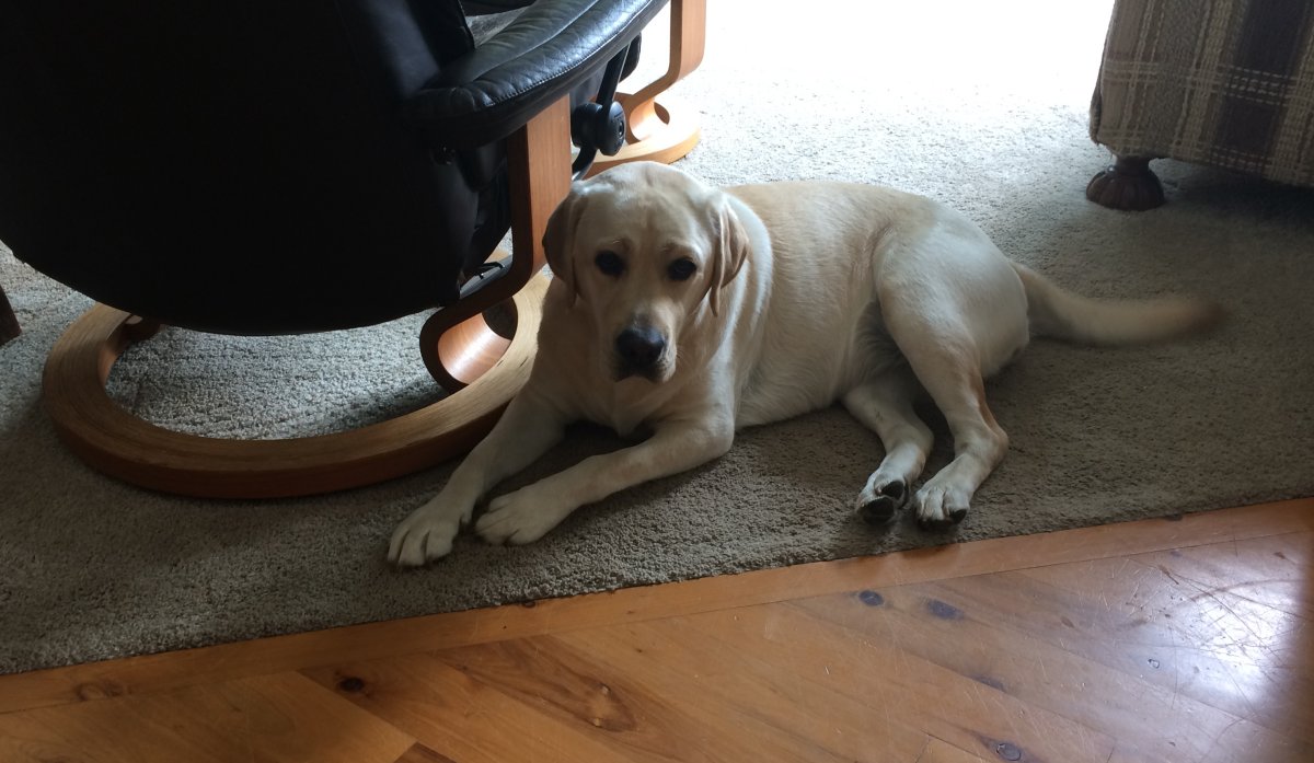
Even Fletcher was not happy.
|
| |
 |
|
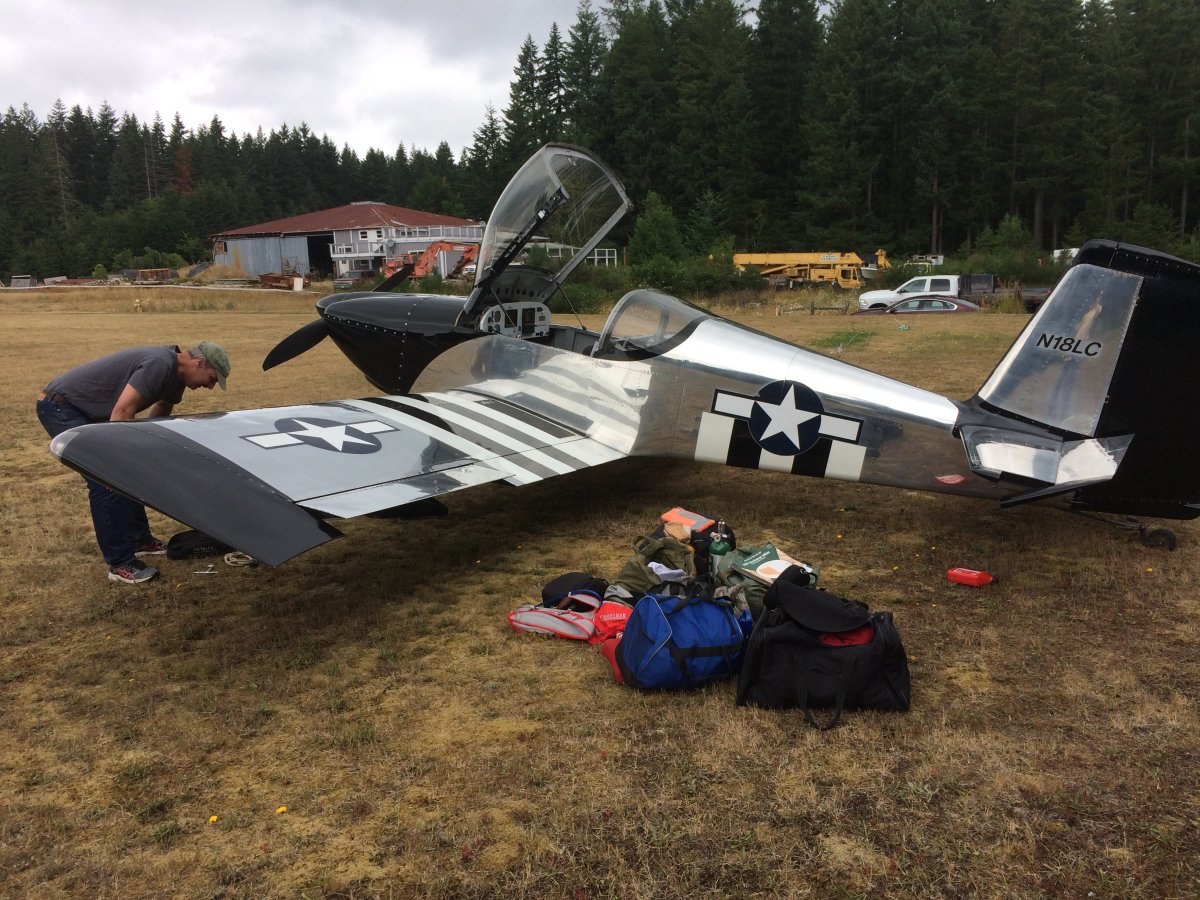
| We hung around all morning then finally went out to the airplane after noon or so. |
| |
 |
|
|
Finally I was on my way. The low overcast layer was definately better than it had been earlier and was lifting. I knew it was clear south of Seattle.
|
| |
 |
|
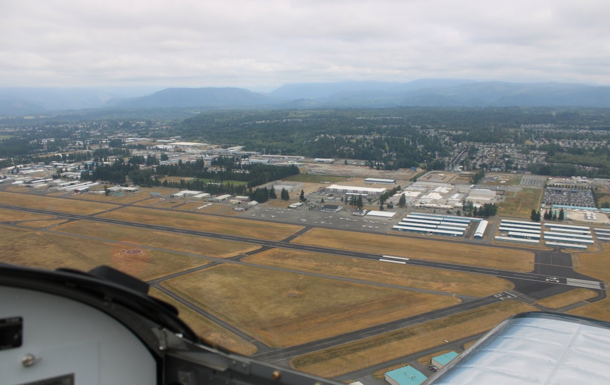
| I went back over to Arlington and topped off with gas. |
| |
 |
|
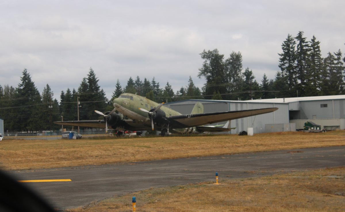
| An old DC-3 parked on the grass. |
| |
 |
|
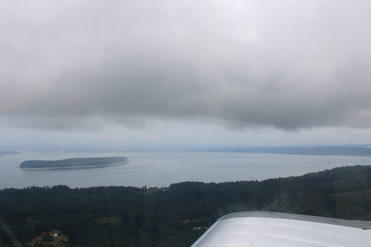
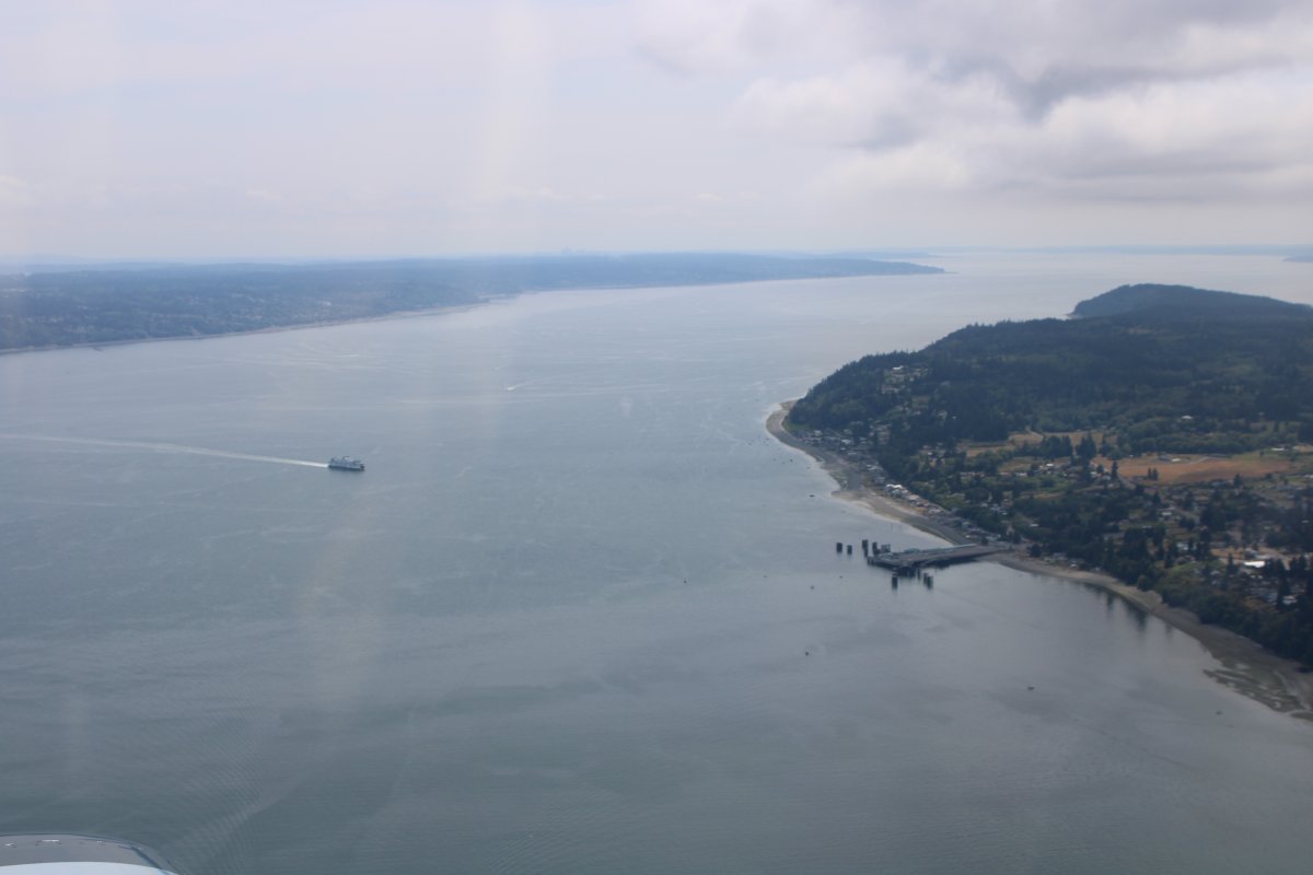
| Soon I was heading south down Puget Sound. |
| |
 |
|
|
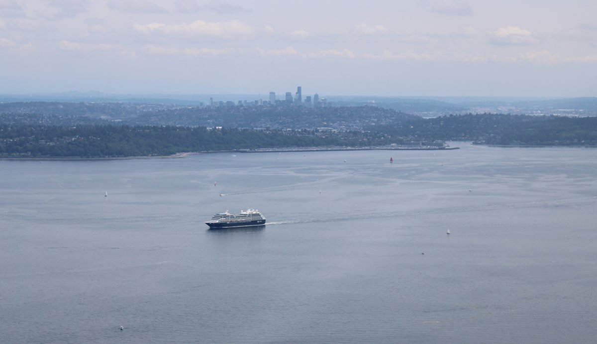
A cruise boat heads north as I head south.
|
| |
 |
|
|
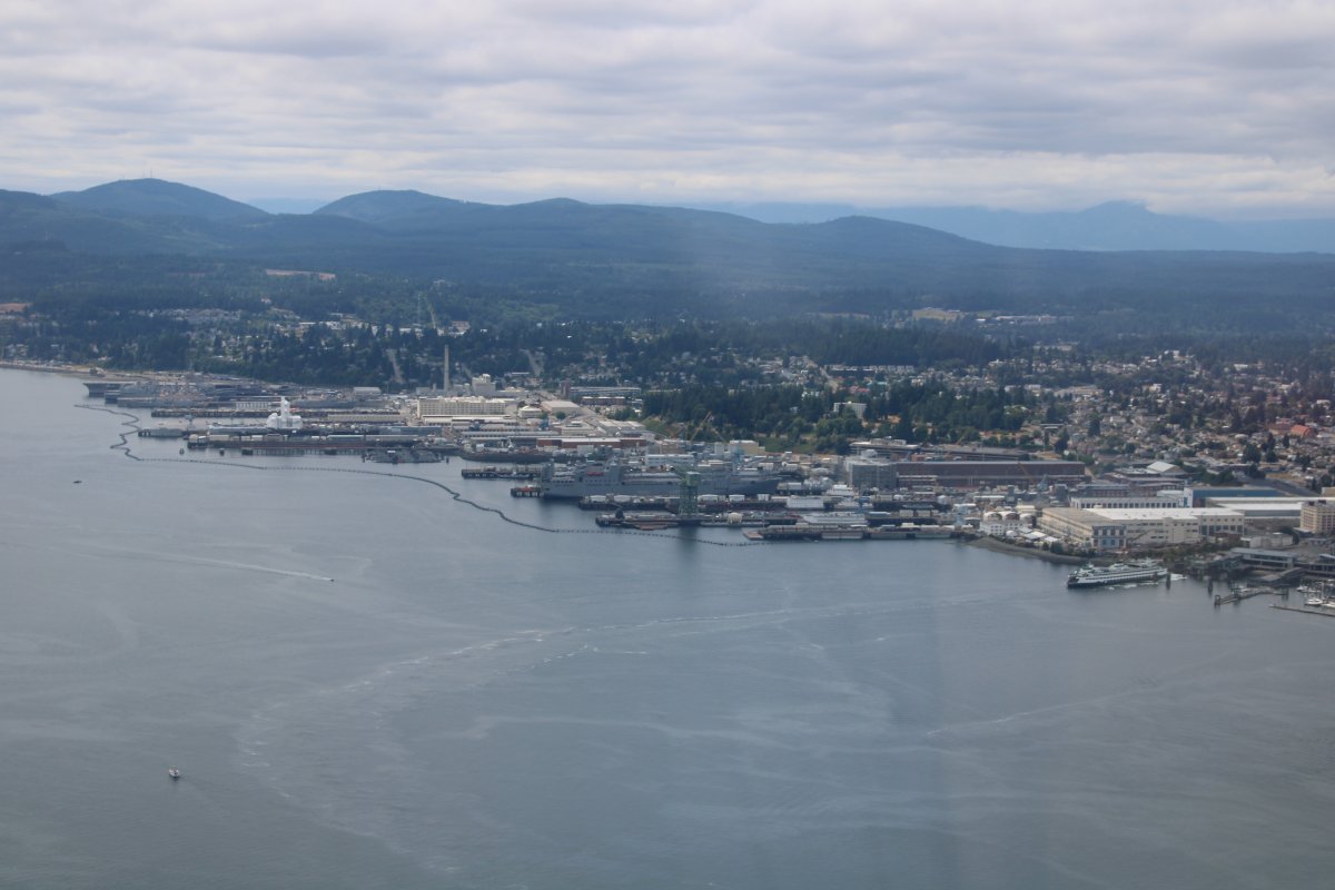
I passed by Bremerton and the Naval Base which is called Kitsap now.
Naval Base Kitsap -- which just does not sound right -- is the third-largest Navy base in the U.S. It features one of the U.S. Navy's four nuclear shipyards, one of two strategic nuclear weapons facilities, the only West Coast dry dock capable of handling a Nimitz-class aircraft carrier and the Navy's largest fuel depot. Two Nimitz-class carriers are based here plus a bunch of subs. It is also home to an inactive ship facility for several decommissioned warships, including aircraft carriers.
|
| |
 |
|
|
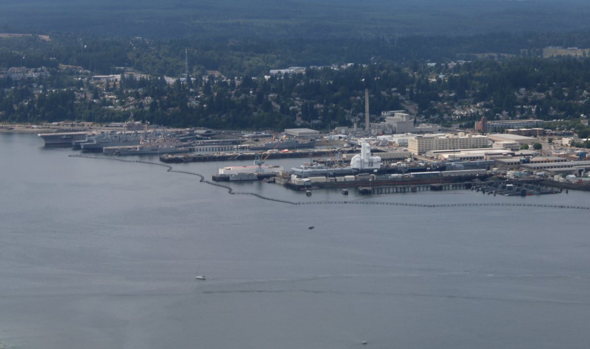
The subs are visible at far right.
|
| |
 |
|
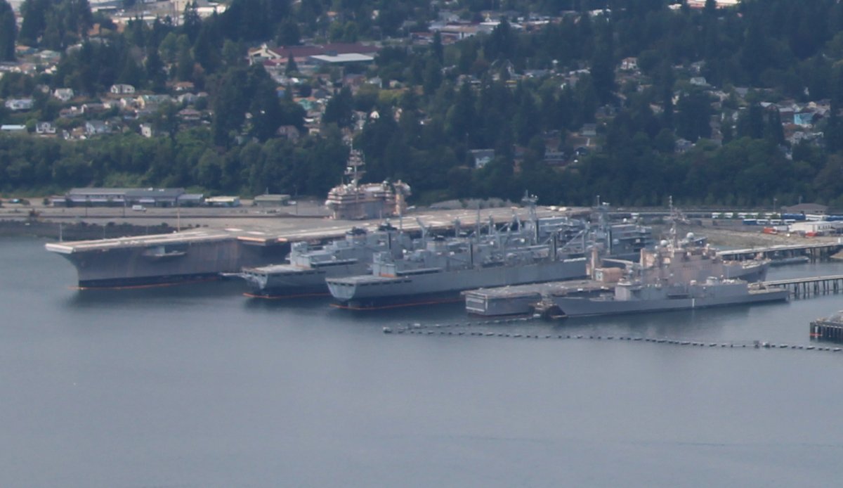
| I wonder if those are the inactive ships? |
| |
 |
|
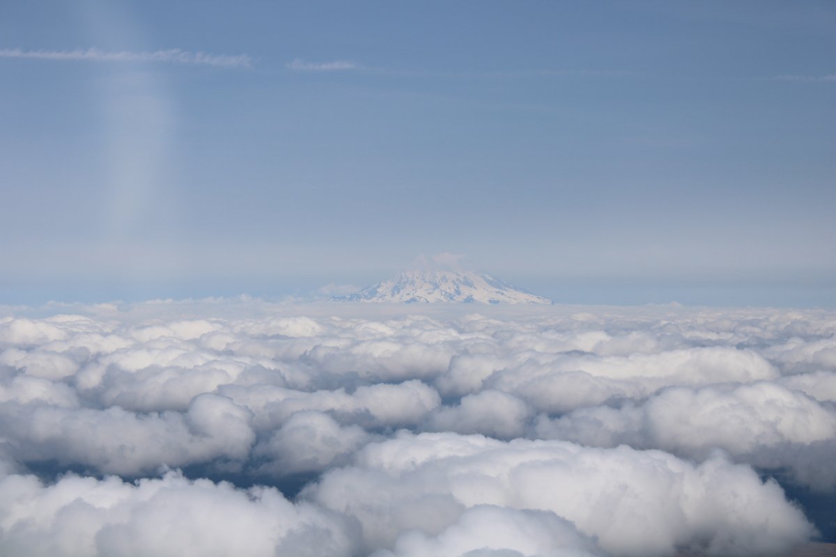
| One last look at Mount Rainer. |
| |
 |
|
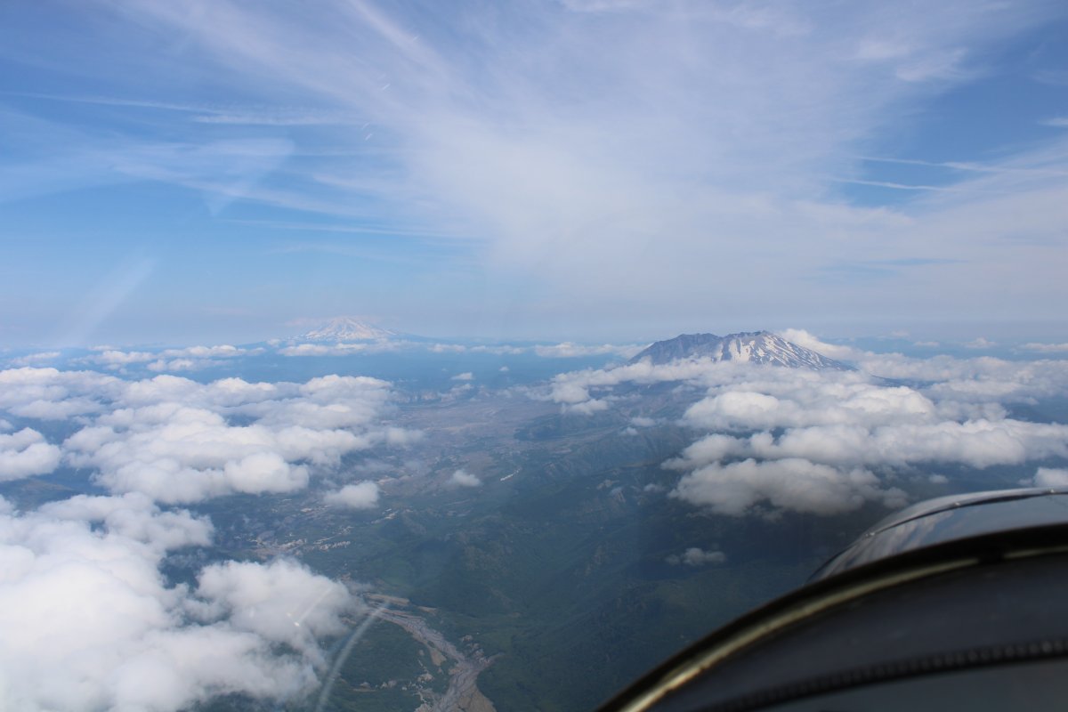
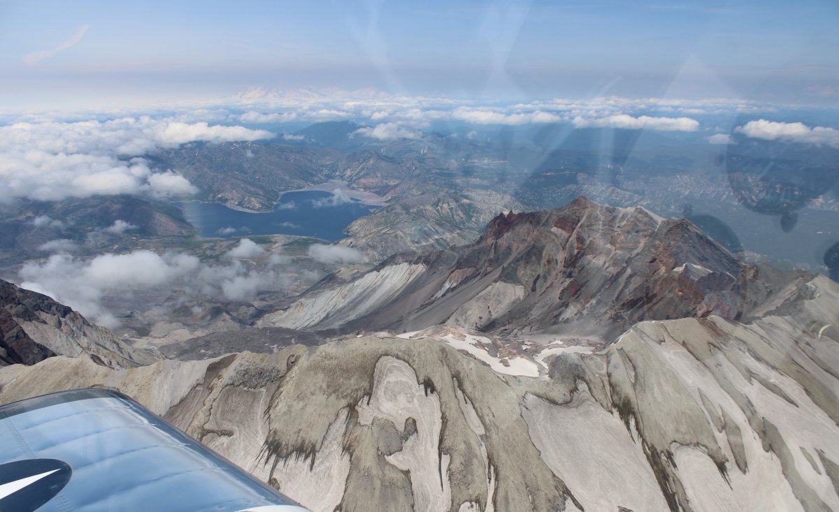
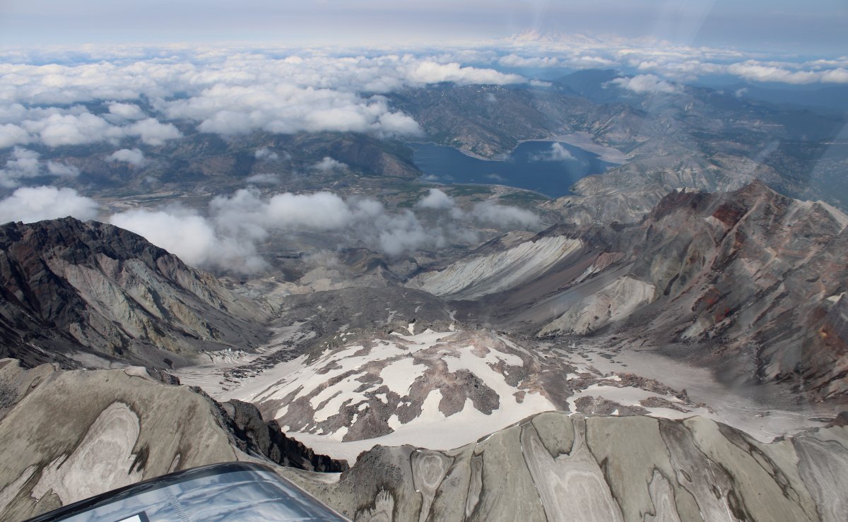
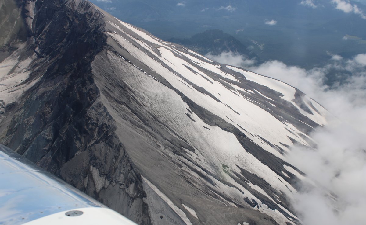
| One of the things I had wanted to do was overfly Mount St. Helens which is north of Portland. There it is, dead ahead. That is Mount Adams to the left in the distance. |
| |
 |
|
|
Mount St. Helens is most notorious for its major eruption on May 18, 1980, the deadliest and most economically destructive volcanic event in U.S. history.
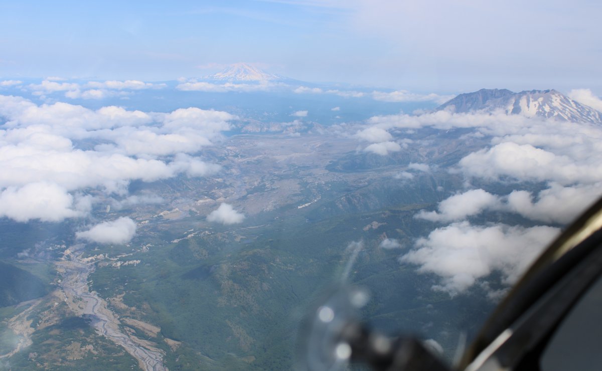
I guess all the lava flowed down the left side.
|
| |
 |
|
|
Mount St. Helens is now 8,365 ft tall. I wonder how tall it was before it blew?
|
| |
 |
|
| |
| |
 |
|
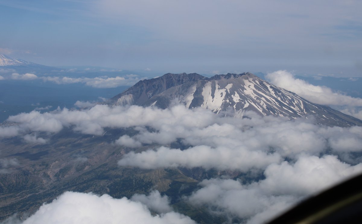
| I began a counter-clockwise circle around the summit. |
| |
 |
|
| |
| |
 |
|
|
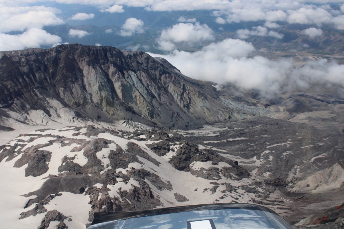
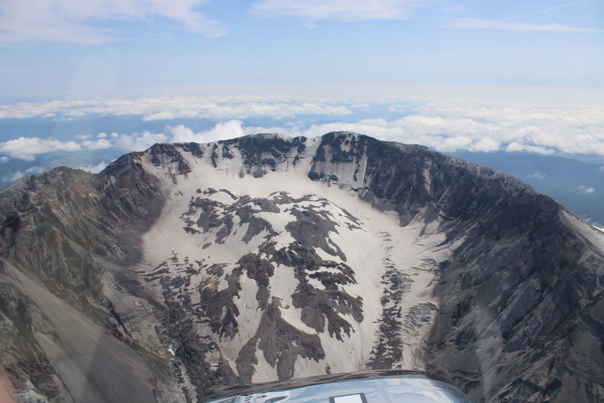
Peering into the crater.
|
| |
 |
|
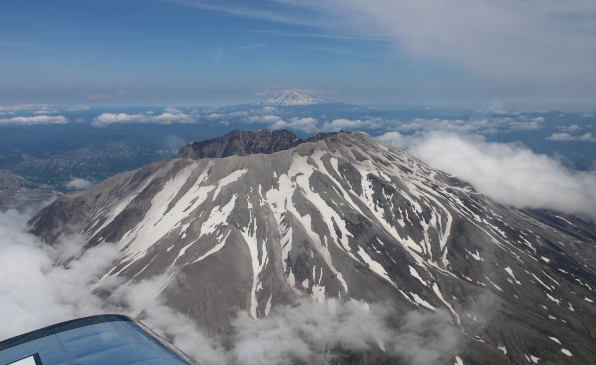
| A good look at the entire interior of the crater. |
| |
 |
|
|
|
| |
 |
|
| |
| |
 |
|
|
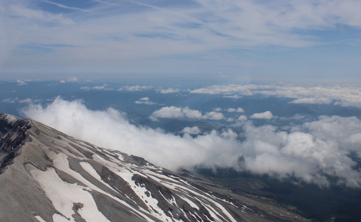
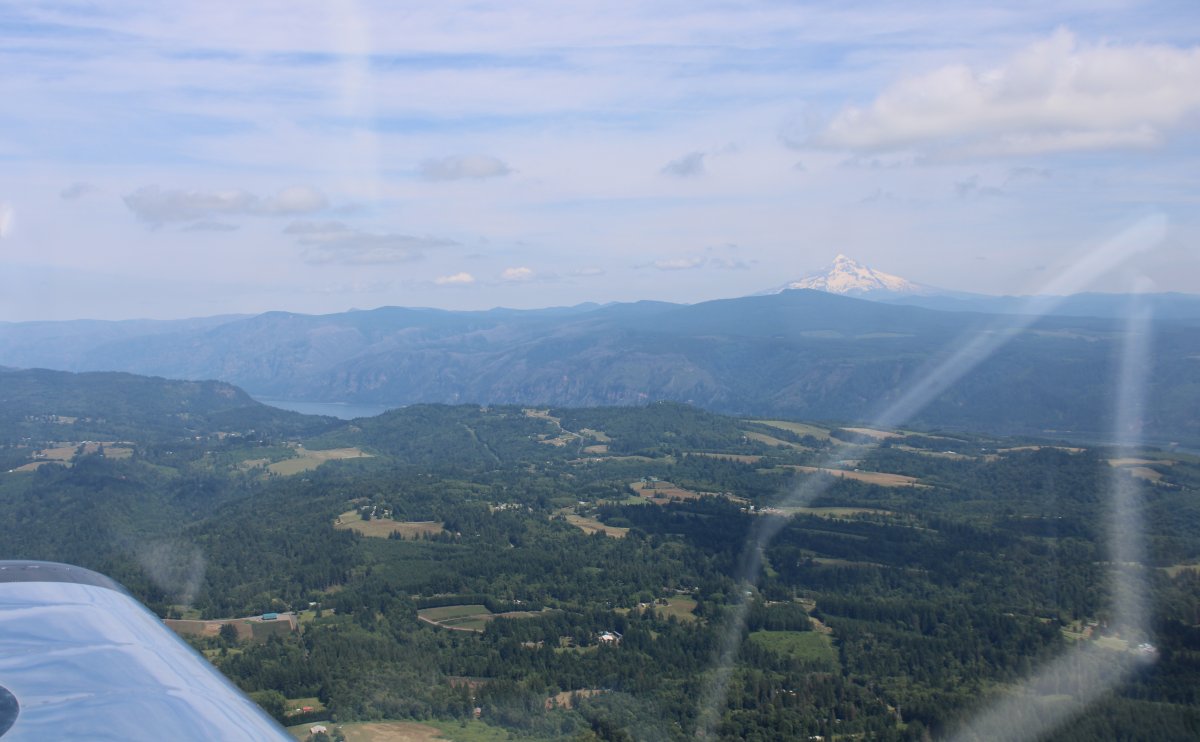
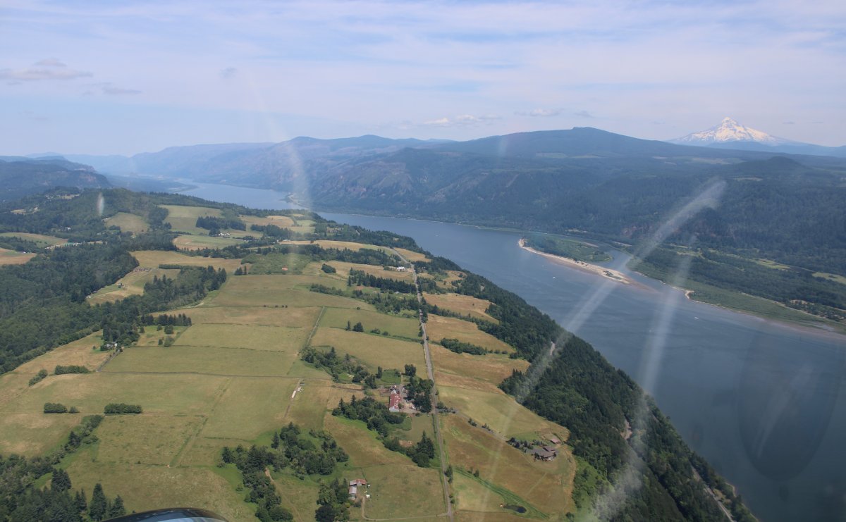
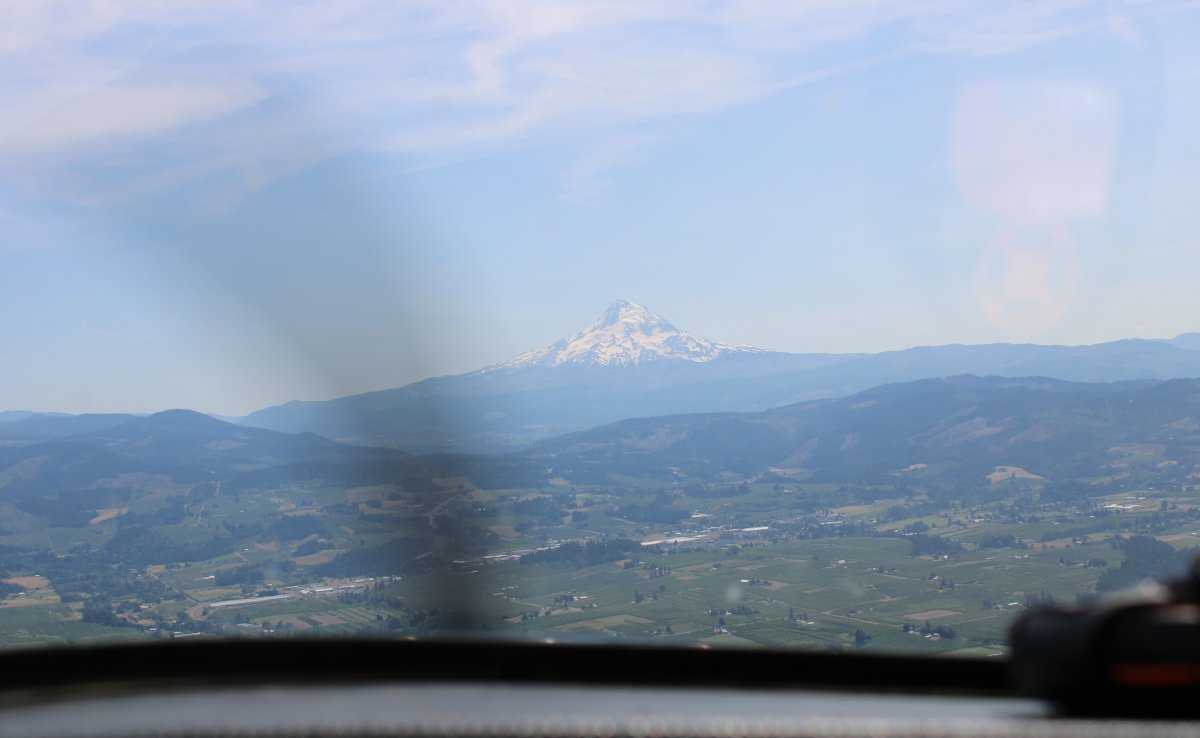
Heading south for the Columbia River gorge with Mount Hood (11,299 ft) visible in the distance.
|
| |
 |
|
| Portland is out there in the haze. |
| |
 |
|
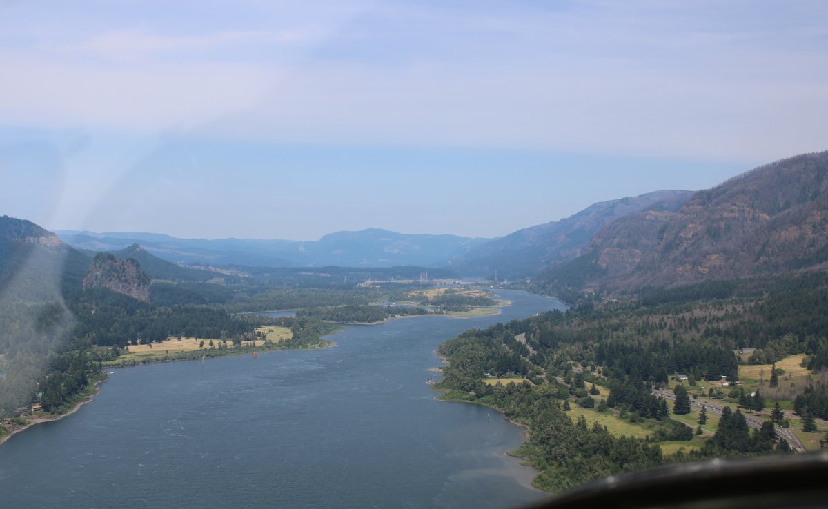
| I had flown the Columbia River gorge heading west in the Citabria back in 2006. But it was in the late afternoon with the sun in my eyes so it wasn't that good. I wanted to fly it again. It's the afternoon again, but I'm heading east this time. |
| |
 |
|
|
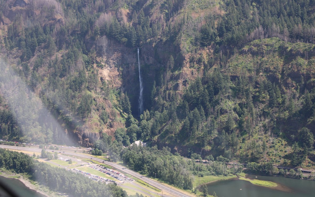
Nice waterfall! Named Bridal Veil falls, like most of them are, it seems.
|
| |
 |
|
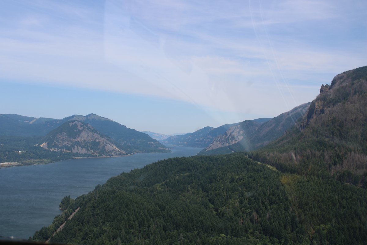
| Heading east following the Columbia River. Somewhere around here I picked up an airplane on my ADS-B coming the other way. I spotted him on the other side of the gorge. It was a red and white RV! I wagged my wings and he wagged his. |
| |
 |
|
|
|
| |
 |
|
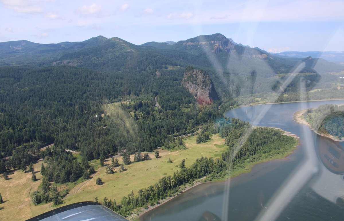
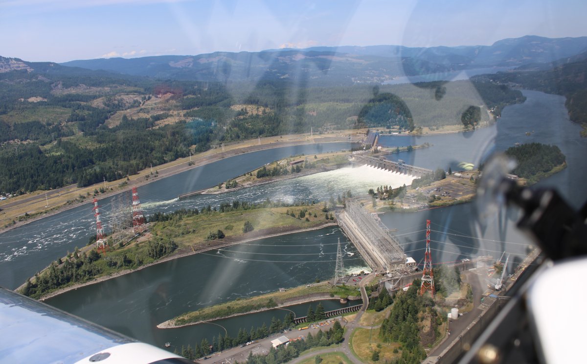
| The Bonneville Lock and Dam and hydropower complex on Bradford Island. |
| |
 |
|
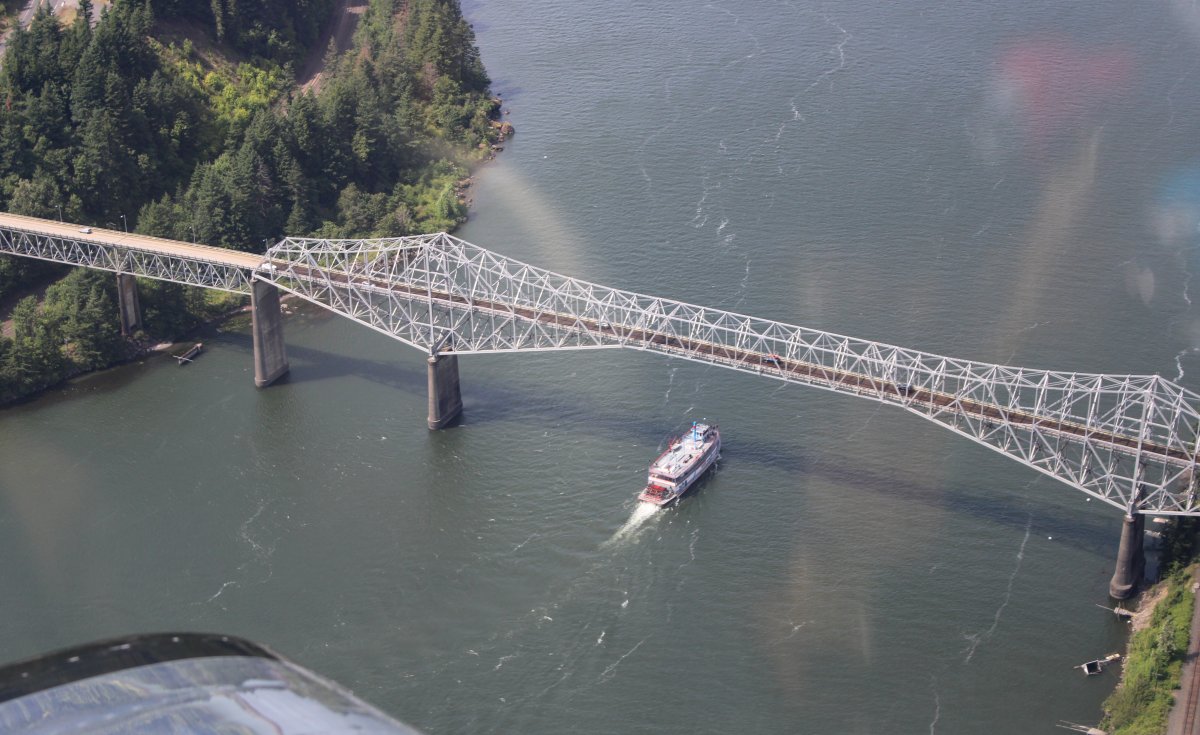
| Bridge of the Gods. Completed and opened in 1926. Onlookers in September 1927 saw Charles Lindbergh fly the Spirit of St. Louis from Portland low over the new bridge and then in a bit of barnstorming, make a 180 degree turn and fly back under the bridge, continuing to the Portland Airport. Not advisable these days. |
| |
 |
|
| |
| |
 |
|
|
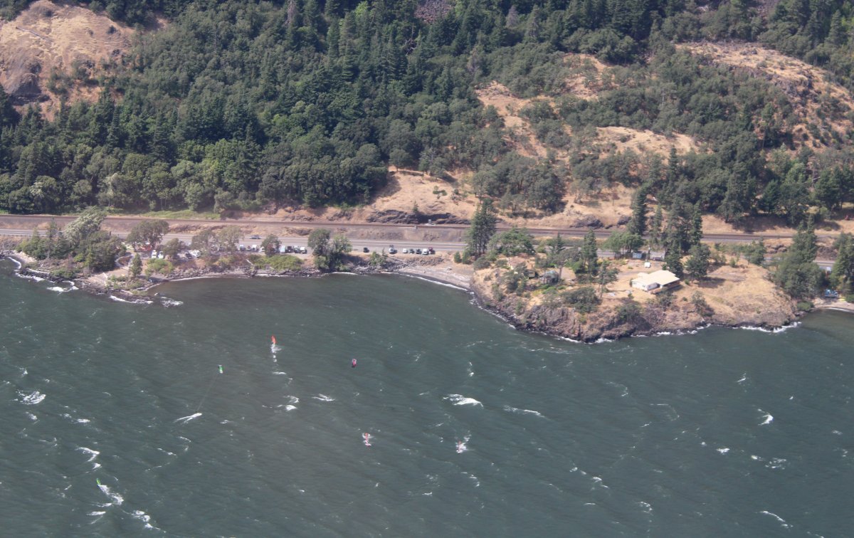
The gorge became very windy, because of its funnelling characteristics. Para-surfers can be seen down below taking full advantage!
|
| |
 |
|
| After awhile I'd seen enough of the Columbia River Gorge so I turned south at Hood River and headed for Mount Hood. |
| |
 |
|
|
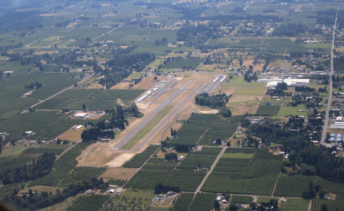
Passing by Ken Jernstedt Airfield (4S2) just south of Hood River town.
|
| |
 |
|
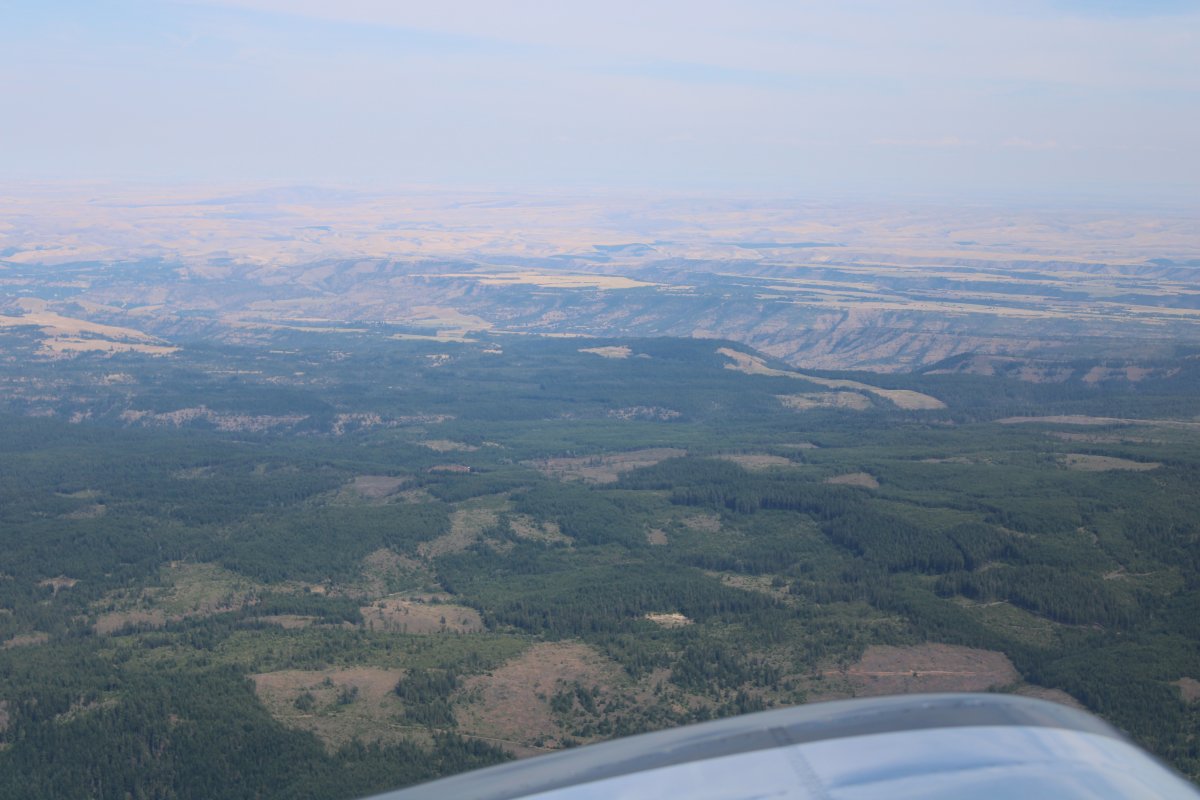
| Now I'm leaving civilization, heading south into the mountains. High desert off to the west. |
| |
 |
|
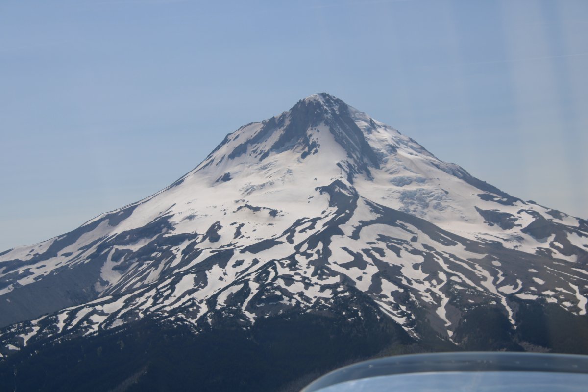
| Passing by Mount Hood. |
| |
 |
|
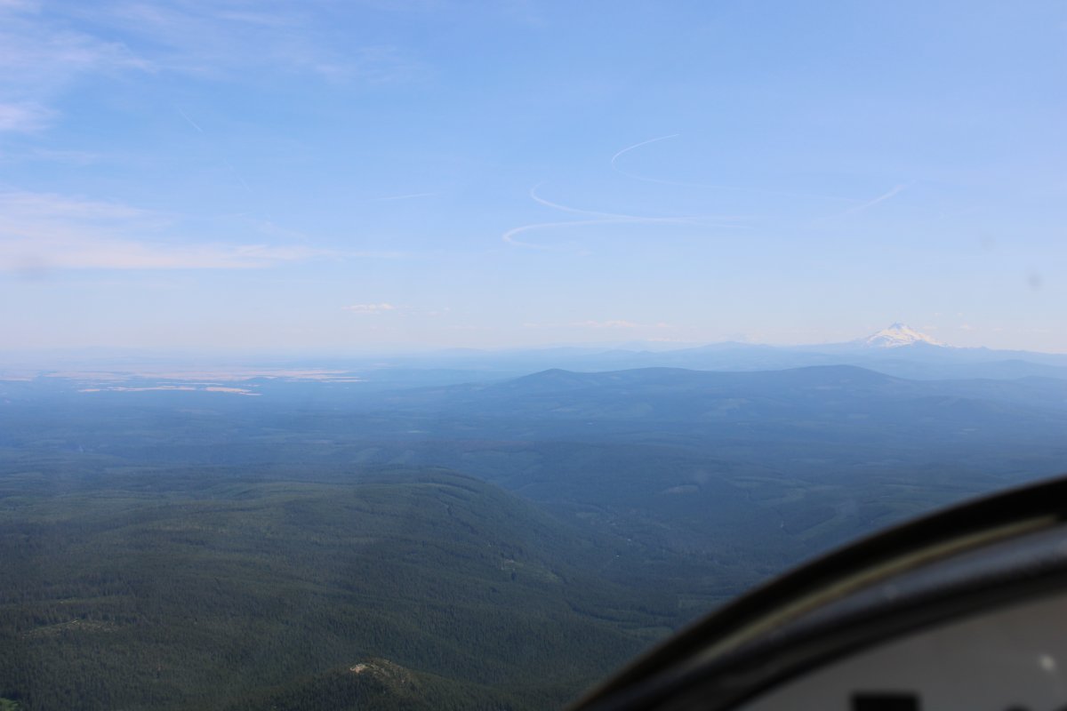
| Nothing but trees now with Mount Jefferson in the far distance. |
| |
 |
|
|
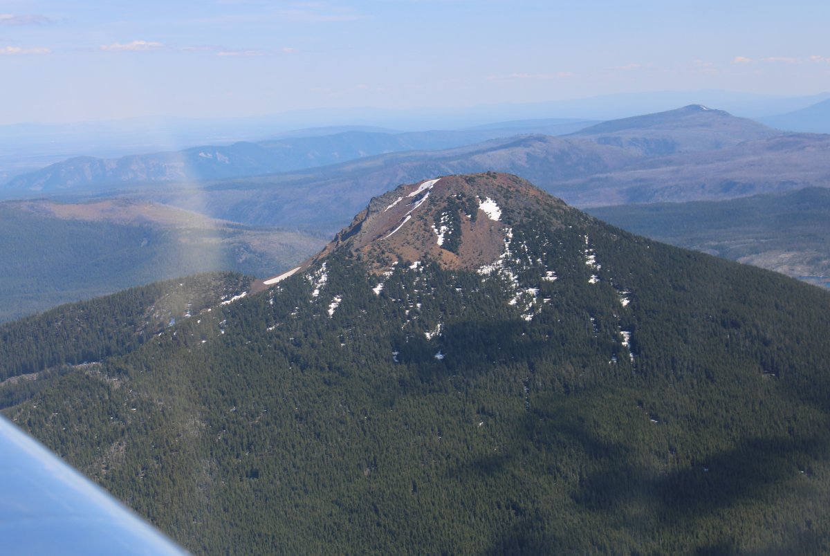
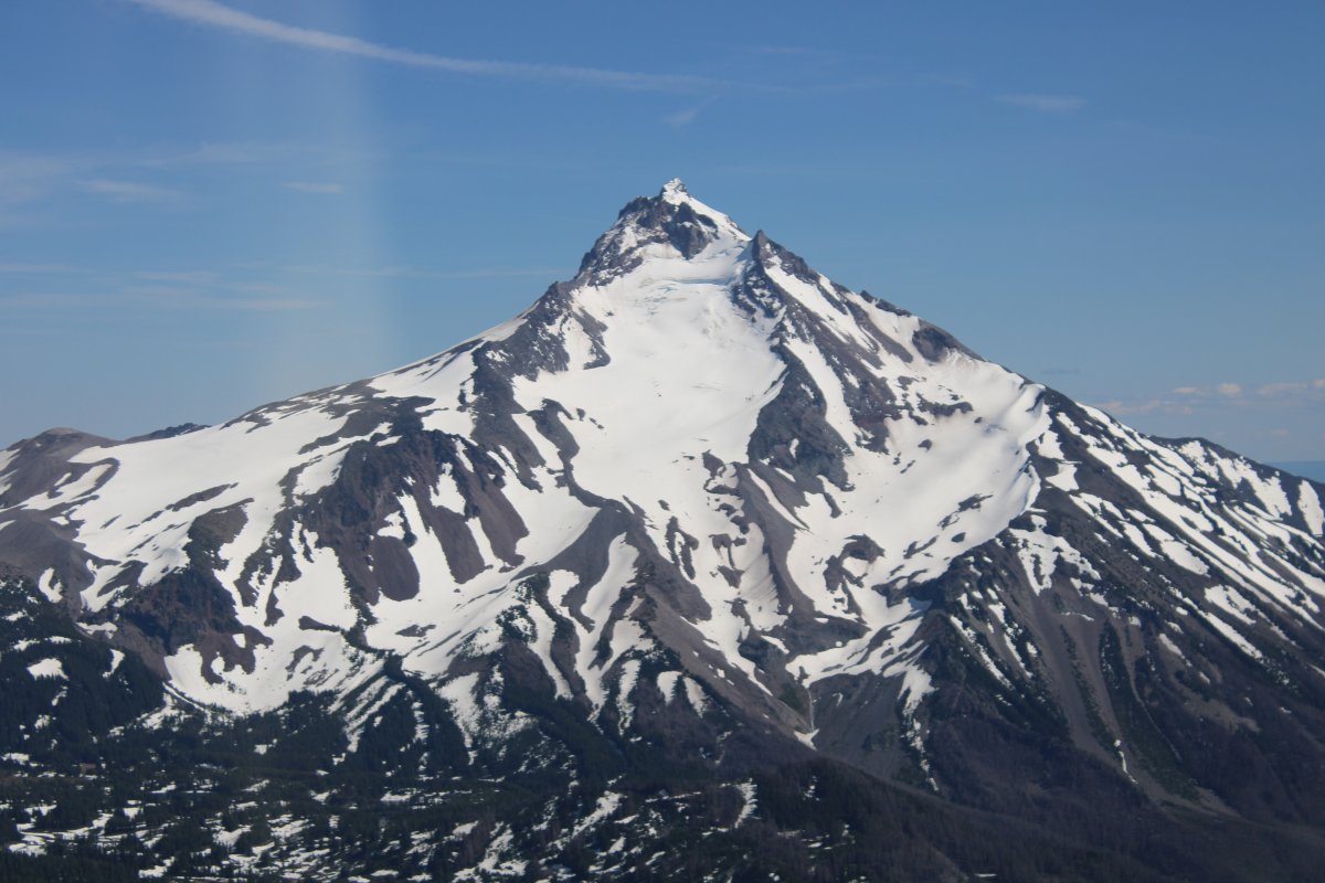
I pass by a scenic little guy. Mount Wilson? Only 5,600 ft.
|
| |
 |
|
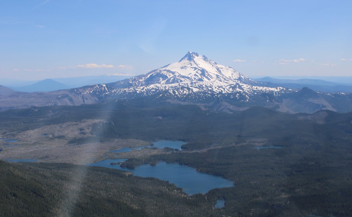
| A good look at Mount Jefferson at 10,497 ft. |
| |
 |
|
|
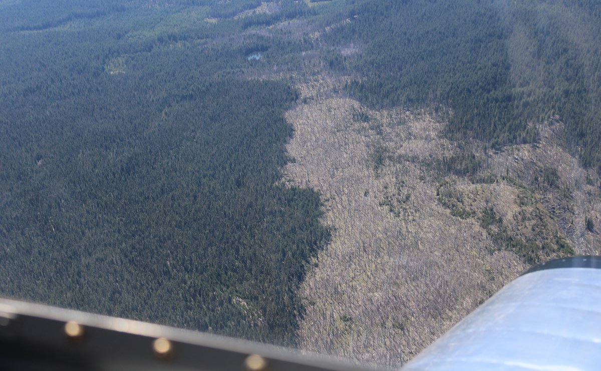
I wonder if that brown tree area was was burnt by fire?
|
| |
 |
|
| I pass close by Mount Jefferson. |
| |
 |
|
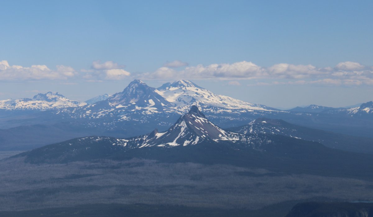
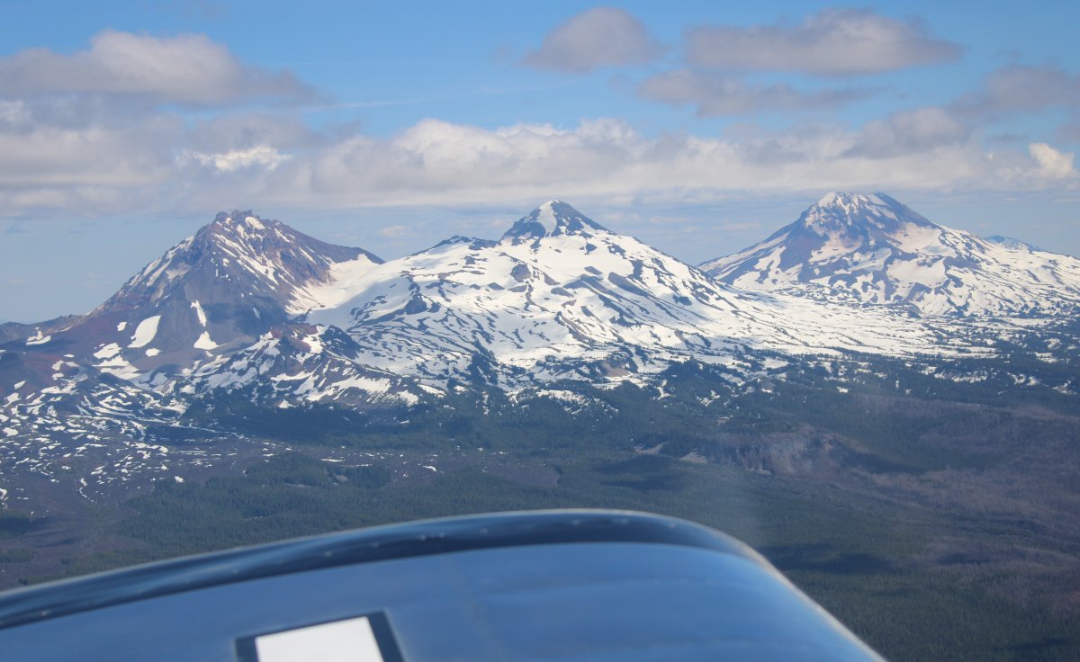
| It's just one after another. Mount Washington -- 7,794 ft -- in the foreground with the Three Sisters in the distance. |
| |
 |
|
|
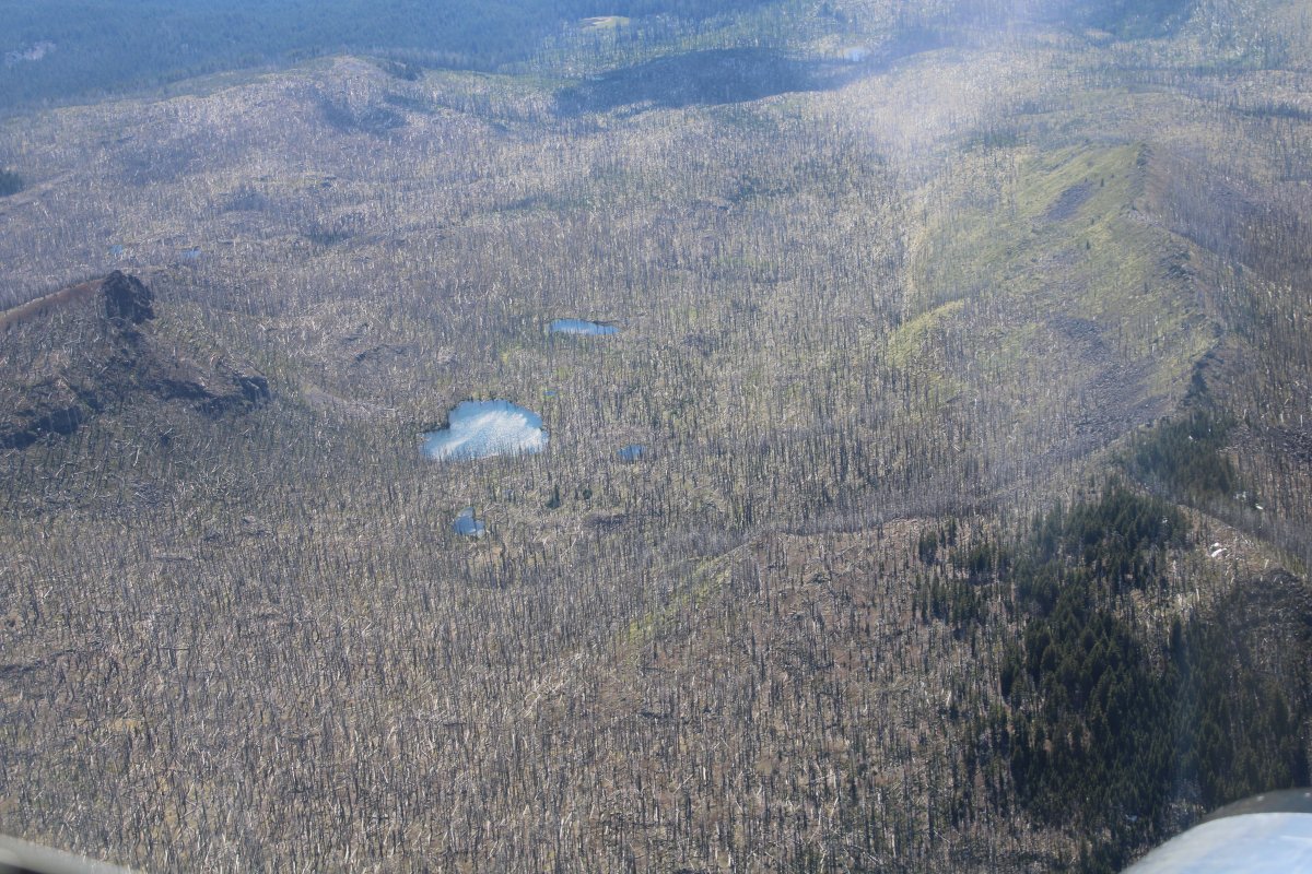
Yes, clearly there was a forest fire here.
|
| |
 |
|
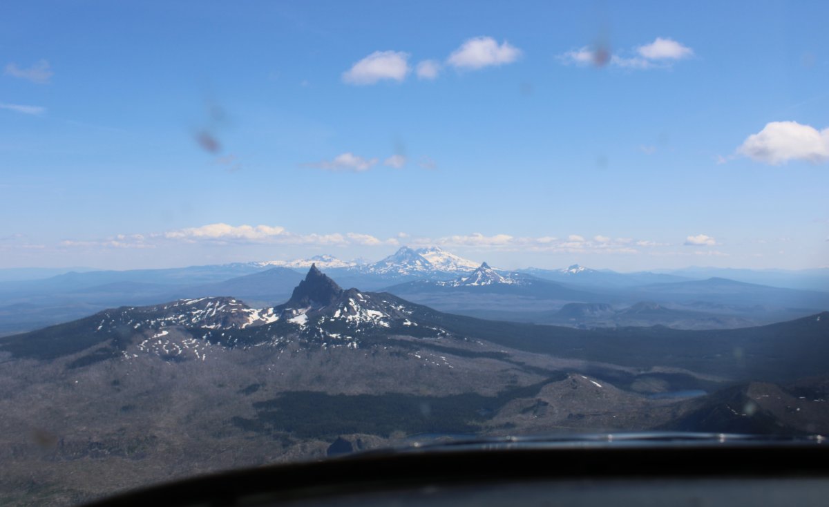
| An un-named peak is in the foreground with a pyramid-shaped mountain in the background. |
| |
 |
|
|
Mount Washington is in the foreground with the Three Sisters in the background.
|
| |
 |
|
|
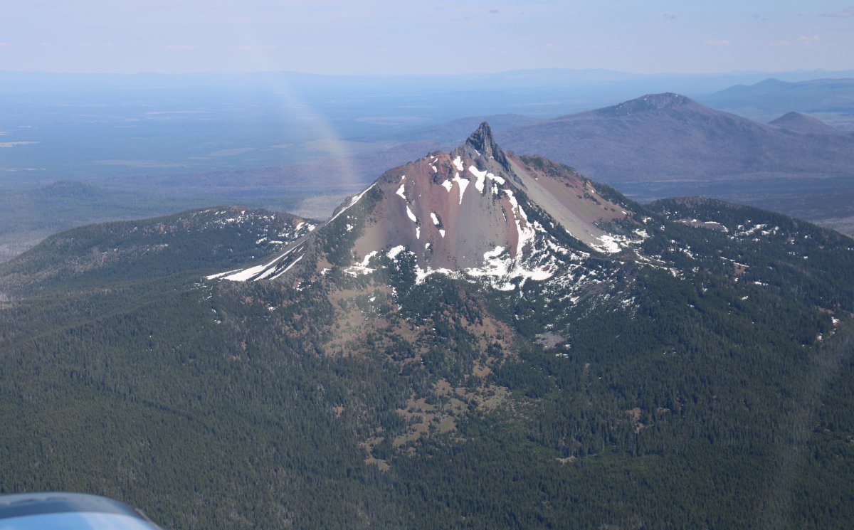
Close-up of Mount Washington.
|
| |
 |
|
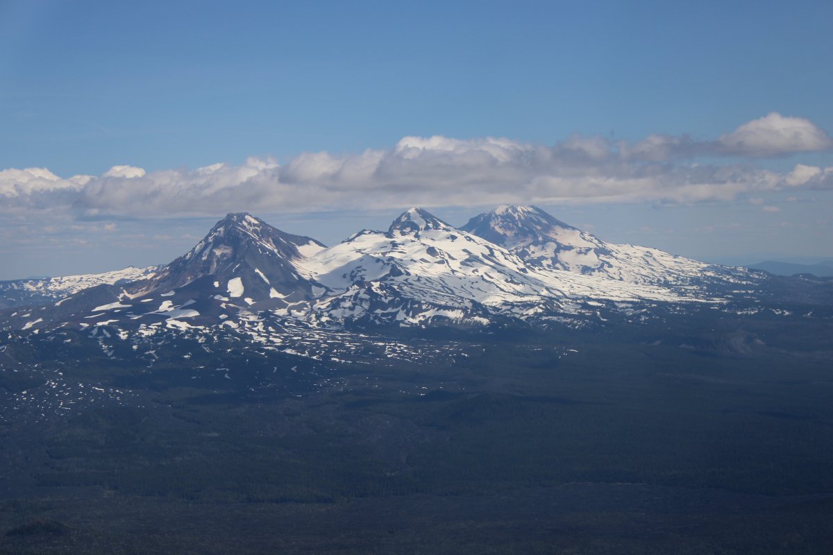
| It's easy to see why these are called the Three Sisters. All are over 10,000 ft tall. |
| |
 |
|
|
More burned out forest.
|
| |
 |
|
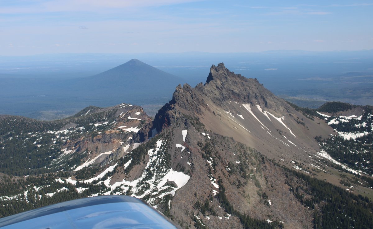
| Close-up of the Three Sisters. |
| |
 |
|
|
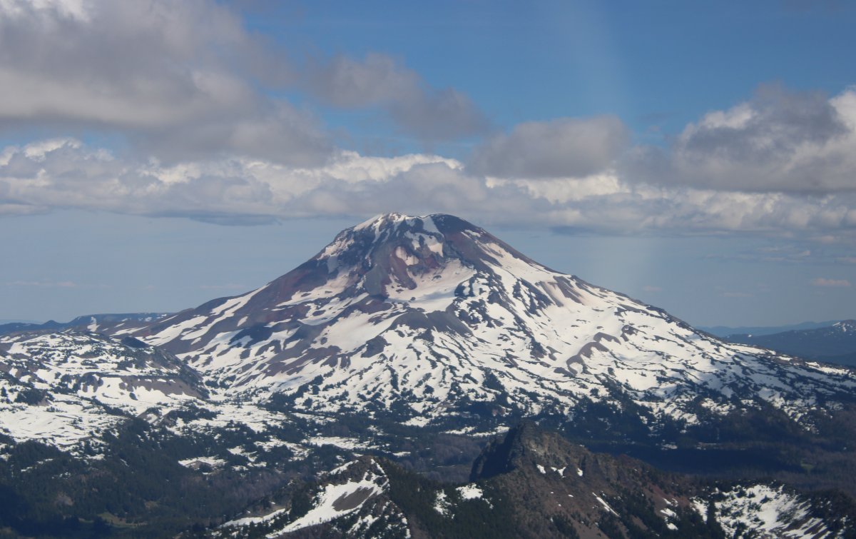
The South Sister.
|
| |
 |
|
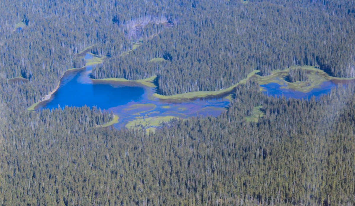
| Psychedelic Lake. (My own name for it) |
| |
 |
|
|
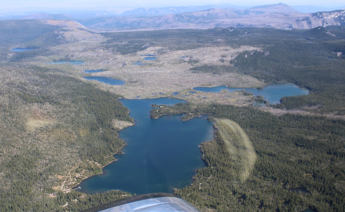
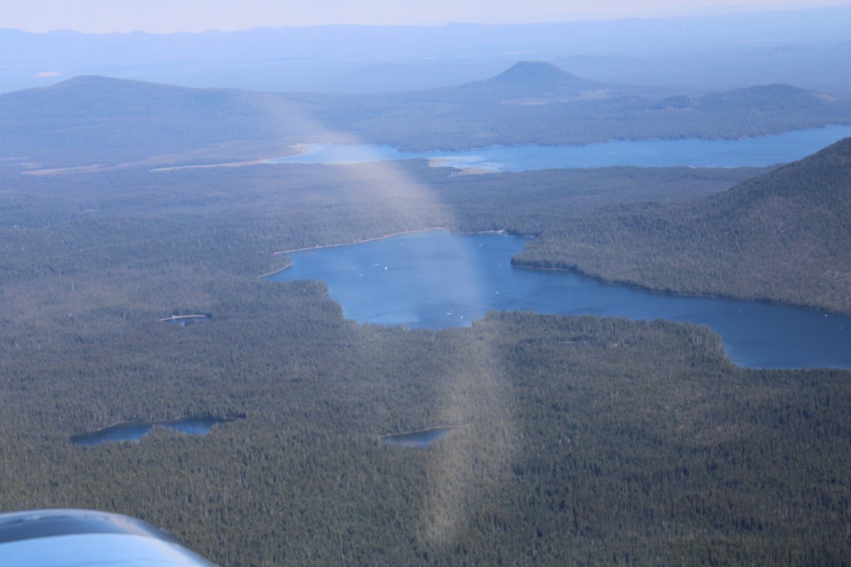
Some big lakes in the high country.
|
| |
 |
|
|
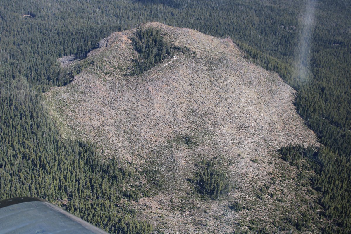
Burned out.
|
| |
 |
|
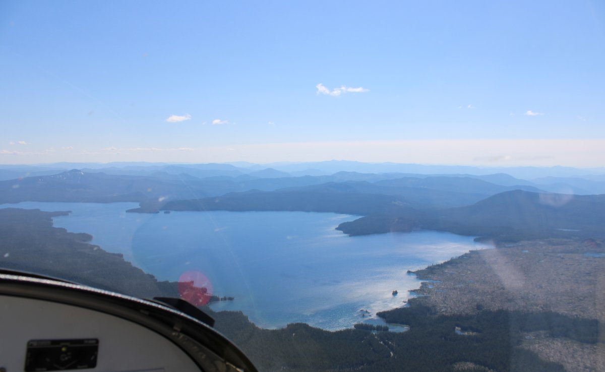
| Lots of big lakes in this area. |
| |
 |
|
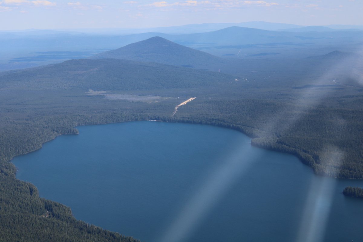
| And even a little public airstrip: Crescent Lake State Airport (5S2). |
| |
 |
|
|
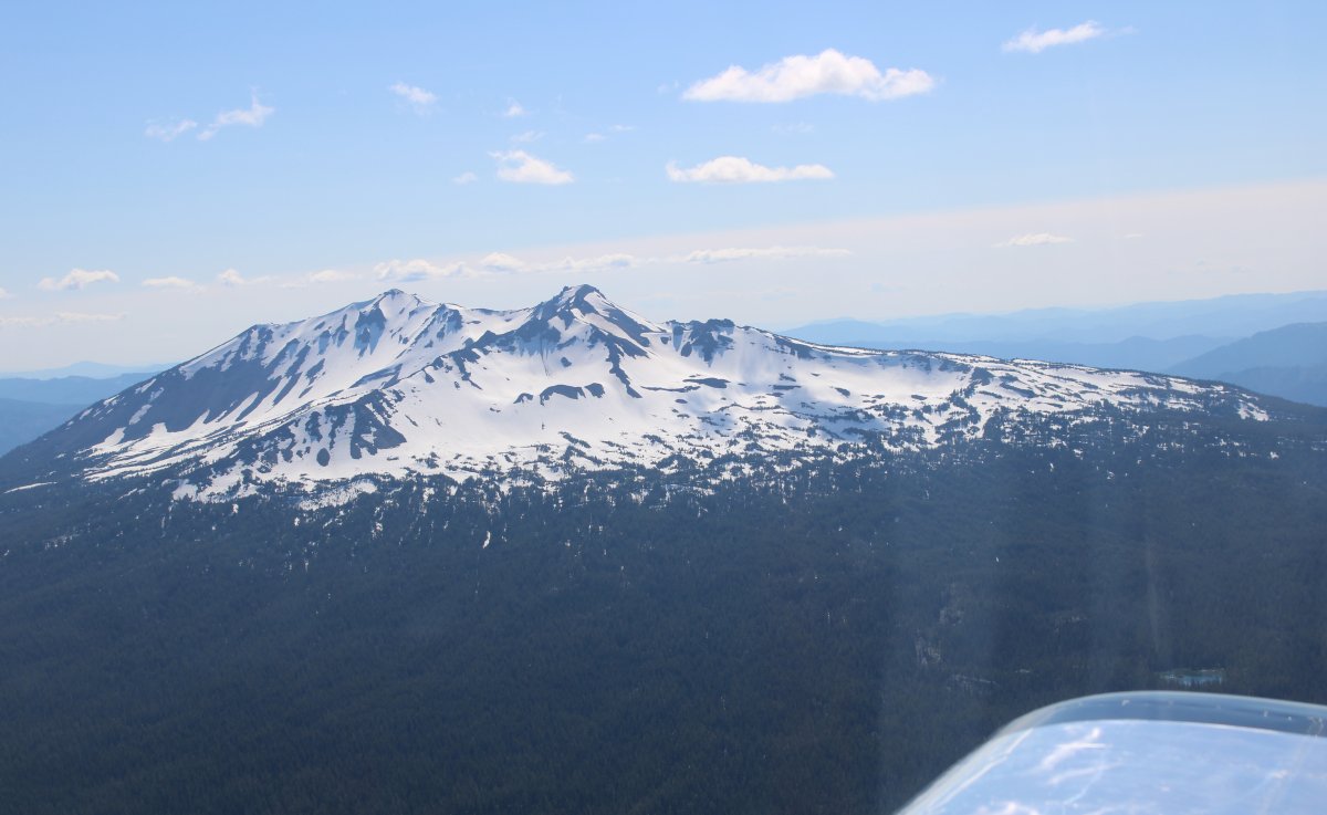
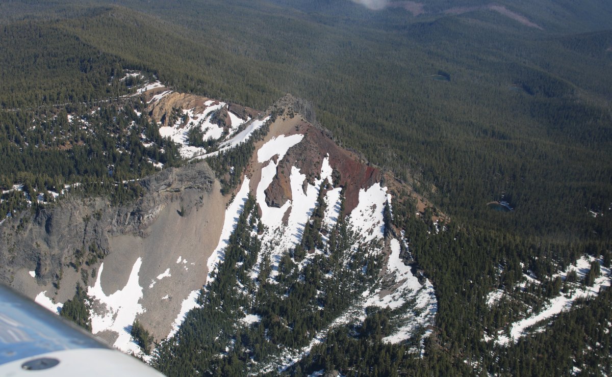
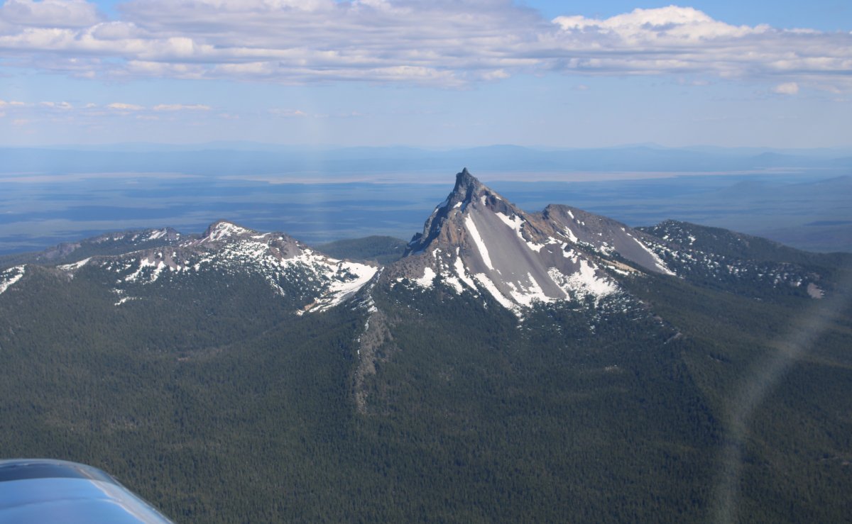
Mount Thielson?
|
| |
 |
|
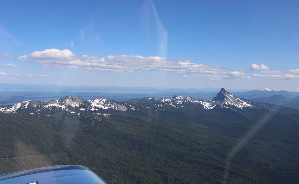
| Pretty. |
| |
 |
|
|
|
| |
 |
|
| |
| |
 |
|
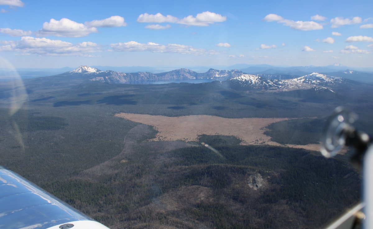
| Another thing I really wanted to see on today's flight: Crater Lake. Dead ahead. |
| |
 |
|
| |
| |
|
|
|
|
|
|