Preparation and Execution of the Flight West
As I have said before, a long cross-country like this requires a lot of research and planning to get the most out of it. I guess you could just hop in the plane, head west and go and see what you see. But I like maximize the fun I have and the things I see on a trip like this. For me, the research and planning is part of the fun. And writing up the trip in a web log afterwards. That takes a lot of time but is totally worth it because you can go back and relive the trip. Without it, the flight would just be a memory, gradually fading away year by year. With it, a couple of years later you look at it and say, I need to do another long cross-country!
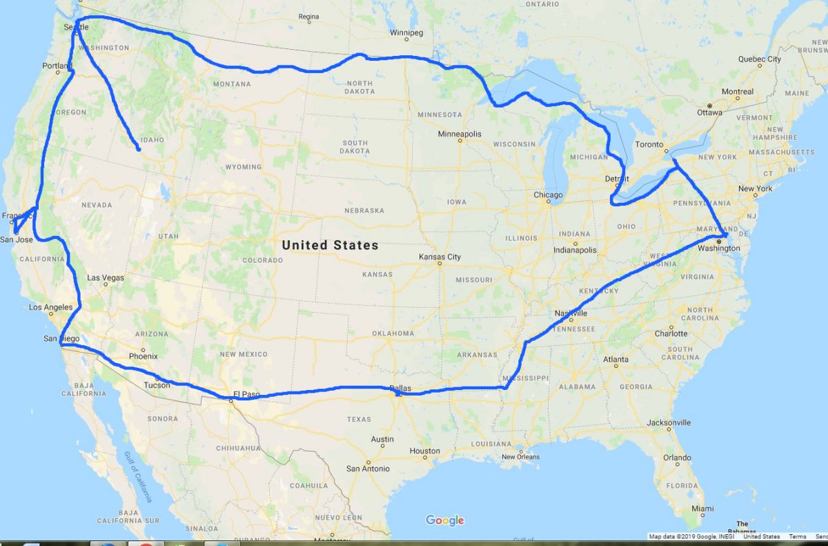
I had the general outline of the flight: fly to Niagara Falls, then follow the Great Lakes and the Canadian border all the way to Seattle, then down to San Diego, then head home via Tucson and Dallas.
As I do now with all my long cross-countries (and vacations) I start a detailed itinerary in Word. I have a section for each day. For each day, I write down all the information on airports, things to do, and places to visit for that day. AirNav.com and Foreflight is the source of information for airports. I record on the document whether the airport has a courtesy car or not, nearby motels, the general tenor of the comments, and most importantly, the gas price. I look on the sectional chart for interesting things to see from the air: mountains, rivers, lakes, canyons, dry lake beds, etc. I keep another Word document on future destinations. Anytime I see something interesting in the Vans Air Force forums, Facebook, word of mouth, etc. I paste it into the document. I review it while flight planning. I use the SkyVector online sectional chart via Airnav.com or Foreflight on my iPad. Sometimes I'll use Google Maps to take a look at the actual thing. Trip Advisor.com is sometimes useful for things to do. I include in the document the phone number and addresses of friends I would be staying with and motel and car reservations (although there were few on this trip).
At first the Word document is just a mass of information. But then I start refinining it. What can I actually do in the day? How long does it take to get from place to place? How long will it take to accomplish the ground stuff? It's like a puzzle, fitting the pieces together, but eventually I work out a doable plan. On the aggressive side, perhaps, but doable. I carry the polished itinerary in the aircraft and refer to it often. But it's just a plan. I can, and do, deviate from it.
Since I would be flying over some remote country, I was loaded for bear with regards to emergency equipment. I wore a survival vest with the most critical items: PRB, fire starter, space blanket. I had a survival bag filled with other useful items close at hand. I also carried a tent, cold weather sleeping bag, and even an air mattress (and pump). For aircraft issues, I had tools and equipment to change a tire tube, or even remove the prop if I had to.
I brought my brother-in-laws portable oxygen system although I ended up not using it.
Although it wasn't too critical on this trip -- I enjoyed excellent weather for the most part -- I regard in-flight weather as essential on a long cross-country like this. I have XM Satellite weather and it's worth every penny.
This is the first long cross-country where I used my iPad and Foreflight software extensively. I have a very good mounting device for my iPad, acquired at AirVenture So that my iPad batteries would last, I installed a dual USB power port in the panel right next to the iPad mount. This worked great! Thanks to the iPad/Foreflight software combo, throughout the 17 day trip, it was great seeing my position on the sectional chart. It's an excellent complement to my Garmin 496 GPS. Plus, Foreflight allowed me to flight plan and get AvGas prices in the air. Of course, on the Foreflight, all the sectional charts are current. I didn't need to buy a set of paper charts which would be expensive for a flight covering as much distance as this one.
The iPad was most useful to check weather before even heading out to the airport in the morning. I'm here to tell you that even the smallest Mom & Pop motel has free WiFi these days and it works. I use Weathermeister.com as my primary short-term weather resource prior to the flight. I use Weather.com (10-day) for the long-term forecast.
Back in March, I installed ADS-B Out. I already had ADS-B In using a Foreflight Scout device. The ADS-B In was useful in congested airspace and saved me in the middle of nowhere near El Centro, California.
I re-read Steve Coonts great book Cannibal Queen a few weeks prior to the trip. In that book, Coonts describes his flying a Stearman around the continental U.S. during the late 70s. I was struck by how much has changed in general aviation since then.
SPOT -- the breadcrumb tracker -- worked great. Lynnette loves seeing where I am and tracking my progress. I also had a portable 406 EPERB I kept on my person when flying. I flew over some remote country, but was comfortable with it, since I knew that if I made a forced landing, someone would be able to get to me.
Is it even necessary to say how necessary GPS is for a trip like this? My Garmin 496 worked flawlessly the entire trip.
Generally, I get an early start since the air is cool, calm and the lighting is good for pictures in the morning. In the afternoon, it is hot, turbulent, possibly windy, and the lighting isn't very good. The first two days, I was done flying by 2PM. I usually flew two to three hour flight legs.
The RV is a superb airplane for this sort of thing. The speed makes it all possible. You can transit long distances fast, then slow it down for sightseeing. You have the power to get over the mountains and weather if necessary.
Statistics:
67 hours total flight time
Highest altitude: 14,500 feet
Longest single flight: 3 hours 45 minutes